
Seonginbong 987m
The National Spirit That Weathered Rough Seas
Easy Moderate Valleys Snow scenery Silver grass Sea views Public transport


- Location
- Ulleung-eup, Seo-myeon, and Buk-myeon, Ulleung-gun, Gyeongsangbuk-do
- Courses
- 4 · 55 min – 4 h 50 min
- Distance
- 1.8 km – 11 km
- Facilities
- Toilets 2 · Parking 0
- Managed by
- Ulleung-gun County Office · 054-791-2191
Trail map
Why it is one of the 100 famous mountains
Selected as the highest peak of volcanic Ulleungdo, serving as the headwaters for all island streams, and for its well-preserved primeval forest with unique flora. Famous for Nari Basin—the only flat plain on Ulleungdo—and the primeval forest designated as Natural Monument No. 189 (1967). The Ulleungkukhwa (chrysanthemum) and Seombaekrihyang (thyme) colony in Nari-dong is designated as Natural Monument No. 52 (1962).
About Seonginbong
Ulleungdo is an island. The island was formed by volcanic activity. The mountain is the island itself. Yet, there is no single mountain name covering the entire island; there are only peaks such as Seonginbong, Naribong, and Duribong.
Peaks like Mireuksan, Cheondusan, and Bipasan carry the name '-san', but they are merely secondary peaks of Seonginbong and lack representative status. There is no overarching mountain name for Ulleungdo.
The name lies in history: Usan, from Usanguk, which was conquered by General Isabu during the reign of King Jijeung. Thus, Seonginbong can be considered the highest peak of Usan.
Although it exceeds 900m, its rugged volcanic terrain allows for only three hiking trails due to dangerous caves and gorges. As a result, hikers often find climbing Seonginbong once sufficient, complementing their trip by backpacking around the island perimeter, where most scenic wonders and attractions reside, or taking a round-the-island cruise.
Because it receives heavy snowfall, winter ski touring is also a viable option. Gliding over the dwarf bamboo forests along the Seonginbong to Nariryeong ridge toward the winter sea offers an unforgettable experience.
Covering an area of 72 square kilometers with a circumference of 44.12 kilometers, Ulleungdo lies 188 kilometers by sea from Pohang, making it the most distant island from the mainland along with Dokdo. Surrounded mostly by coastal volcanic cliffs, Seonginbong stands at the very heart of the island.
Rising high above the small island, Seonginbong essentially embodies Ulleungdo itself. Historically, royal dynasties imposed evacuation policies forbidding settlements here, but ancestors persevered, secretly settling to keep it as our land—a symbol of enduring spirit. Records of Ulleungdo date back to the Silla Dynasty.
Both Samguk Sagi (History of the Three Kingdoms) and Samguk Yusa (Memorabilia of the Three Kingdoms) record the island during the reign of King Jijeung, the 22nd monarch of Silla. Samguk Sagi records that in the 13th year of King Jijeung, Usanguk surrendered after General Isabu of Hasil-la arrived with wooden lions. Samguk Yusa notes a slightly different account: located a two-day favorable sail east of Aseulla-ju, the arrogant barbarians of Ureungdo refused tribute relying on the deep seas, but surrendered when Ichang Bak I-jong threatened them with wooden lions.
Ulleungdo is warm in winter and cool in summer, blessed with abundance. It is famously known for the 'Three Absences' (no thieves, beggars, or snakes) and the 'Five Abundances' (fragrance, wind, beauty, water, and stones). Along the coast, unique rock formations such as Gumeongbawi (Gongam), Geobukbawi, Sajabawi, Gombawi, Malbawi, and Guksubawi (which resembles draped noodles) are easily seen. On the northern descent from Seonginbong, the expansive Nari Basin—spanning roughly 660,000 square meters—presents scenic landscapes blending silver grass fields, tiger lilies, and Albong Peak (538m) rising to the west.
At Taeha-dong on the western tip of the island sits Seonghasindang, the representative shrine of Ulleungdo. Local residents hold rituals here every February of the lunar calendar to pray for bountiful harvests and safe, prosperous fishing. Legend says Seonghasindang was founded by Kim In-u, an appeasement commissioner during the reign of King Taejong of Joseon. Stranded by rough storms and unable to return to the mainland, Kim received a divine command to leave a young maiden and youth behind in Taeha-dong. He was then able to sail back safely. Returning years later, he found the two embraced as skeletal remains and built the shrine to soothe their aggrieved spirits. Along the trail from Jeodong toward Bongnae Falls, cool subterranean air blowing through rock crevices—known as the Natural Air Conditioner—cools hikers down.
Climbing about 40 minutes from this natural vent toward the summit leads to Bongnae Falls, where three cascades plunge through primeval forest. Walking about 200 meters west along Cheonbu Pier, where the descent from Nari Basin ends, one finds Punghyeol, a cold-air cave vent. While smaller than the one near Bongnae Falls, it provides refreshing cool air after a summer hike.
Courses recommended by the Korea Forest Service
- Island Circumference Trekking (4 Days 3 Nights)
- Day 1: Dodong → Jeodong → Naesujeon → Upper Hansolgyegok Valley → Upper Yeomsogolgyegok Valley → Seommok (Homestay or camping)
- Day 2: Seommok → Jukam → Cheonbu → Hyeonpo → Hyangmongnyeong Pass → Taeha Lighthouse → Taeha (Inn available)
- Day 3: Taeha → Hakpo Manmulsang → Sucheung-dong → Gubau → Sataegam → Namyang (Inn available)
- Day 4: Namyang → Tonggumi → Gadubong Lighthouse → Jungnyeong → Sadong → Dodong
Public transport
Ferries to Ulleungdo operate daily from Pohang (☎ 054-242-5111~5) and Donghae (☎ 033-531-5891~2), and irregularly from Hupo (☎ 054-787-2811~2). Departures may be canceled during weather advisories, so check beforehand.
Island excursion cruises depart from the passenger ferry terminal in Dodong, running 9 times daily during peak season and twice daily in off-season (☎ 054-791-4468/7010). Local buses departing Dodong run to Cheonbu via Namyang and Taeha, as well as to Naesujeon and Bongnae Falls in Jeodong.
Food, lodging & more (Korea Forest Service data, may change)
● Food, Lodging, and Other Info
Most lodging facilities are concentrated in Dodong.
Marina Tourist Hotel ☎ 054-791-0020~4
Ulleung Beach Hotel ☎ 054-791-2335
Ulleung Hotel ☎ 054-791-6611
Ulleung Condo ☎ 054-791-1020
Taeha Dongbaekjang Inn ☎ 054-791-5339
Namyang Ulleung Resortel ☎ 054-791-7744
Homestay Inquiries: Ulleung Tourism Information Center ☎ 054-790-6454
● Inquiries
Ulleung-gun County Office Dodong Tourist Information Center ☎ 054-791-2191 ext. 6454
Nearby attractions
-
 Bongnaepokpo Falls [Ullengdo & Dokdo National Geopark] (봉래폭포 (울릉도, 독도 국가지질공원))
1.5 km from the summit
-
 Dokdo Observatory Cable Car (독도전망대 케이블카)
2.9 km from the summit
-
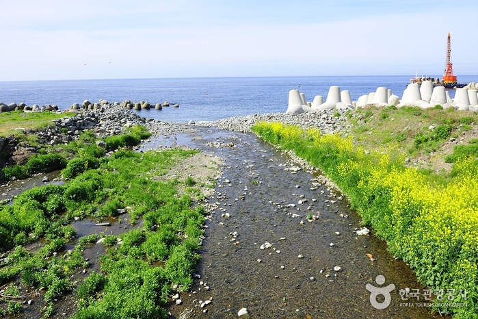 Tonggumi Pebble Beach (통구미몽돌해변)
3.6 km from the summit
-
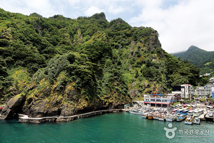 Ulleungdo Island (울릉도)
3.7 km from the summit
-
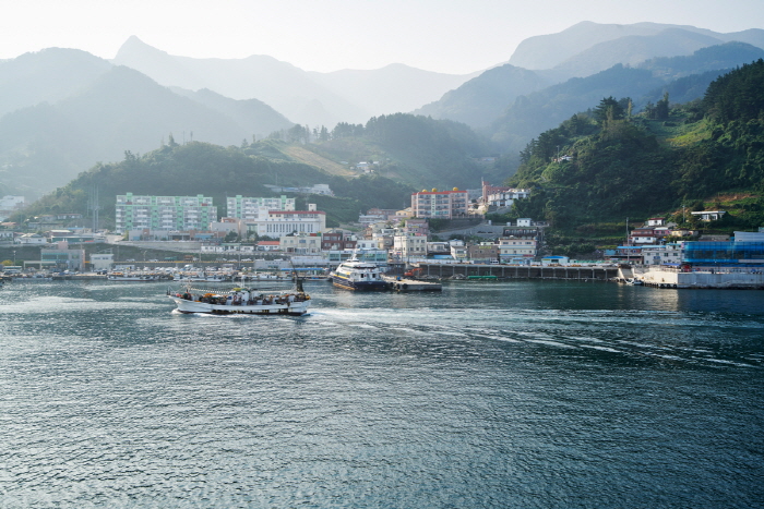 Jeodonghang Port (저동항)
4.1 km from the summit
-
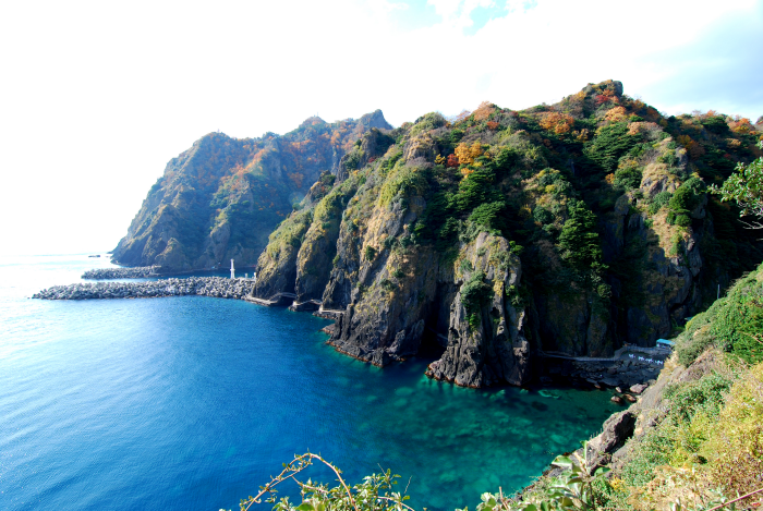 Dodong Coastal Trail (도동 해안산책로)
4.1 km from the summit
Times and difficulty are estimates from GPS tracks. Before you go, check the weather, sunset time and any trail closures. Course tracks recorded: 2022-01-06
Text on this page was translated automatically from Korean public data. Place names follow the Revised Romanization; signs on the trail are in Korean.
Data: Korea Forest Service and Korea Hiking & Trekking Support Center (Public Data Portal). Course times and difficulty are estimates from GPS tracks (2022).