
Doraksan 965m
A mountain where one can attain enlightenment and find self-delight
Moderate Valleys Public transport
- Location
- Danseong-myeon and Daegang-myeon, Danyang-gun, Chungcheongbuk-do
- Courses
- 1 · 3 h 50 min – 3 h 50 min
- Distance
- 6.6 km – 6.6 km
- Facilities
- Toilets 0 · Parking 3
- Managed by
- Danyang County Office · 043-422-3011
Trail map
Why it is one of the 100 famous mountains
Located midway between Sobaeksan and Woraksan, this rocky mountain is selected for its outstanding scenery and proximity to Danyang's Eight Scenic Views including Haseonam, Jungseonam, and Sainam. Notable highlights along the roughly 10 km stretch of the Danyangcheon Stream (a tributary of the Namhangang River) include Haseonam Rock, Jungseonam Rock with its grand boulders like Ssangnyongpokpo Falls, Ongnyeomdae, and Myeonggyeongdae, and Sangseonam Rock, renowned for Gyeongcheonbyeok, Waryongam, Ilsadae, and Myeonggyeongdam.
About Doraksan
Doraksan (965.3 m) is located at the edge of Woraksan National Park, neighboring Sobaeksan National Park. Legend says scholar Uam Song Si-yeol named the mountain based on the idea that "to attain enlightenment, one must follow their own path, and that path must also be accompanied by joy." The summit marks the border between Danseong-myeon and Daegang-myeon in Danyang-gun. Similar in terrain to Woraksan, rocky peaks rise throughout the mountain, and ridges extending in all directions form a fortress-like chain of spectacular rocky crags.
In particular, the ridge extending northeast from the summit features a series of rocky peaks such as Sinseonbong, Chaeunbong, and Geombong, offering wonderful scenery and a thrilling scramble along the rocky ridges. However, the rocky trails of Doraksan are quite challenging for beginners. It is advisable to hike with an experienced guide, and extra caution is needed during snowfall. Once on the mountain, drinking water is difficult to find, so carry sufficient water in advance.
Named Doraksan by Song Si-yeol as "a place where one can attain enlightenment and find joy," the mountain lies close to the provincial border between Gyeongsangbuk-do and Chungcheongbuk-do. Part of Woraksan National Park, it borders Danyang-eup and Daegang-myeon in Danyang-gun, Chungcheongbuk-do. At its base lie four of the Eight Scenic Views of Danyang—Sainam, Sangseonam, Jungseonam, and Haseonam—making it a treasure trove of sightseeing.
Courses recommended by the Korea Forest Service
- Sangseongyo Bridge → Seonbawi Rock → Chaeunbong Peak → Three-way Junction → Summit → Three-way Junction → Jebong Peak (Sangseonsangbong Peak) → Sangseongyo Bridge 5 h 10 min
- Gungteotgol → Samopokpo Falls → Naegunggi Village → Sinseonbong Peak → Summit → Sangseonam 3 h 30 min
Public transport
The starting point is Danyang.
Local bus toward Banggok runs to Beolcheon-ri 9 times a day between 06:20 and 19:40. Cross Sanggeumgyo Bridge and get off at Sangseon Rest Area. Takes 40 minutes.
Sin-Danyang Bus Terminal ☎043-422-2866
Food, lodging & more (Korea Forest Service data, may change)
● Lodging and Other Info
There are many homestays (minbak) near Sangseonam, most combining a restaurant and a small store.
Daemyung Resort is located in Danyang-eup.
Seonam Garden Minbak ☎043-422-1447
Doraksan-jang ☎043-422-1501
Sangseon Rest Area ☎043-422-1511
● Inquiries
Danyang Branch Office ☎043-422-5062~3
Nearby attractions
 Sainam Rock (단양 사인암)
 Chungju Lake Tour (충주호 유람선)
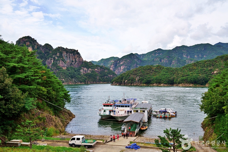 Janghoe Quay (장회나루)
Times and difficulty are estimates from GPS tracks. Before you go, check the weather, sunset time and any trail closures. Course tracks recorded: 2022-01-06
Text on this page was translated automatically from Korean public data. Place names follow the Revised Romanization; signs on the trail are in Korean.
Data: Korea Forest Service and Korea Hiking & Trekking Support Center (Public Data Portal). Course times and difficulty are estimates from GPS tracks (2022).