
Yonghwasan 878m
A Rock Exhibition with Stories
Easy Moderate Valleys Autumn foliage Public transport


- Location
- Gandong-myeon and Hanam-myeon, Hwacheon-gun, and Sabuk-myeon, Chuncheon-si, Gangwon-do
- Courses
- 8 · 2 h 15 min – 4 h 40 min
- Distance
- 5.7 km – 11.2 km
- Facilities
- Toilets 4 · Parking 6
- Managed by
- Hwacheon County Office · 033-442-1211
Trail map
Why it is one of the 100 famous mountains
Selected for its beautiful scenery and excellent views combining dense forests and bizarre rock formations, situated adjacent to Paroho Lake, Chuncheonho Lake, and Soyangho Lake. It is also well-known for the site of Seongbulsa Temple and various lifelike rock formations steeped in legends, such as Gwangbawi Rock, Jujeonjabawi Rock, and Badukbawi Rock.
About Yonghwasan
Yonghwasan is a rocky mountain rising along the border between Sabuk-myeon in Chuncheon-si and Hanam-myeon in Hwacheon-gun, Gangwon-do, serving as a natural fortress surrounded by Chuncheon's Uiam Dam, Soyang Dam, Chuncheon Dam, and Hwacheon Dam. Entering Yonghwasan through Yangtonggol Valley in Goseong 2-ri, the usual trailhead, rock peaks are the first sight to catch the eye. Rocky cliffs face Chuncheon-si, and the rugged rock formations around Manjangbong Peak, descending west from the summit—along with distinct rocks such as Saenambawi (named because it resembles a flying bird), Haneulbyeok Chotdaebawi Rock, Cheungcheungbawi Rock, and Deungnambawi Rock—are considered the pinnacle of Yonghwasan. In particular, the view of Haneulbyeok Chotdaebawi Rock from the broad rock of Manjangbong Peak, framed by old pine trees, is outstanding. A rock climbing route was established on Manjangbong Peak in 1976 and is still regularly frequented by climbers.
From the rocky ridge between Manjangbong Peak and the summit, Chuncheon's mountain ranges are clearly visible. Approaching the summit, hikers can see the peaks of Daeryongsan (899.3m) and Samaksan (655.8m), as well as Bukbaesan and Gadeoksan extending northwest from Samaksan, and Satgatbong Peak and Eungbong Peak to the west. In addition, traces of about 10 mountain passes that once served as fortress gates for the ancient state of Maekguk in the Chuncheon area—including Baehuryeong, Seongbullyeong, Sayaryeong, Keungogae, and Moraejae—remain on Yonghwasan.
Standing at 878m above sea level, Yonghwasan spans across Yuchon-ri in Gandong-myeon, Samhwa-ri and Georye-ri in Hanam-myeon, and Gotan-ri in Sabuk-myeon, Chuncheon-si. It is situated at the center of Paroho Lake to the north, Chuncheonho Lake to the west, and Soyangho Lake to the south.
Between the ridge of Yonghwasan and Obongsan lies a pass named Seongbullyeong, which is the site of the former Seongbulsa Temple. Since ancient times, the evening bell of Seongbulsa Temple, the mist and clouds of Yonghwasan, the bizarre rocks, the clear waters of Woncheon-ri Valley, the bright moon over Buyongsan, the autumn leaves of Jungnyeopsan, and the fish of Guunso have been celebrated as the Eight Scenic Views. The mountain features strikingly lifelike rock formations such as Gwangbawi Rock, Simbawi Rock, Kkokjibawi Rock, Jujeonjabawi Rock, Magwihalmibawi Rock, and Badukbawi Rock.
Courses recommended by the Korea Forest Service
- Yangtong Village → Keungogae Pass → Summit → 858 Peak → Kkaltakgogae Pass → Yangtong 4 h 20 min
- Samhwa-ri Pass Summit → Yonghwasan Summit → Seongbulchi Pass → Paroho Lake 4 h
Public transport
Chuncheon is the primary starting point.
Because bus services are infrequent, taking a taxi is an option, taking around 35 minutes.
- Chuncheon Hupyeong-dong → Goseong 2-ri Yangtong Intersection: 5 times daily
- Goseong 2-ri Yangtong Intersection → Chuncheon: 5 times daily
- Chuncheon City Bus No. 37 → Gotan: 6 times daily
- Hwacheon City Bus → Georye-ri via Samhwa-ri: 4 times daily
Food, lodging & more (Korea Forest Service data, may change)
● Food, Lodging, and Other Info
There are no lodging facilities in Yangtong Village. Please use facilities in Chuncheon or Hwacheon.
● Inquiries
Hwacheon County Office Culture and Tourism Division ☎033-440-2543
Nearby attractions
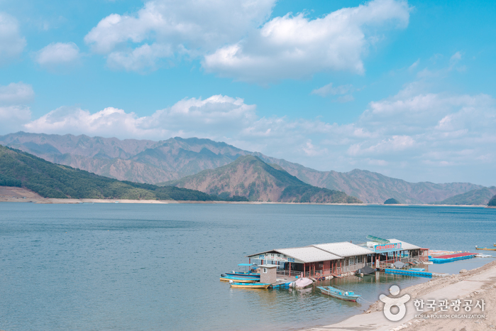 Paroho Lake (Hwacheon) (파로호(화천))
 Chuncheon Cheongpyeongsa Temple (청평사 (춘천))
 Bungeoseom Island (붕어섬)
 Chuncheon Makguksu Museum (춘천막국수체험박물관)
Times and difficulty are estimates from GPS tracks. Before you go, check the weather, sunset time and any trail closures. Course tracks recorded: 2022-01-06
Text on this page was translated automatically from Korean public data. Place names follow the Revised Romanization; signs on the trail are in Korean.
Data: Korea Forest Service and Korea Hiking & Trekking Support Center (Public Data Portal). Course times and difficulty are estimates from GPS tracks (2022).