
Woraksan 1,095m
A Deep Valley Beyond the Reach of War
Moderate Hard Valleys Public transport


- Location
- Hansu-myeon and Deoksan-myeon, Jecheon-si, Chungcheongbuk-do
- Courses
- 4 · 2 h 10 min – 4 h 20 min
- Distance
- 3.1 km – 8.9 km
- Facilities
- Toilets 7 · Parking 6
- Managed by
- Jecheon City Hall · 043-641-5114
Trail map
Why it is one of the 100 famous mountains
Selected for its rugged terrain and harmonious rock formations, having been revered as a sacred mountain since ancient times, home to the 8 Scenic Views of Songgye and 9 Valleys of Yongha, and designated as a national park (1984). It is also renowned for the Standing Stone Buddha of Mireuksa Temple Site, where Prince Mae and Princess Deokju of Late Silla are said to face each other to console their sorrow of national loss, the Rock-carved Buddha of Deokjusa Temple, and Deokjusanseong Fortress.
About Woraksan
Woraksan (1,095.3m) features a landscape that blends the dazzling beauty of Seoraksan with the majesty of Jirisan. While sheer cliffs quicken the pulse, the gentle ridges offer comforting warmth. The summit, also called Guksabong, has long been regarded as a sacred peak and is named 'Yeongbong Peak.' Standing atop the colossal rocky summit of Yeongbong Peak, you get a spectacular panoramic view of Chungjuho Lake reflecting the shadow of Woraksan.
Along with picturesque peaks like Munsubong, Haseolsan, Maedumak, Daemisan, Hwangjeongsan, and Mapyebong, it was designated as Woraksan National Park in 1984. Between the high ridges and peaks wind Songgye Valley, Yongha Gugok Valley, and Seonam Valley, showcasing the grandeur of a mountain park. It also holds numerous cultural heritages, including the Standing Stone Buddha of Jungwon Mireuksa Temple Site, said to reflect Prince Mae and Princess Deokju facing each other to soothe the sorrow of a fallen kingdom at the end of the Silla era, the Rock-carved Buddha of Deokjusa Temple, and Deokjusanseong Fortress, making it a mountain park combining culture, history, and natural scenery.
Woraksan National Park marks the boundary between Hansu-myeon and Deoksan-myeon in Jecheon-si, Chungbuk. It rises north of the Baekdudaegan ridge line where it runs past Ihwaryeong, Joryeongsan, Joryeong, Mapaebong, Bubong, Wolhangsambong, Haneuljae, and Poamsan toward Daemisan. Spanning 373㎢, the Woraksan ridge is higher than the Baekdudaegan itself and, being formed primarily of rugged rocks and crags, stands out prominently compared to the main range.
Located on the boundary between Hansu-myeon in Jecheon-si and Salmi-myeon in Chungju-si, Woraksuribong Peak may be unfamiliar to many, but it is a famous peak with numerous hidden scenic spots. Once hiking, the dynamic changes of crags and cliffs unfolding everywhere draw admiration from mountaineers. Looking around the hidden landscapes as you climb to the summit, affection for Woraksuribong Peak naturally grows, making you want to visit again.
Behind Woraksan (1,095.3m), Yongha Gugok Valley stretches for 30 ri (about 12 km), and Woraksirubong Peak stands like a folding screen to the west of Yongha Gugok. To reach Sirubong Peak, you must first pass through Deoksan-myeon. Deoksan (德山) literally means 'benefiting from the mountain's virtue,' and Deoksan-myeon has long been famous as an ideal location for ginseng cultivation. Outstanding views are scattered across the mountain, especially from Observatory Rock. Climbing Observatory Rock, the summit of Woraksan to the northwest resembles a roaring tiger, commanding the viewer's gaze, while to the east across Yongha Gugok Valley, the ridges of Haseolsan, Maedusan, and Munsubong unfold in scenic splendor.
Courses recommended by the Korea Forest Service
- Deokjugol Rest Area → Maaebul → Songgye Three-way Intersection → Yeongbong Peak → via Jungbong and Habong to Bodeogam Hermitage. *The Bodeogam Hermitage → Yeongbong Peak section is closed during forest fire prevention periods 5 h 20 min
- Worak-ri Deoksan Ticket Office → Silleuksa Temple → Jeolgol Yeongbong Peak → Songgye-ri Dongcheongyo Ticket Office 4 h 20 min
Public transport
The starting point is Chungju.
Take a local bus bound for Songgye (Chungju Transportation ☎043-845-5176).
First bus 07:15, last bus 18:35. Runs at 40- to 60-minute intervals. Takes 1 hour. Last bus to Chungju around 18:00.
Food, lodging & more (Korea Forest Service data, may change)
● Accommodations and Other Info
Deokjugol Sanjang (☎043-653-8352), Songgye Minbak Village 53 households (☎043-640-4171)
Deokju Minbak (☎043-653-1531), and many other lodging facilities in the Deokjugol and Songgye-ri areas.
● Inquiries
Woraksan National Park Office (☎043-653-3250)
Nearby attractions
- Woraksan National Park (월악산국립공원) 2.4 km from the summit
-
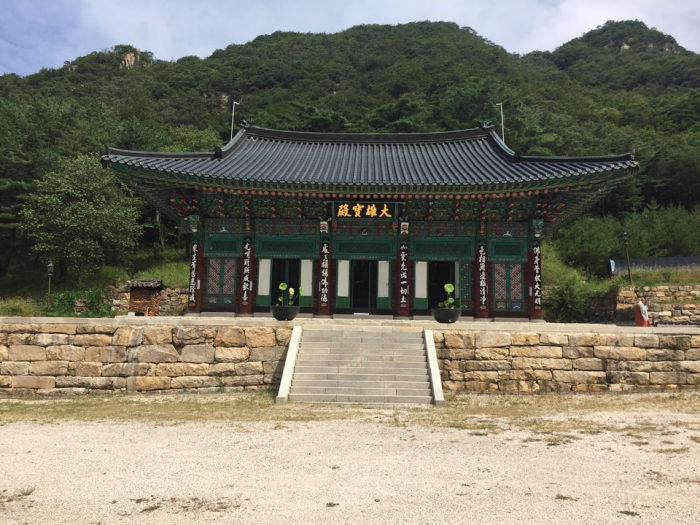 Jecheon Deokjusa Temple (덕주사(제천))
2.7 km from the summit
-
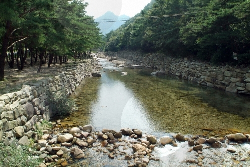 Songgyegyegok Valley (송계계곡)
2.9 km from the summit
-
 Ageobong Peak (악어봉)
6.5 km from the summit
-
 Chungju Mireukdaewon Stone Temple Site (충주 미륵대원지)
7.2 km from the summit
-
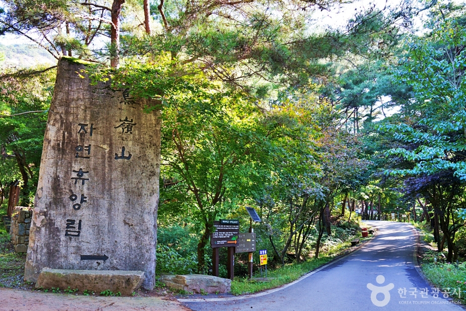 Joryeongsan Recreational Forest (조령산자연휴양림)
9.8 km from the summit
Times and difficulty are estimates from GPS tracks. Before you go, check the weather, sunset time and any trail closures. Course tracks recorded: 2022-01-06
Text on this page was translated automatically from Korean public data. Place names follow the Revised Romanization; signs on the trail are in Korean.
Data: Korea Forest Service and Korea Hiking & Trekking Support Center (Public Data Portal). Course times and difficulty are estimates from GPS tracks (2022).