
Taebaeksan 1,567m
Sacred Mountain Where Dangun Rituals Are Performed
Moderate Hard Spring flowers Valleys Autumn foliage Snow scenery Sunrise Sea views Public transport


- Location
- Taebaek-si, Gangwon-do; Seokpo-myeon, Bonghwa-gun, Gyeongsangbuk-do
- Courses
- 6 · 2 h 5 min – 5 h 20 min
- Distance
- 4 km – 12.7 km
- Facilities
- Toilets 11 · Parking 7
- Managed by
- Taebaek City Hall · 033-552-1360
Trail map
Why it is one of the 100 famous mountains
Celebrated since ancient times as one of the great mountains of the Samhan states. Selected for its alpine flora thriving on the summit, outstanding winter snowscapes covering yew tree colonies, and its designation as a provincial park in 1989. According to the Samguk Sagi (History of the Three Kingdoms), kings personally officiated heavenly rituals at Cheonjedan Altar on the summit. Notable temples include Manggyeongsa and Baekdansa.
About Taebaeksan
A sacred mountain where two Silla kings once made royal tours. At the time, it belonged to Bonghwa, which is actually the true front face of Taebaeksan. Taebaek-si to the north, which covers most of the mountain's area today, was an uninhabited wilderness until divination seekers gathered there in the late Joseon period.
Viewed from the south, the mountain carries a deeply sacred presence. In particular, the main peak Janggunbong, seen while traversing the slope of Busoebong Peak, resembles India's Great Stupa of Sanchi, known as the origin of stupas. A square altar resting atop the burial mound-like rounded mountain mass evokes that UNESCO World Heritage site.
It is also a sacred ground for Korean folk religion. Shamans constantly visit Danggol at the main trailhead throughout the year. Praying at the summit is believed to recharge spiritual energy effectively, which explains why practitioners continue to visit despite numerous government crackdowns on folk shrines since the Third Republic.
Taebaek-si, named after the mountain, hosts four major festivals around it: the Royal Azalea Festival in June, the Taebaekje Festival highlighted by the National Foundation Day Heavenly Ritual, the New Year Sunrise Festival, and the Snow Festival in January. The city has developed cultural tourism combining its royal azaleas and winter snowscapes with ritual heritage dating back to the Silla era. Taebaeksan fully warrants that status.
Bordering Daehyeon-ri in Seokpo-myeon, Bonghwa-gun, Gyeongsangbuk-do, Mungoksodo-dong in Taebaek-si, and Cheonpyeong-ri in Sangdong-myeon, Yeongwol-gun, Gangwon-do, Taebaeksan stands at 1,566.7m at 128°56' E longitude and 37°05' N latitude. Waters originating from this mountain feed the Nakdonggang River that sustains the Yeongnam Plain, the Hangang River central to Korean history, and Osipcheon Stream in Samcheok, establishing it as a foundational root mountain and patriarchal peak of the southern Korean Peninsula.
Taebaeksan centers around Yeongbong Peak, where Cheonjedan Altar stands, bordered by Janggunbong Peak (1,567m) to the north, Munsubong Peak (1,514.9m) to the east, and Busoebong Peak (1,549.4m) between Yeongbong and Munsubong. With minimal rocky crags and gentle inclines, it offers easy hiking for all ages. Alpine plants thrive on the summit; colonies of royal azaleas and Korean azaleas greet hikers in spring; dense woods and cold, clear streams offer relief in midsummer; colorful foliage drapes the slopes in autumn; and snow-clad yew colonies define the winter scenery. It is a grand, welcoming soil mountain.
Sunrise and sunset from the summit are magnificent, offering a scene evocative of the celestial world, and on clear days the distant East Sea comes into view. It also holds Yongjeong and Yongdam, celebrated as top-ranked natural springs among Korea's high-altitude waters. Designated as a provincial park with an area of 17.44 sq km on May 13, 1989, the Sodo Facility Complex provides accommodations such as the Taebaeksan Minbak Village condo, restaurants, and campsites, alongside the Coal Museum illustrating the history of local mining, and a large snow-sledding hill open in winter.
Courses recommended by the Korea Forest Service
- Danggol → Sanjedanggol → Munsubong Peak → Munsubong Saddle → Busoebong Three-way Intersection → Summit → Yuilsa Temple → Yuilsa Ticket Office 4 h 5 min
- Baekdansa Ticket Office → Baekdansa Temple → Summit → Busoebong Three-way Intersection → Munsubong Peak → Duribong Peak → Jijirigol → Jatbat 4 h 35 min
- Danggol → Jeonggabawugol Auraji → Banjae → Summit → Munsubong Peak → Somunsubong Peak → Dojanggol → Bulmusilgol 4 h 15 min
Public transport
The travel base is Taebaek-si. From Hwangji, where Taebaek Station and the intercity bus terminal are located, buses to Danggol run every 30 to 60 minutes. Taebaek is served by 9 daily Taebaek Line trains from Cheongnyangni (Seoul); trains from Busan via the Gyeongbu, Gyeongbuk, and Yeongdong Lines; trains from Bujeon and Dongdaegu via the Jungang and Yeongdong Lines; and trains from Gwangju via the Honam, Chungbuk, and Taebaek Lines. In winter, the Yeongdong Line Snow Flower Train operates additionally. From East Seoul Terminal, express buses run 17 times daily (1 late-night), direct non-stop buses 15 times, and regular direct buses 11 times. Intercity buses also connect from Daegu, Pohang, Andong, Incheon, Suwon, Seongnam, Ansan, Uijeongbu, and Daejeon.
Food, lodging & more (Korea Forest Service data, may change)
● Lodging and Dining Information
Numerous accommodations are available in downtown Taebaek-si.
Meridian Hotel ☎ 033-553-1366, Sky Hotel ☎ 033-552-9977, Donggyeong Motel ☎ 033-552-6624
Near Danggol entrance: Gilmok Minbak ☎ 033-553-1147, Tongnamujip ☎ 033-552-9966
● Inquiries
Taebaeksan Provincial Park Office ☎ 033-550-2828
Nearby attractions
-
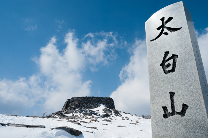 Cheonjedan Altar on Taebaeksan Mountain (태백산 천제단)
4 km from the summit
-
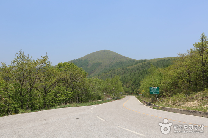 Hambaeksan Mountain (함백산)
6.9 km from the summit
- Cheongoksan Mountain (Bonghwa) (청옥산(봉화)) 7 km from the summit
-
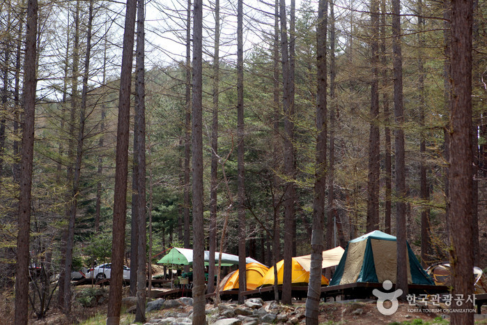 Cheongoksan National Recreational Forest (국립 청옥산자연휴양림)
9.4 km from the summit
- 365 Safe Town (365세이프타운) 9.7 km from the summit
Times and difficulty are estimates from GPS tracks. Before you go, check the weather, sunset time and any trail closures. Course tracks recorded: 2022-01-06
Text on this page was translated automatically from Korean public data. Place names follow the Revised Romanization; signs on the trail are in Korean.
Data: Korea Forest Service and Korea Hiking & Trekking Support Center (Public Data Portal). Course times and difficulty are estimates from GPS tracks (2022).