
Songnisan 1,058m
A Sanctuary for Those Leaving the Mundane World
Easy Moderate Hard Valleys Sea views Public transport


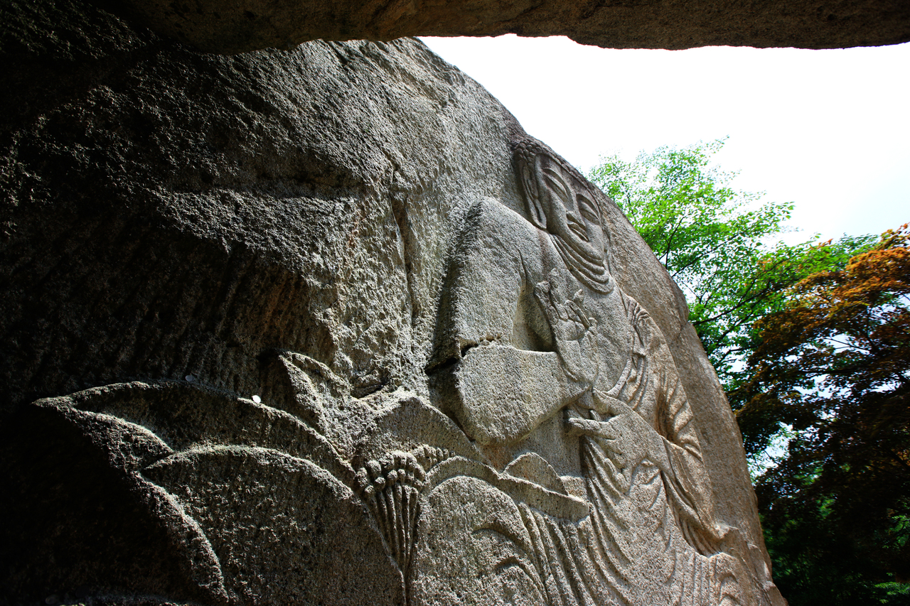
- Location
- Naesongni-myeon, Boeun-gun, Chungcheongbuk-do; Hwabuk-myeon, Sangju-si, Gyeongsangbuk-do
- Courses
- 3 · 1 h 30 min – 6 h 40 min
- Distance
- 3 km – 15.6 km
- Facilities
- Toilets 0 · Parking 1
- Managed by
- Boeun County Office · 043-540-3000
Trail map
Why it is one of the 100 famous mountains
Celebrated since ancient times for its magnificent landscape, earning it names like the Second Geumgang or Sogeumgang, it is home to more than 1,000 species of flora and fauna including the Korean berchemia and white forsythia. Designated as a national park in 1970, it is famous for Beopjusa Temple, Munjangdae, the Jeongipumsong Pine Tree (Natural Monument No. 103), and Korean berchemia trees (Natural Monument No. 207).
About Songnisan
Designated as a national park in 1970, Songnisan is one of the Eight Scenic Views of Korea. Beginning with its highest peak, Cheonhwangbong Peak (1058.4m), eight peaks including Birobong Peak, Gilsangbong Peak, and Munsubong Peak, along with eight rock platforms including Ipseokdae, Munjangdae, and Sinseondae, and eight stone gates curve like an arched bow. These fantastic granite peaks and the lush forest covering the mountain harmonize beautifully with the thousand-year-old Beopjusa Temple to form a splendid landscape.
Unlike the steep Hwabuk-myeon side, the broad slopes of the Naesongni-myeon side embrace historic sites and scenic treasures such as Beopjusa Temple, Bokcheonam Hermitage, Jungsajaam Hermitage, and Sanghwanam Hermitage. Nestled between layered peaks are Eunpokdong Valley, Yongyudong Valley, Ssangnyong Falls, and Osong Falls, making it a treasure trove of natural resources inhabited by 1,016 species of flora and fauna. Cheonhwangbong Peak is the headwaters of Sampasu, one of the three renowned historic waters of Joseon (Sampasu, Dalcheonsu, and Utongsu); rainwater falling here flows east into the Nakdonggang River, south into the Geumgang River, and west into the Namhangang River.
Rising at the junction where the Baekdudaegan Mountain Range, the spine of the Korean Peninsula, meets the Hannam Geumbukjeongmaek ridge stretching toward the West Sea, Songnisan (1,058.4m) is known as one of the Eight Scenic Views of Joseon, Sogeumgang, or the Second Geumgang. Administratively, this renowned mountain spans Boeun in Chungbuk and Sangju in Gyeongbuk.
Courses recommended by the Korea Forest Service
- Beopjusa Temple → Munjangdae → Sinseondae → Sesimjeong 3-way Intersection → Beopjusa Temple 5 h
- Beopjusa Temple → 3-way Intersection → Sinseondae → Birobong Peak → Sanghwanam Hermitage → Sesimjeong 3-way Intersection → Beopjusa Temple 4 h 50 min
- Sieodong Ticket Office → Munjangdae → Jungsajaam Hermitage → Beopjusa Temple 5 h 10 min
Public transport
Starting points are Boeun or Cheongju.
- From Boeun (☎ 043-543-1580) to Songnisan: Local buses run from 07:20 to 21:30 at 10-minute intervals. Takes 20 minutes.
- From Cheongju (☎ 043-234-6543) to Songnisan: Intercity buses run via Boeun 29 times a day from 06:30 to 20:40. Takes 1 hour 50 minutes.
Food, lodging & more (Korea Forest Service data, may change)
● Food, Lodging, and Other Info
Numerous accommodations and restaurants are located in Songnisan Tourist Village.
Songnisan Tourist Hotel ☎ 043-542-5181, Haniljang ☎ 043-543-1100
Songrim Yeogwan ☎ 043-543-3911, Cheongunjang ☎ 043-543-3906
Maltijae Natural Recreation Forest ☎ 043-543-1667, Gyeonghui Sikdang ☎ 043-543-3736
Cheonggang Sikdang ☎ 043-542-5081
● Inquiries
Songnisan Office ☎ 043-542-5267~8
Nearby attractions
-
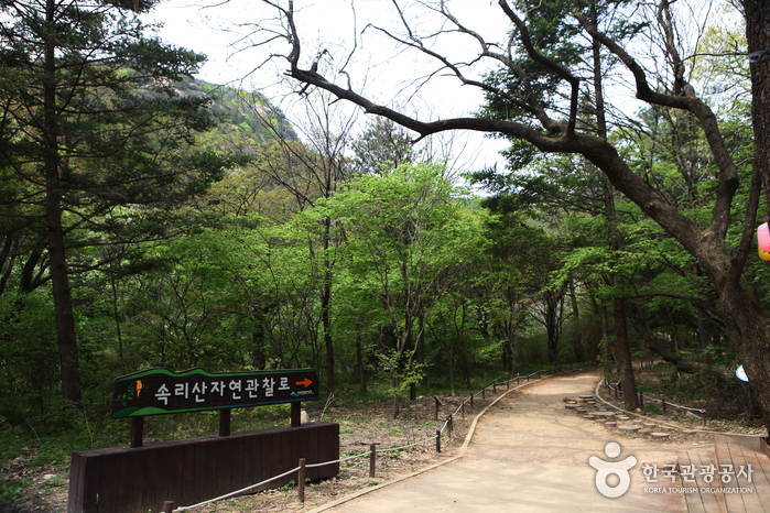 Songnisan Special Tourist Zone (속리산 관광특구)
3.4 km from the summit
-
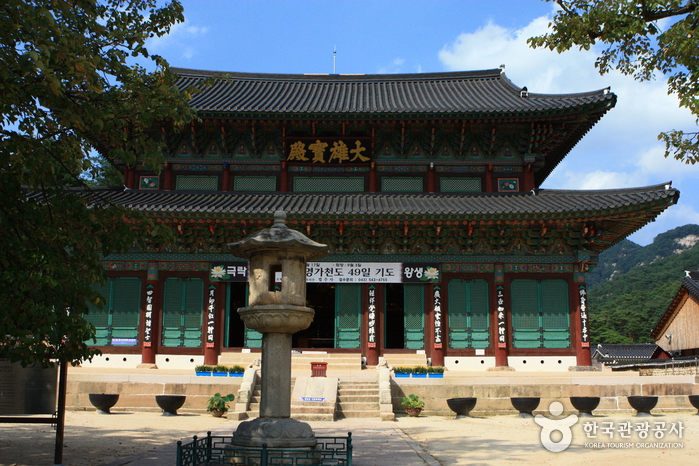 Boeun Beopjusa Temple [UNESCO World Heritage] (보은 법주사 [유네스코 세계문화유산])
3.4 km from the summit
-
 Sangju Maengmundong Pine Forest (상주 맥문동 솔숲)
4.6 km from the summit
-
 Janggakpokpo Falls (장각폭포)
4.7 km from the summit
-
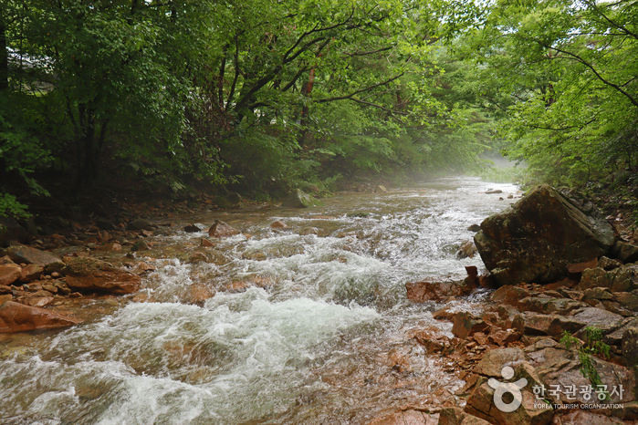 Mansugyegok Valley (만수계곡)
5.3 km from the summit
-
 Songnisan National Park (Chungcheongbuk-do Section) [속리산국립공원(충북)]
5.6 km from the summit
Times and difficulty are estimates from GPS tracks. Before you go, check the weather, sunset time and any trail closures. Course tracks recorded: 2022-01-06
Text on this page was translated automatically from Korean public data. Place names follow the Revised Romanization; signs on the trail are in Korean.
Data: Korea Forest Service and Korea Hiking & Trekking Support Center (Public Data Portal). Course times and difficulty are estimates from GPS tracks (2022).