
Sobaeksan 1,440m
The mountain where Toegye Yi Hwang wrote poems
Easy Moderate Hard Spring flowers Sea views Public transport


- Location
- Danyang-eup, Danyang-gun, Chungcheongbuk-do / Punggi-eup, Yeongju-si, Gyeongsangbuk-do
- Courses
- 9 · 1 h 5 min – 7 h
- Distance
- 2.6 km – 17.8 km
- Facilities
- Toilets 18 · Parking 13
- Managed by
- Danyang County Office · 043-422-3011
Trail map
Why it is one of the 100 famous mountains
Designated for its massive mountain cluster at around 1,300m above sea level stretching from Gukmangbong Peak to Birobong Peak and Yeonhwabong Peak, featuring plateau-like grasslands above 1,000m, being the origin of Gukmangcheon Stream and Jukgyecheon Stream (upper reaches of the Nakdonggang River), and its status as a National Park (designated in 1987). Near the main peak, Birobong Peak, there are colonies of yew trees (Natural Monument No. 244) and Korean edelweiss (Somdari). Huibangsa Temple, Guinsa Temple, Sosu Seowon (Historic Site No. 55), Buseoksa Temple, Ondanseong Fortress, and the National Astronomical Observatory are famous nearby.
About Sobaeksan
Sobaeksan (1,439.7m) is one of the celebrated mountains along the Baekdudaegan Mountain Range. A grand ridge extending over 20km connects peaks above 1,000m from east to west, including Gukmangbong Peak, Birobong Peak, Yeonhwabong Peak, and Dosolbong Peak beyond Jungnyeong Pass. Excluding Dosolbong Peak, the three main peaks of Sobaeksan (Gukmangbong, Birobong, and Yeonhwabong) rise in a line across roughly 13km. When a sea of clouds rolls in, the high peaks resemble islands floating in an open sea.
In May and June, royal azaleas form a sea of blooms, drawing many hikers, with the ridge connecting the three peaks being the highlight. In August, the gentle grassy slopes are blanketed with various alpine plants, resembling a sky-high botanical garden. The yew tree habitat near Birobong Peak is a Natural Monument preserving primeval characteristics. Huibang Valley is the most historic valley in Sobaeksan's grand yet gentle topography and serves as a major starting point for hiking trails.
Straddling the boundary between Gyeongsangbuk-do and Chungcheongbuk-do, Sobaeksan is considered one of Korea's 12 celebrated mountains and is often called the 'Alps of Korea.' Covering an area of 320.5㎢, the vast mountain range forms a grand ridge lined with 1,000-meter peaks, including the highest peak Birobong, Yeonhwabong Peak (1,376.9m), Yeonhwabong 2-bong Peak (1,357.3m), and Gukmangbong Peak (1,420.8m).
Courses recommended by the Korea Forest Service
- Cheondong Ticket Office → Darian Falls → Daegwolteo → Minbaegijae Pass → Birobong Peak → Descent 3 h
- Jungnyeong → Yeonhwabong 2-bong Peak → Astronomical Observatory → Birobong Peak → Descent 4 h 30 min
- Samga Ticket Office → Birosa Temple → Birobong Peak → Descent 2 h 40 min
Public transport
Base points are Danyang and Punggi.
Get off at Danyang Station (☎ 043-422-7788), Huibangsa Station (☎ 054-638-7788), or Punggi Station (☎ 054-636-7788) on the Jungang Line.
Buses from Punggi to Huibangsa Temple operate from 06:30 to 19:00 at 30-minute intervals (takes 30 minutes). Buses from Danyang to Cheondong-ri (☎ 043-422-3214) run 14 times a day.
Food, lodging & more (Korea Forest Service data, may change)
● Accommodations and Information
Punggi: Punggi Hotel ☎ 054-637-8800, Huibang Motel ☎ 054-638-8000, Ongnyeobong Natural Recreation Forest ☎ 054-636-5928
Danyang: Daemyung Resort ☎ 043-423-7070, Geumsujang ☎ 043-422-2402. The wild vegetable set meal at Jungnyeong Jumak (☎ 043-638-6151) is recommended.
● Inquiries
Sobaeksan National Park Office ☎ 054-638-6196, Northern Office ☎ 043-423-0708
Nearby attractions
-
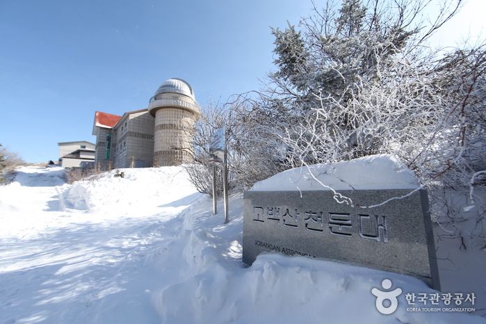 Sobaeksan Optical Astronomy Observatory (소백산천문대)
3.2 km from the summit
- Huibangsa Temple (Yeongju) (희방사(영주)) 4.6 km from the summit
- Sobaeksan National Park (Gyeongsangbuk-do Region) (소백산국립공원(경북)) 7.3 km from the summit
-
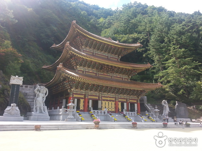 Guinsa Temple (Danyang) (구인사(단양))
8.3 km from the summit
-
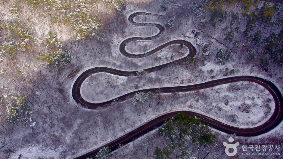 Danyang Bobaljae Pass (단양 보발재)
8.6 km from the summit
- Gosudonggul Cave (단양 고수동굴) 9.3 km from the summit
Times and difficulty are estimates from GPS tracks. Before you go, check the weather, sunset time and any trail closures. Course tracks recorded: 2022-01-06
Text on this page was translated automatically from Korean public data. Place names follow the Revised Romanization; signs on the trail are in Korean.
Data: Korea Forest Service and Korea Hiking & Trekking Support Center (Public Data Portal). Course times and difficulty are estimates from GPS tracks (2022).