
Seoraksan 1,708m
An all-around masterpiece blessed with delicate scenic wonders
Easy Moderate Hard Valleys Snow scenery Public transport
- Location
- Seo-myeon and Ganghyeon-myeon, Yangyang-gun; Seorak-dong, Sokcho-si; Buk-myeon and Inje-eup, Inje-gun, Gangwon-do
- Courses
- 8 · 40 min – 7 h 50 min
- Distance
- 0.9 km – 16.1 km
- Facilities
- Toilets 23 · Parking 4
- Managed by
- Yangyang County Office · 033-670-2114
Trail map
Why it is one of the 100 famous mountains
Selected as South Korea's third highest mountain, showcasing the peak of Korean alpine scenery where numerous passes like Hangyeryeong, Madeungnyeong, and Misiryeong converge with prominent ridges and valleys. It is managed as a National Park (designated in 1970) and a UNESCO Biosphere Reserve (designated in 1982). Notable landmarks include Baekdamsa Temple, Bongjeongam Hermitage, Sinheungsa Temple, Gyejoam Hermitage, Oseam Hermitage, Heundeulbawi Rock, Towangseong Falls, and Daeseung Falls.
About Seoraksan
In a word, it is the Alps of Korea. Although often compared to Geumgangsan, Seoraksan is 72 meters lower and lacks a long east-west ridge, covering a significantly smaller mountain area. However, Geumgangsan was historically more famous because of easier access and gentler slopes that anyone could climb even in straw sandals. From an alpinism perspective, Seoraksan is considered superior.
Ranked third in height after Hallasan and Jirisan, it is undoubtedly the finest mountain in South Korea in terms of sheer grandeur. It is conventionally divided into Naeseorak (Inner Seorak) to the west and Oeseorak (Outer Seorak) to the east by Gongnyong Ridge on the Baekdudaegan, with the Osaek area often designated as Namseorak (Southern Seorak). Naeseorak features scenic valleys such as Baekdam, Suryeomdong, Gayadong, and Tangsudong (12 Seonnyotang) valleys. Oeseorak boasts the beautiful streams of Cheonbuldong Valley, tributary gorges, and majestic rock formations and cliffs like Ulsanbawi Rock, Bonghwadae, Janggunbong Peak, and Beombong Peak.
Due to abundant snowfall, it was also referred to as Seolsan, Seolbongsan, or Hangyesan. Donggukyeojiseungnam records that "it is called Seorak because the snow that begins to fall on Chuseok only disappears around the summer solstice." Even today, lingering snow remains in the valleys until May.
Seoraksan is the third highest mountain in South Korea after Hallasan (1,947.3 m) and Jirisan (1,915.4 m), spanning Sokcho-si, Yangyang-gun, and Inje-gun in Gangwon-do.
Historical documents record that only the mountains in Yangyang and Sokcho surrounding present-day Daecheongbong Peak were called 'Seorak', while the mountain around Gwittaegicheongbong Peak in Inje was separately called 'Hangyesan'. Hangyesanseong Fortress near Jangsudae south of Ansan supports this record. The highlight of the northern main ridge stretching from Jinburyeong to Daecheongbong Peak is the Gongnyong Ridge, composed of countless jagged peaks; this route traverses the backbone of the ridge in the shortest time. First traversed in the winter of 1963 by Korean rock-climbing pioneers including Seonu Jeong-ok, Jeong Gyu-hyeon, and Chae Tae-ung, this ridge has gained tremendous popularity and now features well-maintained trails accessible to everyday hikers.
Seoraksan supports the waist of the Baekdudaegan spine extending south from Baekdusan. Towering between Geumgangsan in the north and Odaesan in the south, it is celebrated as Korea's premier scenic destination. It was designated a Natural Monument Preservation District (163.4 sq km) on November 5, 1965, a Tourism Zone (16.2 sq km) in 1969, and a National Park (174 sq km) in 1970. The Seoraksan National Park Office opened in September 1971, and the park was expanded to 354.6 sq km over two phases in 1977 and 1978, later expanding to 374 sq km. Located at the entrance to the Ulsanbawi trail, Sinheungsa Temple serves as the head temple of the 3rd District of the Jogye Order of Korean Buddhism and is the foremost temple of Seoraksan. It was originally founded as Hyangseongsa near Norumok by Master Jajang during the Silla period before being rebuilt at its current site during the Joseon Dynasty.
Courses recommended by the Korea Forest Service
- Seorak-dong → Biseondae → Madeungnyeong → Gongnyong Ridge → Huiungak → Socheong → Seoraksan Shelter 11 h
- Yongdae-ri → Baekdamsa Temple → Suryeomdong Shelter → Ssangpokpo Falls → Bongjeongam Hermitage → Socheong → Seoraksan Shelter 8 h
- Namgyo-ri → Tangsudong → Daeseungnyeong → Gwicheong → Hangyeryeong Junction → Seoraksan Shelter 13 h 30 min
Public transport
The main transit hub is Sokcho.
Express buses depart every 30 minutes from Dong Seoul Terminal and Gangnam Express Bus Terminal in Seoul, including two late-night services.
Intercity buses run to Sokcho from Busan, Daegu, Gwangju, Daejeon, Ulsan, Suwon, Seongnam, Chuncheon, Ansan, Ilsan, Uijeongbu, Chungju, Taebaek, and Pocheon.
For Naeseorak, take a direct bus via Hongcheon from Dong Seoul Terminal or Sangbong Terminal.
- Sokcho → Seorak-dong: Local bus No. 7 or 7-1 runs at 10-minute intervals
Food, lodging & more (Korea Forest Service data, may change)
● Food, Lodging & Other Info
Accommodations are widely available throughout the Seorak-dong, Baekdam, and Osaek districts. Seorak-dong offers a broad range from upscale hotels to private guesthouses (minbak), along with a large auto-camping ground in Zone C.
Hotel Seorak Park ☎033-636-7711, Seorak Crystal Motel ☎033-636-7626, Seoraksan Minbak ☎033-635-4231, Osaek Greenyard Hotel (Motel) ☎033-672-8500, Osaek Hot Springs ☎033-672-3635, Yongdae-ri Gangpunggyeong Park ☎033-462-9225, Deli Park ☎033-462-6647, Namgyo-ri Yonga Minbak ☎033-462-6399
● Inquiries
Seoraksan National Park Office ☎033-636-7700
Nearby attractions
- Bongjeongam Hermitage (Inje) (봉정암(인제)) 1.8 km from the summit
- Seoraksan Daecheongbong Peak (설악산 대청봉) 3.8 km from the summit
- Osaek Green Yard Hotel (오색탄산온천) 4.4 km from the summit
- Osaek Mineral Spring (오색약수터) 4.9 km from the summit
-
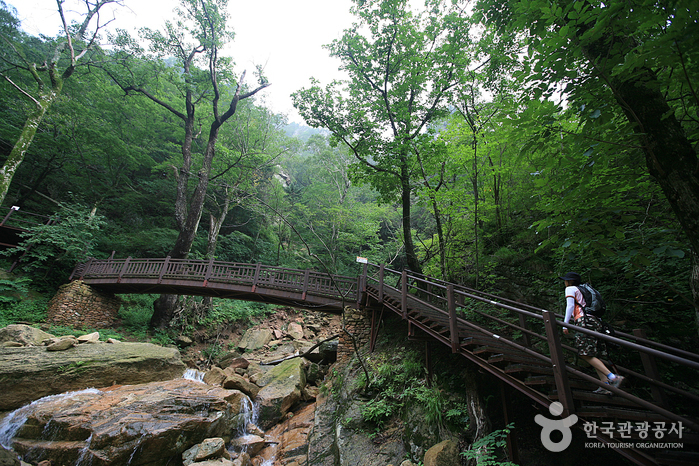 Seoraksan Heullimgol Valley (설악산 흘림골)
5.1 km from the summit
-
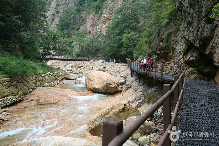 Seoraksan Osaek Jujeongol Valley (설악산 오색주전골)
5.2 km from the summit
Times and difficulty are estimates from GPS tracks. Before you go, check the weather, sunset time and any trail closures. Course tracks recorded: 2022-01-06
Text on this page was translated automatically from Korean public data. Place names follow the Revised Romanization; signs on the trail are in Korean.
Data: Korea Forest Service and Korea Hiking & Trekking Support Center (Public Data Portal). Course times and difficulty are estimates from GPS tracks (2022).