
Seodaesan 905m
Jingnyeotangeumdae Spring Water that Finds One's Spouse
Easy Moderate Hard Valleys Sea views Public transport

- Location
- Chubu-myeon and Gunbuk-myeon, Geumsan-gun, Chungcheongnam-do; Gunseo-myeon, Okcheon-gun, Chungcheongbuk-do
- Courses
- 5 · 1 h 10 min – 4 h 45 min
- Distance
- 2.3 km – 7.2 km
- Facilities
- Toilets 5 · Parking 7
- Managed by
- Geumsan-gun Office · 041-750-2114
Trail map
Why it is one of the 100 famous mountains
Selected for being the highest mountain in Chungcheongnam-do, featuring bizarre rocks and cliff faces throughout, earning it the reputation of the Geumgang of the central region for its scenic beauty, along with splendid summit views. Yonggul Cave, Sajagul Cave, Gyeon-ujangnyeondae, Jingnyeotangeumdae, and Bukdusaeseongbawi Rock are famous.
About Seodaesan
Rising over 900 meters, this is the highest mountain in Chungcheongnam-do, where mountains of such stature are rare. It extends long north-south and narrow east-west as an isolated, imposing mountain. However, there are no open plains at its foot, and its mountain form is obscured by Jangryongsan (654.5m), Maebong (599.5m), and Daeseongsan (705.9m) to the east, and Dodeokbong (372.8m), Jibongsan (464.3m), and Man-insan (537.8m) to the west. It brings to mind the second condition of a renowned mountain described by Yi Jung-hwan: ""It must border a large river or the sea.""
The overall mountain shape resembles the Yeouido Exhibition Hall and is not particularly striking, but along its ridges stand many strangely shaped rocks such as Gyeon-utan-geumdae, Ongnyeojikgeumdae, Dakbyeoseulbawi Rock, Madangbawi Rock, Seonbawi Rock, Namgeunbawi Rock, and Ssalbawi Rock. There are also caves like Yonggul and Sajagul, and waterfalls like Gaedeokpokpo Falls. However, due to inconvenient transportation and lack of wide fame, it remains quiet and secluded.
As suggested by the names of the two representative rocks, it holds the legend of the Cowherd (Gyeon-u) and the Weaver Maiden (Jingnyeo). The story tells of Gyeon-u playing the geomungo yearning for Jingnyeo at Tangeumdae, and Jingnyeo weaving cloth at Jikgeumdae, meeting at the summit of Seodaesan on the seventh day of the seventh lunar month.
Attractions: The most common course visits Gaedeoksa Temple and Gaedeokpokpo Falls, ascends to the summit via Ongnyeojikgeumdae, and descends across the suspension bridge past Gyeon-utan-geumdae. Starting on the ridge to the left of Gaedeokpokpo Falls, there is a spacious, refreshing mineral spring with a good view midway up. Past the Dakbyeoseulbawi Rock ridge intersection, a trail traversing rightward appears, which leads directly to Ongnyeojikgeumdae; one should leave the ridge path and head that way.
Ongnyeojikgeumdae, where a 15-meter-wide rock ledge stretches for about 30 to 40 meters midway up the cliff, offers great views, a spring, and a cave. Located right below the summit, it is also a well-known prayer site visited by worshipers year-round. From here, the summit is less than a quarter of an hour away.
Views from the summit are excellent in all directions except the northwest. However, they do not rival those from Gyeon-utan-geumdae. That famous rectangular rock stands out prominently from both Daejeon and Geumsan. Climbing down the rock and continuing forward leads to the signboard indicating the ""Suspension Bridge Descent Trail.""
Geumsan Insam Festival Executive Committee (041-751-3799)
Forest Trail Highlights: Jingnyeotangeumdae, Jangmyeongdae, Bukdusaeseongbawi Rock, Sajagul Cave, Ssalbawi Rock, Sinseonbawi Rock, Byeoseulbawi Rock, Janggunbawi Rock, Yongbawi Rock, Madangbawi Rock, Nojeokbong Peak, etc.
Seodaesan stands at an elevation of 904.1m. Part of the Geumsan Plateau encircling the Geumgang Basin in southeastern Chungcheongnam-do, it is the crown jewel of the Noryeong Mountain Range and the highest peak in Chungcheongnam-do. At 904.1m, the highest mountain in Chungnam, it features rugged rocky cliffs.
A conical rocky mountain composed of granite, Seodaesan blends bizarre cliffs with lush forest, offering a moderately rugged and thrilling hike. Reaching the summit brings sweeping views of the grand yet gentle mountain terrain, with downtown Daejeon unfolding far to the northwest.
Famous temples like Wonheungsa Temple and Gaedeoksa Temple dot the mountain, while Jingnyeotangeumdae sits just before the summit. Along the ridge leading north toward Peak 546 are Jangmyeongdae, Bukdusaeseongbawi Rock, Sajagul Cave, and Ssalbawi Rock. Around the approximately 50m suspension bridge installed high across the gorge, uniquely shaped rocky cliffs such as Sinseonbawi Rock and Byeoseulbawi Rock combine to create a spectacular scene.
Courses recommended by the Korea Forest Service
- Seodaesan Youth Training Center → Dakbyeoseulbawi Rock → Ongnyeojikgeumdae → Summit → Gyeon-utan-geumdae → First Intersection → Southeast Ridge → Anbogwang-ri 4 h
- Dream Resort → Valley Trail → First Intersection → Main Ridge → Gyeon-utan-geumdae → Summit → Ongnyeojikgeumdae → Wonheungsa Temple 4 h 15 min
- Jangryongsan Natural Recreation Forest → Peak 546 → Dogye Three-way Intersection → Suspension Bridge Intersection → Gyeon-utan-geumdae → Summit → Jingnyeojikgeumdae → Youth Training Center 5 h 45 min
Public transport
Chubu, where buses to Dream Resort run 11 times daily, is the starting point. To reach Wonheungsa Temple, take the Gunbuk-bound bus operating 8 times daily. To reach Chubu, take bus 501 or 520 from Daejeon Station. For Jangryongsan Natural Recreation Forest or Anbogwang-ri, use a taxi from Okcheon-eup or Gunseo-myeon.
Food, lodging & more (Korea Forest Service data, may change)
● Lodging and Other Information
Lodging is available at Seodaesan Dream Resort. ☎041-753-2662
Accommodations are also available in Chubu. Cinderella Park ☎041-753-8262 Taebongsan Motel ☎041-754-8102
● Inquiries
Geumsan-gun Office Culture, Public Information and Tourism Division ☎041-753-4350
Nearby attractions
-
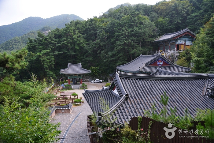 Okcheon Yongamsa Temple (용암사(옥천))
4.8 km from the summit
-
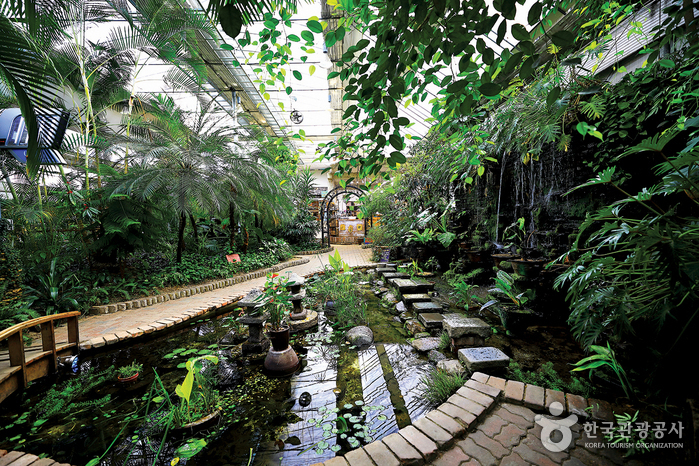 Garden of Sky (하늘물빛정원)
5 km from the summit
-
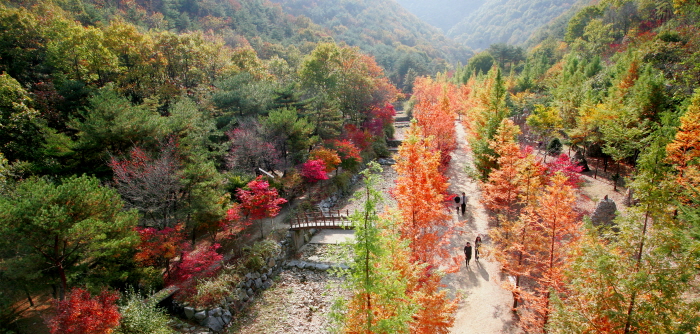 Sangso-dong Forest Park (상소동 산림욕장)
6.2 km from the summit
- Maninsan Recreational Forest (만인산 자연휴양림) 7.8 km from the summit
- Yetteo Folk Museum (옛터민속박물관) 8.8 km from the summit
-
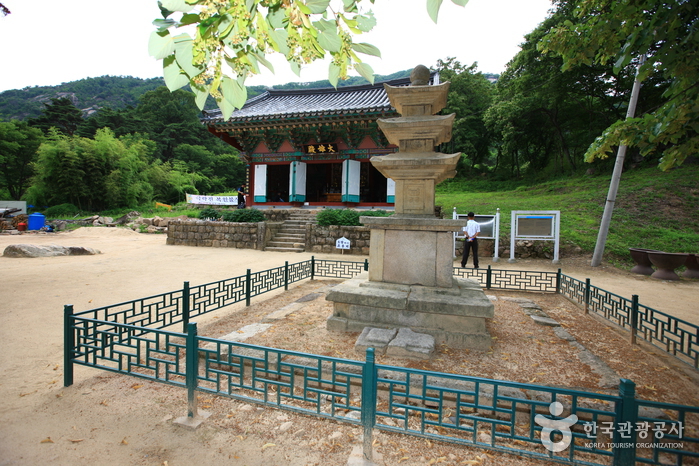 Yeongdong Yeongguksa Temple (영국사 (영동))
9.5 km from the summit
Times and difficulty are estimates from GPS tracks. Before you go, check the weather, sunset time and any trail closures. Course tracks recorded: 2022-01-06
Text on this page was translated automatically from Korean public data. Place names follow the Revised Romanization; signs on the trail are in Korean.
Data: Korea Forest Service and Korea Hiking & Trekking Support Center (Public Data Portal). Course times and difficulty are estimates from GPS tracks (2022).