
Palyeongsan 607m
Clairvoyant Overlooking Tsushima Island
Moderate Hard Valleys Sea views Public transport
- Location
- Yeongnam-myeon and Jeomam-myeon, Goheung-gun, Jeollanam-do
- Courses
- 2 · 3 h 50 min – 5 h
- Distance
- 7.7 km – 9.3 km
- Facilities
- Toilets 4 · Parking 4
- Managed by
- Goheung-gun County Office · 061-830-5114
Trail map
Why it is one of the 100 famous mountains
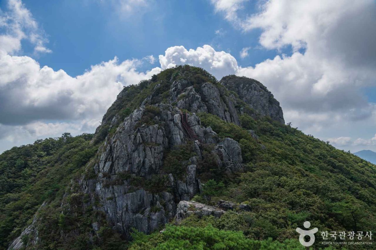
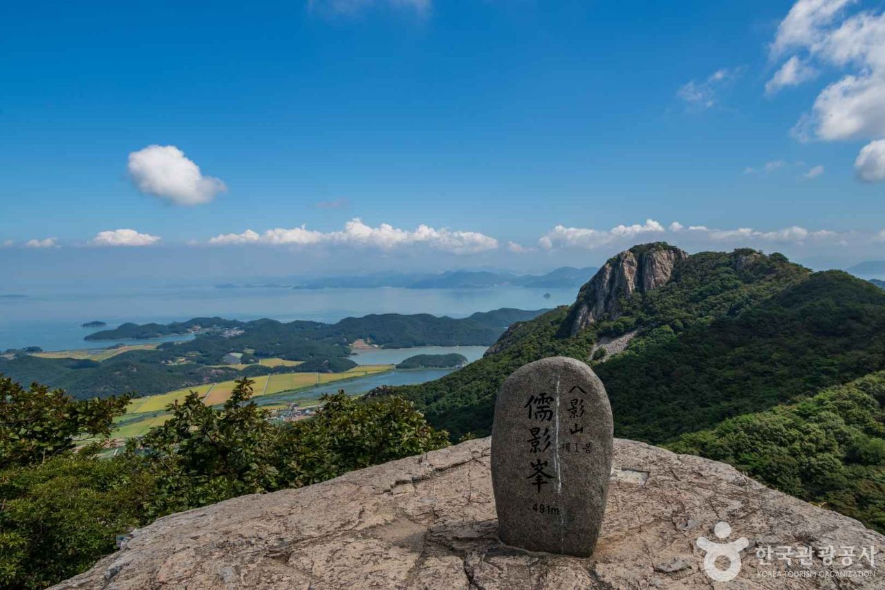
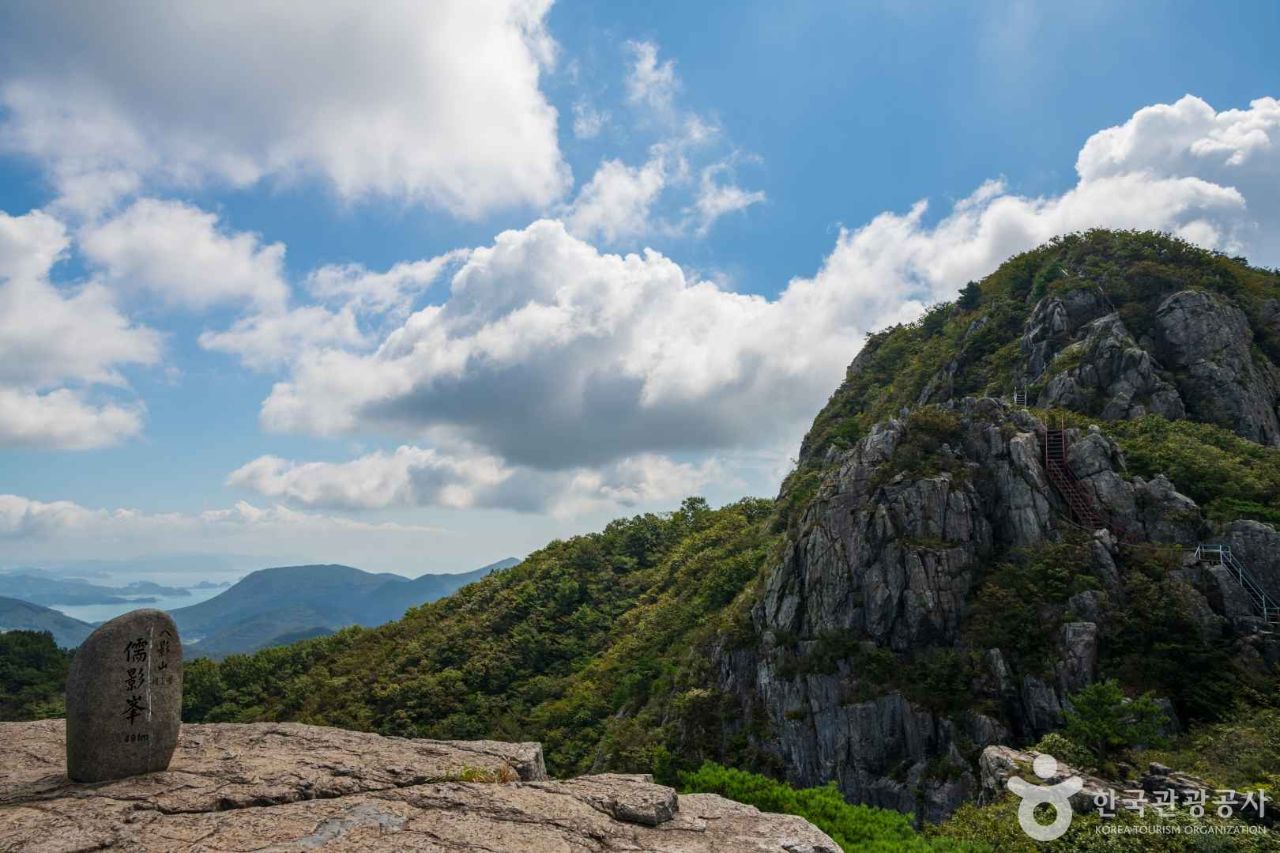
Selected for its rugged landscape made of eight rocky peaks, numerous bizarre rock formations, excellent panoramic views, and designation as a Provincial Park (1998). It houses Neunggasa Temple, once counted as one of the four great temples of Honam along with Hwaeomsa, Songgwangsa, and Daeheungsa. It features Sinseondae, Gangsan Falls, and a natural recreation forest. Views from the summit are so clear that Tsushima Island can be seen.
About Palyeongsan
A mountain boasting sharp and dramatic peak scenery. Mountains with 'pal' (eight) in their name generally feature splendid peaks, but while Palbongsan in Hongcheon or Seosan are smaller and lack grandeur, this highest peak of Goheung rises 600 meters with eight rocky peaks, combining outstanding beauty with magnificence. Its composition is perfectly balanced, with the east-northeast ridge of Peak 2 and the south ridge of Peak 8 on both shoulders, guarded in front by the triangular Cheonjubong Peak. This is why hikers visit continuously despite it being one of the farthest mountains from the Seoul metropolitan area.
Goheung-gun set up stone nameplates: Peak 1 is Yuyeongbong, Peak 2 Seongjubong, Peak 3 Saenghwangbong, Peak 4 Sajabong, Peak 5 Orobong, Peak 6 Durubong, Peak 7 Chilseongbong, and Peak 8 Jeokchwibong. The naming feels rather artificial based on the correlation between sequence and names. Originally, only the slightly separated Peak 1 had an individual name, while the rest were grouped together and called Seongjubong Peak before each was named separately.
The vantage point for panoramic photography is Moryong-ri, where the Jeomam-myeon office is located. Jeomam means that rocks, which Goheung locals call 'bagu', are dotted around; outside Palyeongsan, such terrain is nonexistent in Jeomam-myeon. In Moryong-ri lies Hoegye Village, locally called 'Bagudari'. The original name of Palyeongsan was Bagudarimoe or Bagudarisan.
Because the peaks rise abruptly, valleys are not well-developed. Instead, there is the sea. As a mountain on Goheung, a sweet-potato-shaped peninsula attached to the mainland, lake-like seas stretch out in all directions.
Located 25 km east of Goheung-eup at the very end of the Sobaek Mountain Range, its eight rocky peaks rise in a straight line toward the south.
Courses recommended by the Korea Forest Service
- Neunggasa Temple Entrance → Palyeong Sanjang → Heundeulbawi Rock → Peaks 1 to 8 → Gitdaebong Peak → Southeast Ridge → Yeongnam-myeon Office 3 h 40 min
- Ucheon-ri Ticket Office → Natural Recreation Forest → Peak 2 East Ridge → Peaks 2 to 8 → Palyeongsan Natural Recreation Forest → Ucheon-ri Ticket Office 3 h 20 min
- Gangsan-ri → Sinseondae → Peak 2 East Ridge → Peaks 2 to 8 → Tapjae → Palyeong Sanjang → Neunggasa Temple Entrance 3 h 30 min
Public transport
The base point is Goheung-eup. Local buses passing Jeomam-myeon Office, Neunggasa Temple Entrance, Ucheon-ri, and Yeongnam-myeon Office run 18 times a day. Buses to Goheung run 6 times a day from both Seoul Gangnam Terminal and Busan Sasang Terminal. Buses also run 67 times a day from Gwangju, 90 times a day from Suncheon (a railway hub), and every 20 minutes from Beolgyo, the gateway to Goheung.
Food, lodging & more (Korea Forest Service data, may change)
● Lodging and Local Information
Use Palyeong Sanjang (☎ 061-833-8080) inside Neunggasa Temple or Palyeongsan Natural Recreation Forest (☎ 061-833-8779).
Inns are available in Goheung-eup town. Haengunjang Motel ☎ 061-834-6101, Green Park Motel ☎ 061-835-3364
● Inquiries
Palyeongsan Provincial Park Management Office ☎ 061-835-9566
Times and difficulty are estimates from GPS tracks. Before you go, check the weather, sunset time and any trail closures. Course tracks recorded: 2022-01-06
Text on this page was translated automatically from Korean public data. Place names follow the Revised Romanization; signs on the trail are in Korean.
Data: Korea Forest Service and Korea Hiking & Trekking Support Center (Public Data Portal). Course times and difficulty are estimates from GPS tracks (2022).