
Palgongsan 1,192m
A Small Showcase of National Treasure-Level Cultural Heritage
Easy Moderate Hard Spring flowers Valleys Autumn foliage Snow scenery Public transport


- Location
- Dong-gu, Daegu; Bugye-myeon, Gunwi-gun and Sinnyeong-myeon, Yeongcheon-si, Gyeongsangbuk-do
- Courses
- 20 · 30 min – 5 h 55 min
- Distance
- 0.4 km – 13 km
- Facilities
- Toilets 61 · Parking 47
- Managed by
- Dong-gu Office · 053-662-2000
Trail map
- Directions to trailhead
- Directions to trailhead
- Directions to trailhead
- Directions to trailhead
- Directions to trailhead
- Directions to trailhead
- Directions to trailhead
- Directions to trailhead
- Directions to trailhead
- Directions to trailhead
- Directions to trailhead
- Directions to trailhead
- Directions to trailhead
- Directions to trailhead
- Directions to trailhead
- Directions to trailhead
- Directions to trailhead
- Directions to trailhead
- Directions to trailhead
- Directions to trailhead
Why it is one of the 100 famous mountains
Selected for the scenic ridge landscape stretching 16km east and west around Birobong Peak, its status as the highest mountain near a major metropolitan area providing rest for city dwellers, and its designation as a provincial park in 1980. It is also famous as a sacred center of Buddhist culture, home to temples such as Donghwasa Temple, Eunhaesa Temple, Buinsa Temple, Songrimsa Temple, and Gwanamsa Temple.
About Palgongsan
Considered the central sacred mountain (Jungak) of Silla, Palgongsan is the mother mountain of Daegu mountaineers and the heart of the Bhaisajyaguru (Medicine Buddha) faith.
The name originated because it spans across eight villages: Daegu, Chilgok, Indong (now Inui-dong area in Gumi), Sinnyeong, Uiheung, Yeongcheon, Hayang, and Gyeongsan. The main ridge alone from Gasan to Gatbawi stretches 26km.
Along its foothills lie many renowned temples, including Pagyesa Temple, Buinsa Temple, Donghwasa Temple, Eunhaesa Temple, and the Second Seokguram.
? Best time to visit: Beautiful in all four seasons; the Dalgubeol Festival is held annually in early October.
? Attractions: Stone Seated Bhaisajyaguru Buddha of Gwanbong Peak, Janggunbawi Rock, Seonbonsa Temple, Yaksaam Hermitage, Yongdeoksa Temple, Yongjuam Hermitage, Wonhyoam Hermitage, Cheonseongsa Temple, Bulgulsa Temple.
Azaleas and royal azaleas bloom in spring; lush forests and clear waters thrive in summer; autumn features nationwide renowned foliage along the circular road; and winter harmonizes snowscapes with frost flowers.
? Forest trail highlight: The 16km ridge landscape centered around Birobong Peak stretching east to west is breathtaking.
? Cultural heritage: Stone Seated Bhaisajyaguru Buddha (Gatbawi), Janggunbawi Rock, Cheonseongsa Temple.
Located north of Gyeongsan-si, Gyeongsangbuk-do, this mountain stands at 1,192.3m above sea level. Gwanbong Peak is an 852m peak that is not excessively rugged, making it suitable for average hikers. It has rocky ridge areas, fine natural scenery, and great views from Gwanbong Peak, attracting the largest number of Buddhist believers and hikers year-round.
Courses recommended by the Korea Forest Service
- Hakmyeong-ri → Gasan → Hantijae Pass → Pagyejae Pass → Pagyesa Temple 7 h
- Gatbawi Parking Lot → Gatbawi → Neungseongjae Pass → Sinnyeongjae Pass → Dongbong Peak → Yeomburam Hermitage → Donghwasa Temple 6 h 10 min
- Donghwasa Temple → Yeomburam Hermitage → Dongbong Peak → Sudosa Temple → Sinsiam Hermitage 4 h 30 min
Public transport
The starting hub is Daegu.
Use Daegu city buses. For Donghwasa Temple, take Bus 105 (seated) in front of Hanil Cinema at Gongpyeong Crossroads; it takes about 50 minutes.
For Gatbawi, take Bus 104 (seated) in front of Daegu Station; it takes about 30 minutes. Daegu City Bus Association ☎053-474-1124~5
Food, lodging & more (Korea Forest Service data, may change)
● Food, Lodging, and Other Info
Numerous accommodations are available in the Donghwasa Facility District.
Cosmos Motel ☎053-981-0388
Seungbojang Motel ☎053-981-2900
Deulkkothyang Restaurant ☎053-984-8031
● Inquiries
Provincial Park Management Office ☎054-975-7071~2, Palgongsan Natural Park Management Office ☎053-982-0005
Nearby attractions
- Palgongsan Cable Car (팔공산 케이블카) 2.8 km from the summit
-
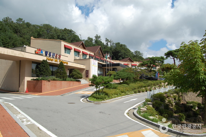 Mt. Palgong Hot Spring Tourist Hotel (팔공산온천관광호텔(온천))
2.8 km from the summit
-
 Palgongsan National Park (Donghwasa Temple District) (팔공산국립공원(동화사지구))
2.9 km from the summit
- Daegu Donghwasa Temple (동화사(대구)) 2.9 km from the summit
-
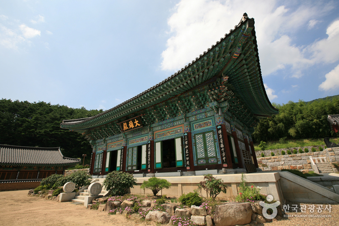 Buinsa Temple (Daegu) (부인사(대구))
3 km from the summit
- Palgongsan National Park (Eunhaesa Temple Section) (팔공산국립공원 - 은해사지구) 4 km from the summit
Times and difficulty are estimates from GPS tracks. Before you go, check the weather, sunset time and any trail closures. Course tracks recorded: 2022-01-06
Text on this page was translated automatically from Korean public data. Place names follow the Revised Romanization; signs on the trail are in Korean.
Data: Korea Forest Service and Korea Hiking & Trekking Support Center (Public Data Portal). Course times and difficulty are estimates from GPS tracks (2022).