
Naeyeonsan 711m
An Earthen Mountain Where a Mystical Mirror Was Buried
Moderate Valleys Sea views Public transport


- Location
- Songna-myeon, Cheongha-myeon, and Jukjang-myeon, Pohang-si / Namjeong-myeon, Yeongdeok-gun, Gyeongsangbuk-do
- Courses
- 5 · 3 h – 4 h 35 min
- Distance
- 6.3 km – 11.5 km
- Facilities
- Toilets 7 · Parking 5
- Managed by
- Pohang City Hall · 054-270-8282
Trail map
Why it is one of the 100 famous mountains
Famous for Cheonghagol Valley, which forms a rugged gorge facing the ridge of Cheonnyeongsan to the south. It is home to Bogyeongsa Temple, which preserves the Stupa of State Preceptor Wonjin (Treasure No. 430) and the Stele of State Preceptor Wonjin (Treasure No. 252).
About Naeyeonsan
Naeyeonsan rises as the Nakdongjeongmaek ridge extends toward the East Coast after passing Juwangsan. Located on the border between Pohang-si and Yeongdeok-gun in Gyeongsangbuk-do, Naeyeonsan connects Munsusan (622m), Samjibong Peak (summit of Naeyeonsan, 711.3m), Hyangrobong Peak (932.4m), and Ucheokbong Peak (Cheonnyeongsan, 774.8m) along its ridgeline. As an earthen mountain with gentle ridges, it may appear unassuming, but nestled along its winding 8 km-long valley are 12 waterfalls.
The highlight of Naeyeonsan is the 12 waterfalls of Cheonghagol Valley, creating scenic spectacles in harmony with rugged cliffs. Starting from Sangsaeng Falls (1st waterfall) at the entrance of Cheonghagol (Naeyeongol) Valley, passing Bohyeon Falls, Sambo Falls, Jamnyong Falls, and Muryong Falls, the valley's beauty reaches its peak around the 6th waterfall, Gwaneum Falls, and the 7th waterfall, Yeonsan Falls.
Renowned for Bogyeongsa Temple and Cheonghagol Valley, Naeyeonsan embraces 12 waterfalls including Sangsaeng Falls, Gwaneum Falls, and Yeonsan Falls, with gentle earthen ridges characterizing most of the terrain.
The trailhead begins at the historic Bogyeongsa Temple, which is said to have been founded in the 25th year of King Jinpyeong of Silla by Buddhist Monk Jimyeong. Returning from studying in China, Monk Jimyeong brought back a mystical eight-sided mirror and advised King Jinpyeong to bury it in a large pond below Naeyeonsan and build a main golden hall over it, establishing the temple under the name Bogyeongsa.
Courses recommended by the Korea Forest Service
- Bogyeongsa Temple → Munsusan Junction → Eunpok Falls → Simyeong-ri → Hyangrobong Peak → Samjibong Peak → Munsusan → Bogyeongsa Temple 7 h 30 min
- Bogyeongsa Temple → Munsusan Junction → Eunpok Falls → Samjibong Peak → Munsusan → Bogyeongsa Temple 5 h 30 min
- Saemjae → Three-way Junction → Cheonnyeongsan → Yeonsan Falls → Bogyeongsa Temple 6 h
Public transport
The starting point is Pohang.
If direct buses to Pohang are unavailable, travel via Daegu, where frequent buses head to Pohang.
- Pohang → Bogyeongsa Temple: 10 times daily, Shinan Passenger ☎054-293-0320, Pohang Bus Terminal ☎054-256-8500
- Pohang → Okgye Valley, Haok-ri: 3 times daily, Seongwon Passenger ☎054-273-7203, Haok Bus Terminus ☎054-262-6631
Food, lodging & more (Korea Forest Service data, may change)
● Food, Lodging & Other Info
Accommodations are mostly concentrated near Bogyeongsa Temple.
Daedongjang Motel ☎054-262-0072
Silla Restaurant & Homestay ☎054-262-0565
Palgakjeong Yeonsanjang ☎054-262-1100
Haok Sanjang (Okgye Valley, Haok-ri) ☎054-262-7885
● Inquiries
Pohang City Hall Culture & Public Relations Division ☎054-245-6063
Nearby attractions
-
 Gyeongsangbuk-do Arboretum (경상북도수목원)
5.3 km from the summit
-
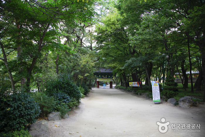 Naeyeonsan Bogyeongsa Municipal Park (내연산보경사시립공원)
5.5 km from the summit
-
 Bogyeongsa Temple (보경사)
5.5 km from the summit
-
 Yeonsan Spa Park (연산온천파크)
5.6 km from the summit
-
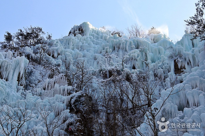 Cheongsong Eoreumgol Valley (Cheongsong National Geopark) (청송 얼음골 (청송 국가지질공원))
6.7 km from the summit
Times and difficulty are estimates from GPS tracks. Before you go, check the weather, sunset time and any trail closures. Course tracks recorded: 2022-01-06
Text on this page was translated automatically from Korean public data. Place names follow the Revised Romanization; signs on the trail are in Korean.
Data: Korea Forest Service and Korea Hiking & Trekking Support Center (Public Data Portal). Course times and difficulty are estimates from GPS tracks (2022).