
Myeongseongsan 922m
The Crying Mountain That Wept with Prince Mauideok
Moderate Valleys Autumn foliage Silver grass Public transport


- Location
- Galmal-eup, Cheorwon-gun, Gangwon-do; Yeongbuk-myeon and Idong-myeon, Pocheon-si, Gyeonggi-do
- Courses
- 1 · 4 h – 4 h
- Distance
- 8.6 km – 8.6 km
- Facilities
- Toilets 5 · Parking 1
- Managed by
- Cheorwon-gun Office · 033-450-5114
Trail map
Why it is one of the 100 famous mountains
Selected for forming part of the watershed for Dopyeongcheon Stream, Yeongpyeongcheon Stream, and the Hantangang River, featuring steep terrain intertwined with rocky crags that create scenic landscapes. It is bordered by Sambuyeonpokpo Falls to the north and Sanjeonghosu Lake to the south. Legend also holds it as the famous site where Gungye was killed while fleeing from Wang Geon.
About Myeongseongsan
Myeongseongsan is renowned as a scenic destination alongside Sanjeonghosu Lake nestled at its foot. Its name, meaning 'Crying Mountain', originates from a legend where Gungye wept bitterly after his defeat by Taejo Wang Geon of Goryeo, who was once his subordinate. Consequently, numerous legends of Gungye linger across the mountain, including Gungyebong Peak, Paejugol Valley where Gungye fled, and Mangmubong Peak named as a spot to watch for approaching troops of Wang Geon.
Spanning Pocheon in Gyeonggi-do and Cheorwon in Gangwon-do, Myeongseongsan features many scenic spots such as Gungye King Cave, Jainsa Temple, Chaekbawi Rock, and Deungnyongpokpo Falls. In particular, the ridge leading to the summit forms a vast silver grass field, prompting Pocheon-si to host an annual Silver Grass Festival on the second weekend of October.
Myeongseongsan is situated 84 km northeast of Seoul and about 4 km from Uncheon. Having Sanjeonghosu Lake at its foot allows visitors to enjoy both mountain hiking and lake scenery.
It is also nicknamed 'Ureumsan' (Crying Mountain), accompanied by a sorrowful legend. It is said that when Prince Mauideok, the last prince of Silla, wailed on this mountain in grief over his fallen kingdom, the mountain wept with him. The mountain took its name Myeongseongsan, meaning 'cry' and 'sound', from this tale of shared sorrow.
The mountain features imposing and steep rock faces, offering spectacular silver grass scenery in autumn. Composed of both rocky ridges and cliffs, it displays diverse landscapes across all four seasons. While the summit is a bare peak, it provides expansive open views, and the ridge of 12 peaks extending southward is truly magnificent. Walking up and down along the ridge through the dense silver grass fields makes the hike engaging from start to finish.
Courses recommended by the Korea Forest Service
- Sanjeonghosu Lake Parking Lot → Biseonpokpo Falls → Silver Grass Habitat → Deungnyongpokpo Falls → Biseonpokpo Falls → Parking Lot 3 h
- Sanjeonghosu Lake Parking Lot → Biseonpokpo Falls → Deungnyongpokpo Falls → Samgakbong Peak → Myeongseongsan Summit → Sanangogae Pass → Parking Lot 6 h
Public transport
Pocheon serves as the base.
Pocheon Intercity Bus Terminal ☎031-532-5217
- Pocheon → Dongsong (Sanjeonghosu Lake): runs every 10 minutes
- Uncheon → Sanjeonghosu Lake: runs every 30 minutes
Food, lodging & more (Korea Forest Service data, may change)
● Lodging and Facilities
Accommodations are available around Sanjeonghosu Lake.
Sanjeonghosu Hotel ☎031-534-4061~5, Sanjeong Camp ☎031-532-6224, 5390
Sanjeonghosu Youth Town ☎031-533-5011~3, Eungok Youth Town ☎031-532-7425~6
Minbak (Guesthouse) Inquiries: Pocheon Yeongbuk Nonghyup Guidance Section ☎031-531-8375, Sanjeonghosu Tourism Branch ☎031-532-6135, 6104
● Inquiries
Pocheon City Hall Culture & Public Information Division, Sanjeonghosu Tourism Branch ☎031-532-6135/6104
Nearby attractions
-
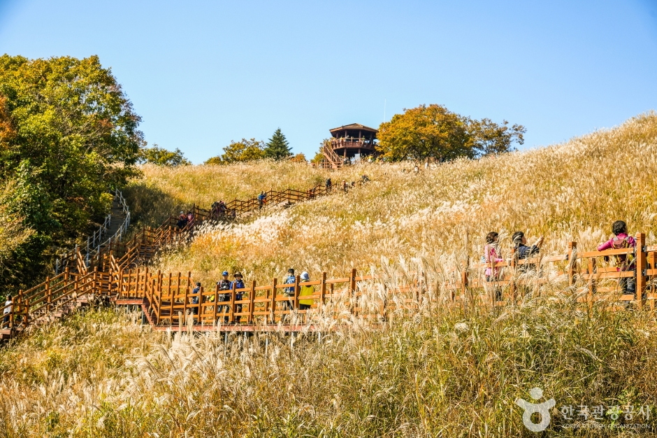 Myeongseongsan Silver Grass Field (명성산 억새밭)
0.9 km from the summit
-
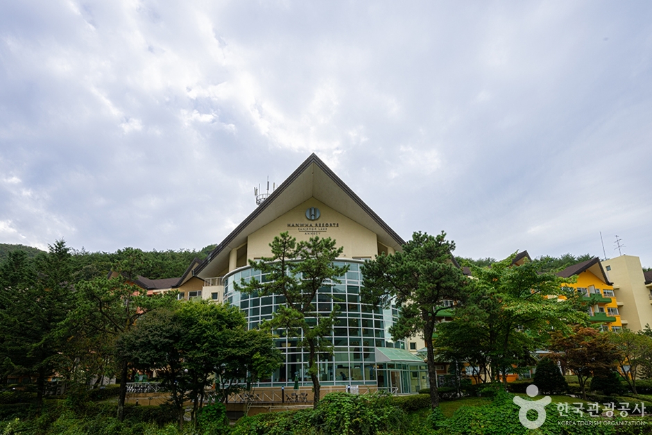 Hanwha Resort Sanjeonghosu Annecy Hot Spring (한화리조트 산정호수 안시 온천사우나)
3.4 km from the summit
-
 HanGwa Culture Museum Hangaone (한과문화박물관 한가원)
3.8 km from the summit
-
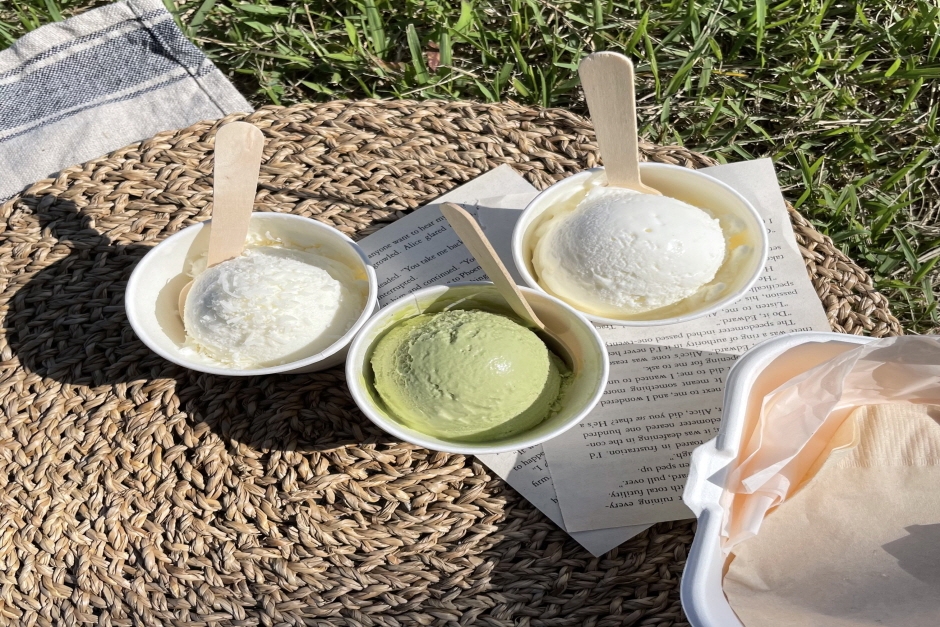 Saruru Farm (사르르목장)
4.8 km from the summit
-
 Sambuyeonpokpo Falls [UNESCO Global Geopark] (삼부연폭포 (한탄강 유네스코 세계지질공원)
6.1 km from the summit
-
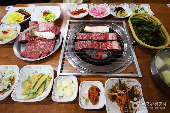 Pocheon Idong Galbi Village (포천 이동갈비마을)
6.6 km from the summit
Times and difficulty are estimates from GPS tracks. Before you go, check the weather, sunset time and any trail closures. Course tracks recorded: 2022-01-06
Text on this page was translated automatically from Korean public data. Place names follow the Revised Romanization; signs on the trail are in Korean.
Data: Korea Forest Service and Korea Hiking & Trekking Support Center (Public Data Portal). Course times and difficulty are estimates from GPS tracks (2022).