
Muhaksan 761m
A Mountain Resembling a Dancing Crane
Moderate Silver grass Sea views Public transport

- Location
- Gyobang-dong, Ducheok-dong, and Naeseo-eup, Changwon-si, Gyeongsangnam-do
- Courses
- 6 · 3 h 40 min – 4 h 25 min
- Distance
- 6.8 km – 9.8 km
- Facilities
- Toilets 7 · Parking 9
- Managed by
- Changwon City Hall · 1899-1111
Trail map
Why it is one of the 100 famous mountains
Selected for its scenic, charming ridges that serve as a retreat for urban dwellers and its sweeping views overlooking the Dadohae archipelago. The rock formations around Sirubong Peak northwest of the summit serve as a great rock climbing training site. The water quality has historically been so pure that brewing thrived here. Near the entrance of Seowongol Valley stands Gwanhaejeong Pavilion, established by disciples of Choe Chi-won, and nearby Wongaksa Temple and Baegunsa Temple are also well known.
About Muhaksan
Muhaksan forms the main backbone of the Nangnamjeongmaek ridge, stretching north and south to embrace Changwon-si to the east, while Jinhaeman Bay at its foot spreads out like a calm lake, resembling a watercolor painting.
Formed as a three-sided pyramid where three mountain ridges meet, Muhaksan is likened to the shape of a dancing crane. The summit consists of a mass of rock without a single blade of grass. Muhaksan is the home of Masan mountaineers, where expeditions to the north faces of the Alps began and journeys to giant Himalayan peaks also started.
Muhaksan is also the birthplace of the fierce free climbing wave that once swept the nation. Its original name was Ducheoksan (斗尺山), which translates to Majae in native Korean. It was also called Semajae.
Muhakbong Peak, presiding over the Nangnamjeongmaek ridge that begins at Samsinbong Peak on Jirisan at the tail end of the Baekdudaegan, is the guardian mountain of Masan. Overlooking Masanman Bay and Jinhaeman Bay, it features the beautiful shape of a crane spreading its wings toward the sea.
Endowed with every quality befitting a renowned mountain, it offers refreshing open views unique to coastal mountains, while the main ridge trail provides a comfortable atmosphere with silver grass fields and rocky observatory peaks.
Below Daegoksan Mountain lies Mannalgogae Pass, a pass steeped in a touching legend of a mother and daughter separated by an arranged marriage due to poverty who, unable to bear their longing, climbed the pass and fortuitously reunited. The ancient name of Muhaksan was Pungjangsan, but it is said that Choe Chi-won of the late Silla period stayed here, observed the topography, and named it Muhaksan because it looked like a crane taking flight.
Courses recommended by the Korea Forest Service
- Jungni Station → Nangnamjeongmaek Ridge Junction → Sirubong Peak Junction → Summit → Gaenaridongsan → Hakbong Peak → Seowongok Valley Entrance 4 h
- Mannalgogae Pass → Daegoksan Mountain → Summit → Geokjeongbawi Rock → Bonghwasan Mountain → Bongguksa Temple 3 h 50 min
Public transport
The starting point is Changwon.
Both Changwon Express Bus Terminal and Changwon Intercity Bus Terminal connect to local city buses.
- Changwon Express Bus Terminal → Seowongol: Bus 71, 71-1
- Changwon Train Station → Seowongol: Bus 28, 208
- Changwon Intercity Bus Terminal → Seowongol: Bus 10, 10-1
Food, lodging & more (Korea Forest Service data, may change)
● Food, Lodging & Other Info
There are numerous inns, hotels, and restaurants in downtown Changwon.
Seowonjang (☎055-246-6610)
Gwibinjang (☎055-248-7878)
In the Odong-dong Agujjim (spicy braised monkfish) Alley, Odongdong Aguhalmae-jip (☎055-248-6202) and Jinjja Choga Wonjo Agujjim (☎055-246-0427) are famous.
● Inquiries
Changwon City Culture and Public Information Division ☎055-600-3243
Nearby attractions
-
 Chang-dong Art Village (창동예술촌)
3.6 km from the summit
- Kyungnam University Museum (경남대학교 박물관) 3.7 km from the summit
-
 Masan Odong-dong Agujjim Street (마산 오동동 아구찜거리)
3.8 km from the summit
- Paryongsan Stone Towers (팔용산 돌탑) 6.8 km from the summit
-
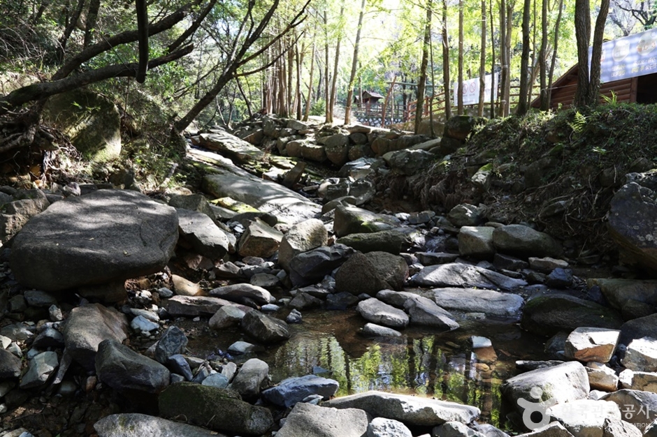 Dalcheongyegok Valley (Changwon) (달천계곡(창원))
10 km from the summit
Times and difficulty are estimates from GPS tracks. Before you go, check the weather, sunset time and any trail closures. Course tracks recorded: 2022-01-06
Text on this page was translated automatically from Korean public data. Place names follow the Revised Romanization; signs on the trail are in Korean.
Data: Korea Forest Service and Korea Hiking & Trekking Support Center (Public Data Portal). Course times and difficulty are estimates from GPS tracks (2022).