
Maisan 687m
Male and female peaks balanced in yin and yang
Easy Moderate Valleys Autumn foliage Snow scenery Public transport
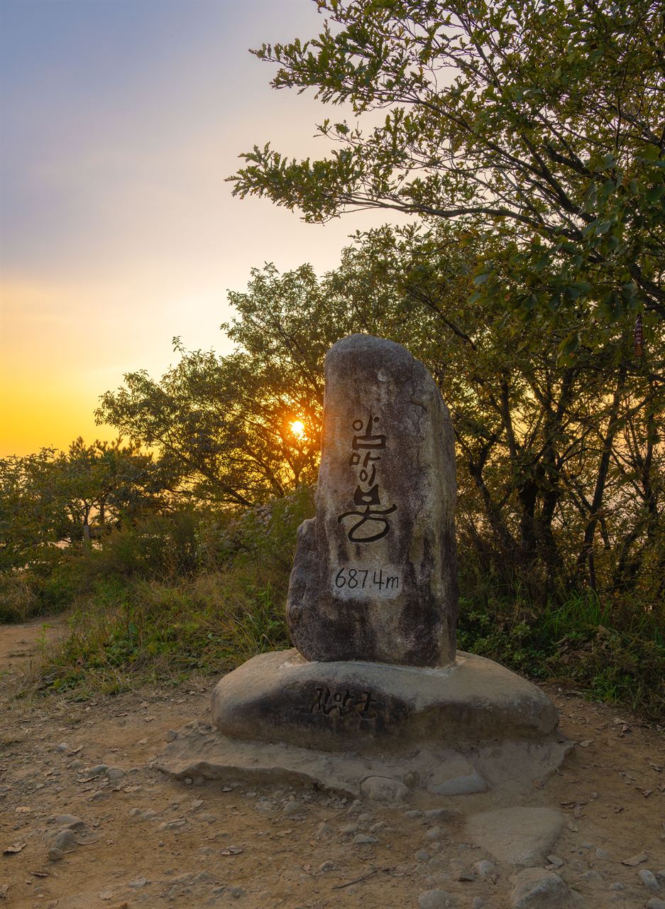
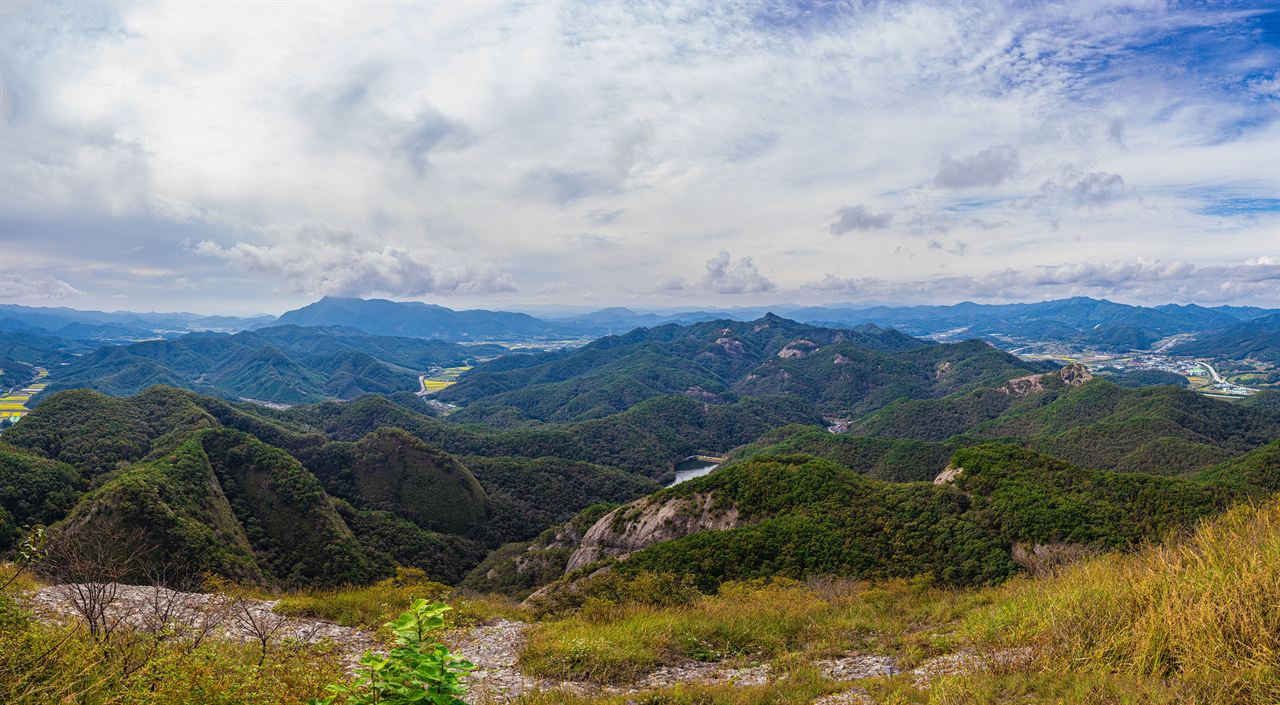
- Location
- Jinan-eup and Maryeong-myeon, Jinan-gun, Jeollabuk-do
- Courses
- 6 · 1 h – 4 h 10 min
- Distance
- 2.3 km – 10.2 km
- Facilities
- Toilets 7 · Parking 4
- Managed by
- Jinan County · 063-430-2114
Trail map
Why it is one of the 100 famous mountains
Selected for its unique topography, for being the headwaters of the Seomjingang and Geumgang rivers, and for its designation as a Provincial Park in 1979. It is a mountain formed by conglomerate rock that was folded and uplifted during the Cretaceous period of the Mesozoic era and shaped by erosion, named Maisan because its shape resembles the ears of a horse. Tapsa Temple, which features about 80 large and small stone pagodas beneath the southern cliff of Ammaisan, and Geumdangsa Temple are famous.
About Maisan
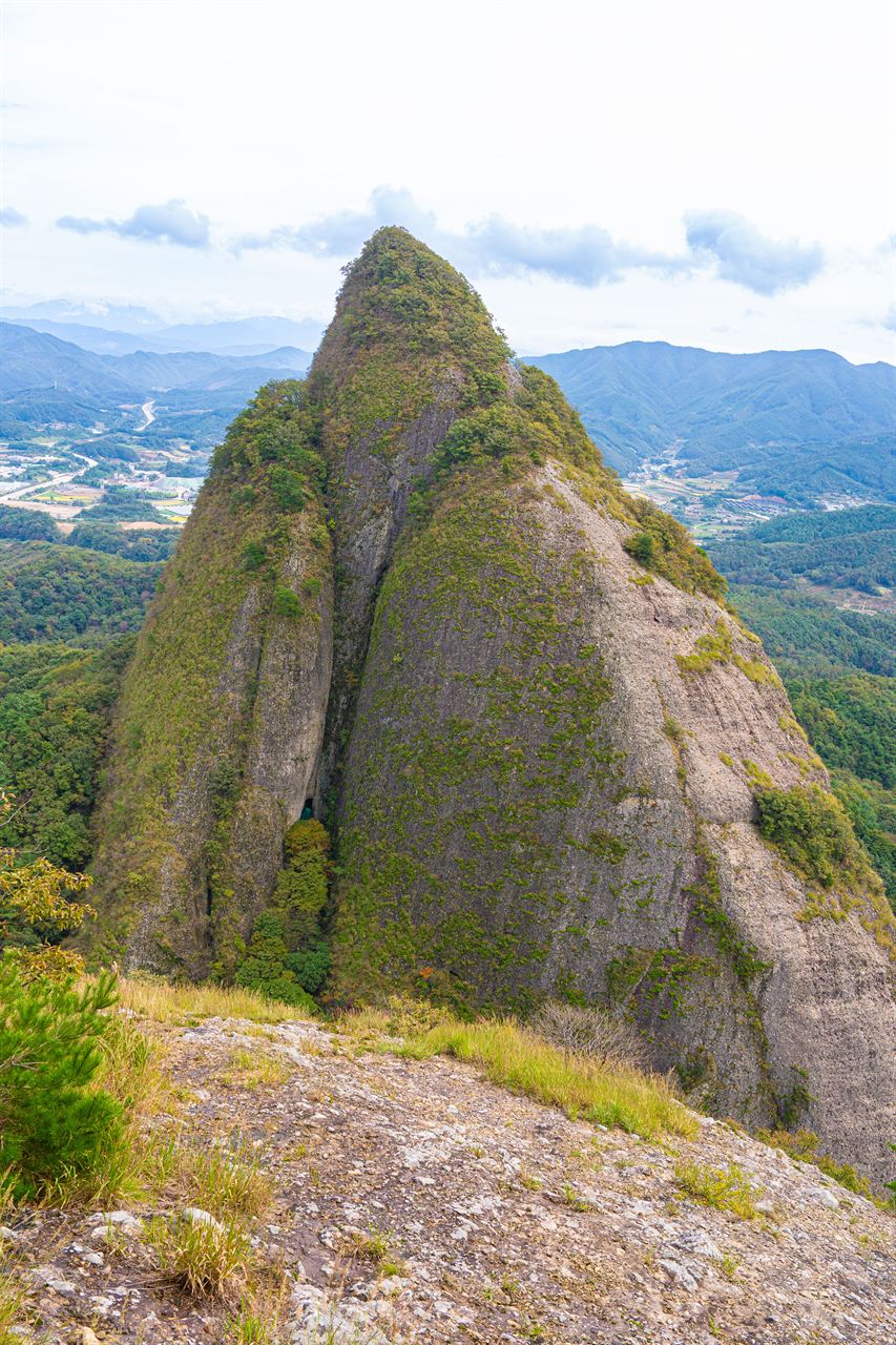
It is a wondrous sight better described as a pair of towers than mountains. The term tower in English fits completely. The western peak, Ammaisan, and the eastern peak, Sutmaisan, stand side by side, resembling a pair of horse ears. With no high mountains to the north or south, the spectacle is even more striking, and the view reflected on the surface of Sayangje Reservoir or from the plains of Jinan is especially fantastic.
It is also famous for its tafoni landforms. These are honeycomb-like hollows carved into rock surfaces as if bombed, forming the largest scale in inland South Korea. They formed as the main component, conglomerate rock, weathered and crumbled from within.
During the Silla period, it was called Seodasan using Idu characters similar to 'Standing Mountain'; in the Goryeo period, it was Yongchulsan meaning 'Soaring Dragon Mountain'; and from the Joseon period, it came to be called Maisan. Its names also change with the seasons: in spring, the peaks rising like a mirage through the mist look like twin masts and are called Dotdaebong; in summer, rising above the hills like dragon horns, Yonggakbong; in autumn with foliage, Maibong; and in winter, because snow does not accumulate and they look like brush tips dipped in black ink, Munpilbong.
Tapsa Temple, situated between the two peaks of Maisan, is filled with a forest of more than 80 man-made stone pagodas. Some measure up to 20 meters in circumference and 15 meters in height, and these natural stone stacks have stood without collapsing for over 140 years.
Maisan had long been called Yongchulsan and Donggeumsan before King Taejong of the Joseon Dynasty referred to it as resembling horse ears, after which it was called Maisan. Interestingly, Maisan appears different depending on the direction from which it is viewed.
Because of its bizarre shapes and distinctive views, Maisan has several names. It is called Munpilbong for resembling a brush tip, Gaegolsan for its many rocks, Dotdaebong for resembling a mast from another angle, and Yonggakbong for looking like dragon horns.
Maisan has two large male and female peaks in the east and west. The eastern male peak resembles a giant man and also carried the ancient name Seodasan; containing intense yang energy, its mountain paths are rugged and impassable for hiking. The western female peak, Ammaibong, gently welcomes many hikers like a beckoning woman. Water flowing north from Maisan forms the Geumgang River basin, and water flowing south flows into the Seomjingang River. As the flow forms a semicircle, Maisan serves as a watershed for the Geumgang and Seomjingang rivers, with the waterways of both rivers forming a Taegeuk pattern around Maisan.
Maisan also has deep ties with Yi Seong-gye, the founder of the Joseon Dynasty. Yi Seong-gye called Maisan Sokgeumsan. Having harbored great ambitions early in life, he prayed at renowned mountains across the nation including Geumsan. One night after praying, a divine figure appeared in his dream, presenting a golden ruler representing the standard for all systems and telling him to measure freely. Later, in the 6th year of King U of Goryeo (1380), General Yi Seong-gye defeated Japanese pirates at Hwangsan in Unbong, Jeolla-do, and was astonished upon seeing Maisan on his triumphal return. The place where he had received the golden ruler from the deity in his dream was none other than Maisan.
Courses recommended by the Korea Forest Service
- Northern Parking Lot → Cheonhwangmun Gate → Eunsusa Temple → Tapsa Temple → Tapyeongje Lake → Geumdangsa Temple → Southern Parking Lot 2 h
- Northern Parking Lot → Cheonhwangmun Gate → Eunsusa Temple → Tapsa Temple → Cheonhwangmun Gate → Northern Parking Lot 2 h
- Hanmisanseong Fortress → Gwangdaebong Peak → Naongdae → Biryongdae → Bongdubong Peak → Cheonhwangmun Gate → Eunsusa Temple → Tapsa Temple → Southern Parking Lot 7 h
Public transport
The starting point is Jinan. From Jinan to Maisan Northern Parking Lot, local buses run 17 times daily; to the Southern Parking Lot, 4 times daily. Direct buses to Jinan run 4 times daily from Seoul Gangnam Terminal and Busan Sasang Terminal, every 10 minutes from Jeonju, and every 30 minutes from Daegu.
Food, lodging & more (Korea Forest Service data, may change)
● Lodging and other information
Use accommodations in Jinan-eup.
Goryeo Inn: 063-433-3374, Resortjang: 063-433-4371, Green Inn: 063-433-2671
● Inquiries
Maisan Provincial Park Management Office: 063-433-3313
Nearby attractions
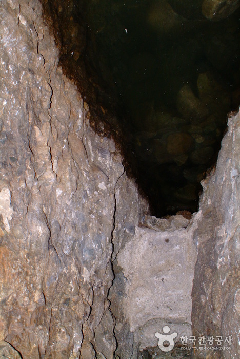 Maisan Hwaeomgul Cave (마이산 화엄굴)
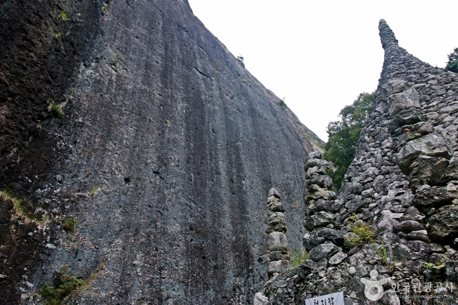 Maisan Mountain Tafoni Terrain (마이산 타포니지형)
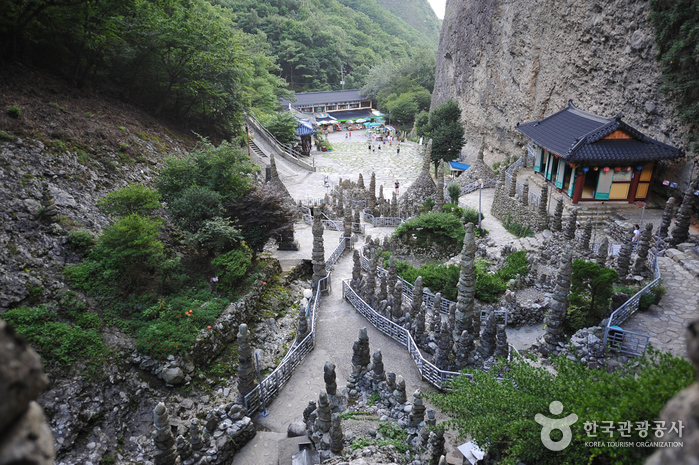 Tapsa Temple (마이산 탑사)
 Jinan Red Ginseng Spa (진안홍삼스파)
Times and difficulty are estimates from GPS tracks. Before you go, check the weather, sunset time and any trail closures. Course tracks recorded: 2022-01-06
Text on this page was translated automatically from Korean public data. Place names follow the Revised Romanization; signs on the trail are in Korean.
Data: Korea Forest Service and Korea Hiking & Trekking Support Center (Public Data Portal). Course times and difficulty are estimates from GPS tracks (2022).