
Jirisan (Tongyeong) 399m
A mountain in Saryang-myeon, Tongyeong-si, Gyeongsangnam-do
Moderate Sea views Public transport


- Location
- Saryang-myeon, Tongyeong-si, Gyeongsangnam-do
- Courses
- 1 · 3 h 5 min – 3 h 5 min
- Distance
- 5.8 km – 5.8 km
- Facilities
- Toilets 2 · Parking 0
- Managed by
- Tongyeong City Hall · 1577-0557
Trail map
Why it is one of the 100 famous mountains
Selected for harmonizing with the outstanding scenery of the Hallyeosudo waterway, and particularly for its rocky high peaks including Bulmosan, Gamabong Peak, Hyangbong Peak, and Ongnyeobong Peak, which feature bizarre rock formations and great views. The name originates from meaning 'a mountain where Jirisan can be seen,' and it is also called Jirisan locally. It offers vistas over the Dadohae archipelago and is especially famous for its rocky ridges.
About Jirisan (Tongyeong)
Jirisan is a mountain located on Saryangdo Island in Hallyeohaesang National Park, originally named Jirimangsan. This name is said to have been given because Jirisan, National Park No. 1, can be seen in the distance. The island is divided into the upper island (Sangdo) and lower island (Hado), and the waterway between these two islands is called Donggang. Jirisan is situated on Sangdo, the main island of Saryangdo. Among the peaks of Jirisan, Ongnyeobong Peak is the most famous for its outstanding landscape and views. However, the ridge trail connecting rocky peaks can be hazardous, though bypass paths exist for beginners. Ongnyeobong Peak is also steeped in legend.
According to the legend, Ongnyeo lost her mother at an early age and grew into a beautiful woman; when her father attempted to assault her, breaking natural filial bonds, Ongnyeo cast herself into the sea from the rugged peak. Not only does the rounded peak resemble a woman's breast, but geomantic tradition also describes the mountain's shape as Ongnyeo Tangeum-hyeong (a jade maiden playing the geomungo zither), giving further weight to the name Ongnyeobong Peak.
Another 'Jirisan' (399.3 m) stands tall on Saryangdo Island. The view of the Hallyeosudo waterway from Ongnyeobong Peak after a strenuous ascent, followed by fresh sashimi after descent, delights both the eyes and palate. Saryangdo has been newly transformed.
The once-hidden landscapes of Saryangdo have revealed their captivating forms to many hikers and travelers. Through tourism development by Tongyeong City, Daehang Beach was developed, the passenger ferry terminal was renovated, and once-dangerous hiking trails were well maintained, improving safety and convenience for visitors.
Saryangdo is an island in Saryang-myeon, Tongyeong-si, surrounded by the southern Dadohae archipelago within Hallyeohaesang National Park. Saryangdo is named as such because the island resembles a snake and had many snakes, though there is also a tale of a man who died of lovesickness from unrequited love and turned into a serpent. Crossing the calm waters off Samcheonpo and arriving at Sangdo on Saryangdo, Jirisan can be seen rising at the center of the island.
Originally called 'Jiimangsan' because the grand Jirisan spanning Jeolla-do and Gyeongsang-do was visible, the name was shortened to 'Jirisan.' Although not particularly high, it harmonizes with the scenery of the Hallyeosudo waterway and holds views equal to those of any renowned mountain.
There are several climbing routes, but starting from Donji Port, following the ridge across Jirisan and Ongnyeobong Peak, and descending toward Jinchon is the best way to experience the mountain's highlights. Donji is a scenic island village set against rocky peaks and rolling blue seas. Heading out of the village and starting the ascent leads to a stony path, but the ocean view keeps the climb engaging.
Courses recommended by the Korea Forest Service
- Geumbukgae → Jirisan → Dalbawi → Gamabong Peak → Ongnyeobong Peak → Jinchon 4 h 40 min
- Daehang → Dalbawi → Gamabong Peak → Ongnyeobong Peak → Jinchon 2 h 50 min
Public transport
The starting point is Tongyeong. Passenger ferries depart from Gaochi Dock in Dosan. Ferries bound for Saryangdo also run from Yongampo in Goseong and Samcheonpo Passenger Terminal.
Tongyeong → Geumpyeong-ri, Saryangdo: Car ferry runs 6 times daily (5 times daily in winter), vehicle transport available.
Food, lodging & more (Korea Forest Service data, may change)
● Lodging and Other Info
Private minbak guesthouses operate in villages across Saryangdo.
Saryang Youth Hostel (055-641-8247)
● Inquiries
Saryang-myeon Office: 055-642-6119
Nearby attractions
 Fossil Dinosaur and Bird Footprints of Goseong (고성 덕명리 공룡과 새발자국 화석 산지)
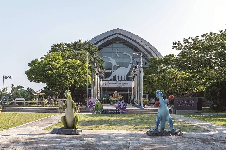 Goseong Dinosaur Museum (고성공룡박물관)
Times and difficulty are estimates from GPS tracks. Before you go, check the weather, sunset time and any trail closures. Course tracks recorded: 2022-01-06
Text on this page was translated automatically from Korean public data. Place names follow the Revised Romanization; signs on the trail are in Korean.
Data: Korea Forest Service and Korea Hiking & Trekking Support Center (Public Data Portal). Course times and difficulty are estimates from GPS tracks (2022).