
Jaeyaksan 1,119m
Surrendering Myself to the Swaying Silver Grass
Easy Moderate Hard Autumn foliage Silver grass Public transport


- Location
- Danjang-myeon and Sannae-myeon, Miryang-si, Gyeongsangnam-do / Sangbuk-myeon, Ulju-gun, Ulsan Metropolitan City
- Courses
- 14 · 2 h 5 min – 6 h 20 min
- Distance
- 2.6 km – 13.3 km
- Facilities
- Toilets 9 · Parking 12
- Managed by
- Miryang City Hall · 055-359-5114
Trail map
- Directions to trailhead
- Directions to trailhead
- Directions to trailhead
- Directions to trailhead
- Directions to trailhead
- Directions to trailhead
- Directions to trailhead
- Directions to trailhead
- Directions to trailhead
- Directions to trailhead
- Directions to trailhead
- Directions to trailhead
- Directions to trailhead
- Directions to trailhead
Why it is one of the 100 famous mountains
Selected for its scenic beauty, featuring gentle overall slopes contrasted by massive cliff faces around the summit, as well as Sajapyeong, the largest silver grass field in Korea. It features Eoreumgol Valley (Natural Monument No. 224), where ice forms during the peak of summer heat, and famous Pyochungsa Temple, founded during Queen Jindeok's reign in Silla and where Monk Seosan gathered righteous army volunteers.
About Jaeyaksan
It is a mountain nestled deeply at a focal point of the Yeongnam Alps, its oval ridge enclosing an auspicious site. Within it lies Pyochungsa Temple, which houses National Treasure No. 75 (Bronze Incense Burner with Inlaid Silver), Treasure No. 467 (Three-story Stone Pagoda), and some 200 relics of Monk Samyeong.
The mountain almost seems to have been created to protect this blessed site and its treasures. Eight peaks—Pilbong Peak, Sangtubong Peak, Sajabong Peak (1,189m), Sumibong Peak (1,108m), Kokkilibong Peak (899m), Jaeyakbong Peak (953.8m), Hyangnosan Mountain (979.1m), and Ssangbong Peak (821.8m)—resemble a shrimp cradling its eggs. Tracing the 800-meter contour lines looks much like an unborn child in the womb, showcasing an exquisite shape of nature that touches the heart.
It is famous for the vast 1.2-million-pyeong silver grass plain of Sajapyeong. Although past farming and goat raising altered its original prairie appearance, crowds still flock here in autumn to witness its landscape. Legend tells that a sick Silla prince drank the mountain's mineral spring water and was cured, giving rise to the name Jaeyaksan. Originally, the mountain was home to Yeongjeongsa Temple, named after the medicinal spring, but when relics of the Joseon monk hero Samyeongdaesa were moved to this auspicious land, the temple became known as Pyochungsa.
Jaeyaksan is part of the Yeongnam Alps mountain group, spreading across Miryang and Cheongdo. Formed by lofty peaks over 1,000 meters, Jaeyaksan (Sajabong Peak) presents gentle mountain contours crowned with massive rock cliffs around its summit.
Covering 1.25 million pyeong to the east of Jaeyaksan, the Sajapyeong Plain is a vast basin entirely blanketed in silver grass, making it the largest silver grass field in Korea. Densely populated silver grass areas alone span about 50,000 pyeong. Jaeyaksan consists of Sumibong Peak (1,108m) and Sajabong Peak (1,189m). The Sajapyeong Plain stretches across gentle oval hills starting at an elevation of 800 meters between the two peaks. The silver grass in Sajapyeong grows only chest-high to an adult.
Compared to silver grass along footpaths or fields below, it is roughly half the height. Its leaves are thin and rugged, and its flower tassels are stubby and short, worn down by harsh mountain winds. Because of this, one rarely sees the tassels bending gently even in a breeze.
Courses recommended by the Korea Forest Service
- Baenaegol Valley → Sajapyeong Plain → Sajabong Peak → Sumibong Peak → Cheungcheungpokpo Falls → Hongnyongpokpo Falls → Pyochungsa Temple 4 h 10 min
- Ticket Office → Maebawi Village → Pilbong Peak → Sangtubong Peak → Sajabong Peak → Sumibong Peak → Cheungcheungpokpo Falls → Hongnyongpokpo Falls → Pyochungsa Temple 5 h
- Eoreumgol Valley → Sajabong Peak → Sumibong Peak → Cheungcheungpokpo Falls → Hongnyongpokpo Falls → Pyochungsa Temple 4 h 45 min
Public transport
The transit hub is Miryang. Direct buses to Pyochungsa Temple run every 30 minutes from Miryang Intercity Bus Terminal. Gyeongbu Line KTX trains make 7 stops, and standard passenger trains make 26 stops at Miryang Station (based on departures from Seoul).
Food, lodging & more (Korea Forest Service data, may change)
● Accommodation and Other Info
Numerous lodging options are available in Gucheon-ri below Pyochungsa Temple: Valentine Motel ☎ 055-351-2388, Equus Motel ☎ 055-351-0347. Guesthouse lodging is also possible at Saemmul Sanjang (☎ 055-356-7664) between Sajabong Peak and Neungdongsan Mountain. If starting from Jukjeon, Sinbulsan Natural Recreation Forest is nearby. ☎ 055-383-6493
● Inquiries
Miryang City Hall Culture and Sports Division ☎ 055-359-5643, Pyochungsa Temple ☎ 055-352-1070
Nearby attractions
-
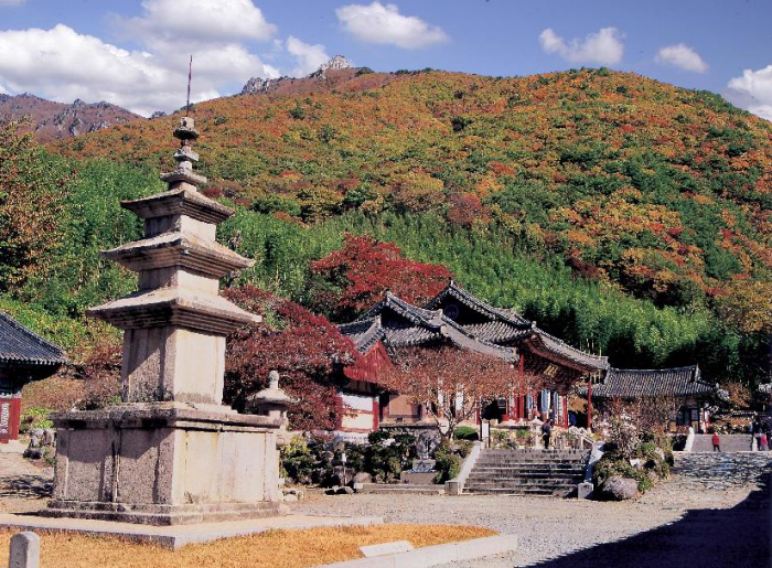 Miryang Pyochungsa Temple (표충사 (밀양))
2.9 km from the summit
-
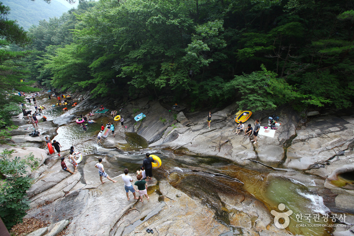 Hobaksogyegok Valley (호박소계곡)
4.5 km from the summit
-
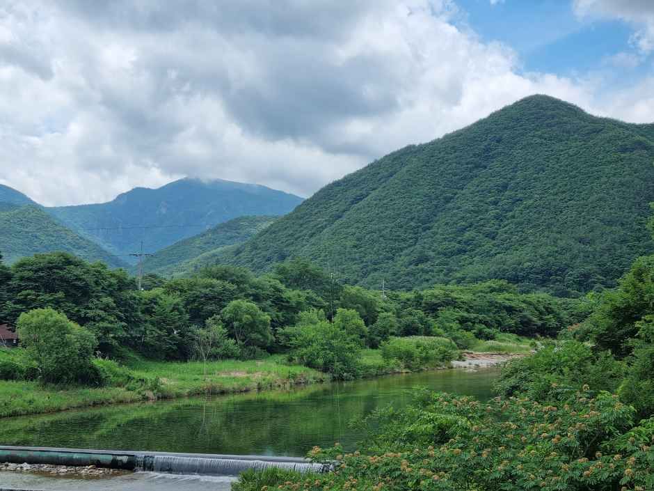 Unmunsan County Park (운문산군립공원)
6.5 km from the summit
- Seokgolsa Temple (석골사) 7.6 km from the summit
-
 Ganwolsan Recreation Forest (간월산 자연휴양림)
7.7 km from the summit
-
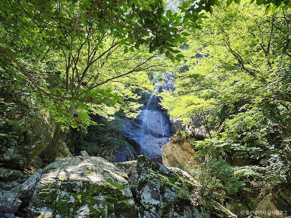 Sinbulsan County Park (신불산군립공원)
7.9 km from the summit
Times and difficulty are estimates from GPS tracks. Before you go, check the weather, sunset time and any trail closures. Course tracks recorded: 2022-01-06
Text on this page was translated automatically from Korean public data. Place names follow the Revised Romanization; signs on the trail are in Korean.
Data: Korea Forest Service and Korea Hiking & Trekking Support Center (Public Data Portal). Course times and difficulty are estimates from GPS tracks (2022).