
Gubyeongsan 876m
Nine Peaks Standing Like a Folding Screen
Moderate Valleys Autumn foliage Public transport
- Location
- Maro-myeon and Songnisan-myeon, Boeun-gun, Chungcheongbuk-do; Hwabuk-myeon, Sangju-si, Gyeongsangbuk-do
- Courses
- 1 · 4 h – 4 h
- Distance
- 8.3 km – 8.3 km
- Facilities
- Toilets 2 · Parking 3
- Managed by
- Boeun County Office · 043-540-3000
Trail map
Why it is one of the 100 famous mountains
Selected because the northern area of the main ridge belongs to Songnisan National Park and features scenic sights such as Seowon Valley. Nine magnificent rocky peaks rise consecutively like a folding screen, earning it the historical name Gubongsan, and the view from the summit is excellent. Traditionally in the Boeun region, Songnisan's Cheonhwangbong Peak is called the father mountain, Gubyeongsan the mother mountain, and Geumjeoksan the son mountain, together referred to as the 'Three Mountains (Samsan)'.
About Gubyeongsan
Gubyeongsan (876.3m) is located along National Route 25 south of Songnisan National Park, spanning Boeun-gun in Chungcheongbuk-do and Sangju-si in Gyeongsangbuk-do. Set apart from Songnisan on the provincial border by Jeogam-ri, Maro-myeon, Boeun-gun, it consists of nine magnificent and scenic peaks, which is why it is also known as Gubongsan. The main ridge stretches long from east to west, with nine peaks standing side by side like a folding screen to form a picturesque landscape that attracts hikers throughout the year.
With dense forests and crystal-clear waters, Gubyeongsan makes an ideal summer hiking destination and offers splendid autumn foliage. Traditionally in the Boeun area, Songnisan's Cheonhwangbong Peak, Gubyeongsan, and Geumjeoksan have been referred to as the father mountain, mother mountain, and son mountain. In 1999, the Boeun County Office registered the 43.9km trail connecting Gubyeongsan and Songnisan as a trademark under the name 'Chungbuk Alps' to promote it widely. Trailheads include Samga Elementary School in Gubyeong-ri, Naesongni-myeon; Jeogam-ri, Maro-myeon; and Songhyeon-ri along Geumgyecheon Stream.
The mountain features a striking profile that was recorded as one of Sangju's three celebrated mountains in the Sejong Sillok Jiriji (Geographical Monograph of King Sejong's Veritable Records). As such, despite not being Songnisan itself, it was included within the southern boundary of Songnisan National Park. Today, most of it falls within Boeun-gun.
It immediately catches the eye when traveling along National Route 25 due to its standout prominence. At its foot, a peak shaped like an overturned steamer pot adds an aura of sacredness, earning it the historical alternate name Guryeongsan (Mountain of Nine Spirits). Gubyeongsan is situated south of Songnisan National Park along the national route bordering Boeun-gun and Sangju.
Traditionally in the Boeun region, Songnisan's Cheonhwangbong Peak is called the father mountain, Gubyeongsan the mother mountain, and Geumjeoksan the son mountain, together referred to as the 'Three Mountains'. Overshadowed by the fame of Songnisan, it remains relatively lesser known to the general public, keeping the mountain clean, quiet, and well-preserved. On May 17, 1999, the Boeun County Office registered the 43.9km section connecting Songnisan and Gubyeongsan as a trademark under the 'Chungbuk Alps' brand to promote tourism. It also contains the site of Togolsa Temple, which fell into ruins during the Korean War, surrounded by centuries-old oak trees.
Courses recommended by the Korea Forest Service
- Samga-ri Suseong Elementary School Samga Branch → Gubyeong-ri → 853m Peak → Summit → Songhyeon-ri 3 h
Public transport
The starting point is Jeogam-ri, Maro-myeon, Boeun-gun.
Take a direct bus bound for Sangju via Cheongju, Boeun, and Jeogam, and get off at Jeogam-ri (Jeogam Rest Area, Checkpoint).
From Seoul Nambu Terminal, direct buses to Sangju run 13 times daily from 06:30 to 18:20. Intercity buses between Boeun and Sangju operate 31 times daily from 07:40 to 21:10.
Local buses from Boeun-eup to Gubyeong-ri run 4 times daily (06:45, 08:20, 12:10, 16:30).
Food, lodging & more (Korea Forest Service data, may change)
● Lodging and Dining Info
In Malti Town, 4km from Boeun-eup toward Sangju: Dongwon Park (☎043-543-8056), Yasong Park (☎043-543-5770), Jeongipum Grand Motel (☎043-543-9993).
Restaurants: Malti Rest Area (☎043-544-3477), Jangjae Song-eochon (☎043-543-4455), Han-uchon (☎043-544-3188)
● Inquiries
Tourism Facilities Management Corporation ☎051-540-3393
Nearby attractions
- Gubyeongsan Mountain (구병산) 0.1 km from the summit
-
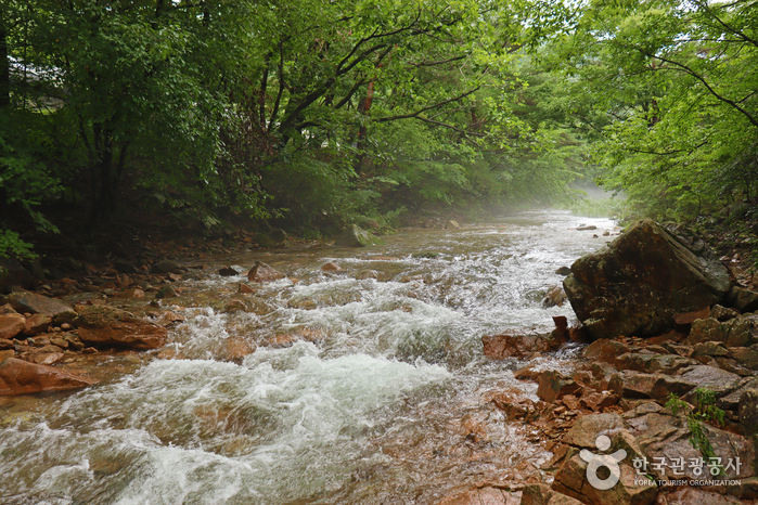 Mansugyegok Valley (만수계곡)
2.8 km from the summit
-
 Songnisan National Park (Chungcheongbuk-do Section) [속리산국립공원(충북)]
3.4 km from the summit
-
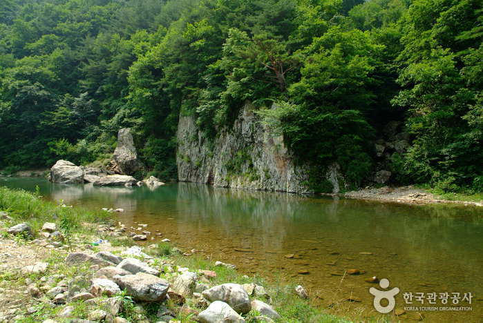 Seowongyegok Valley (서원계곡)
6 km from the summit
-
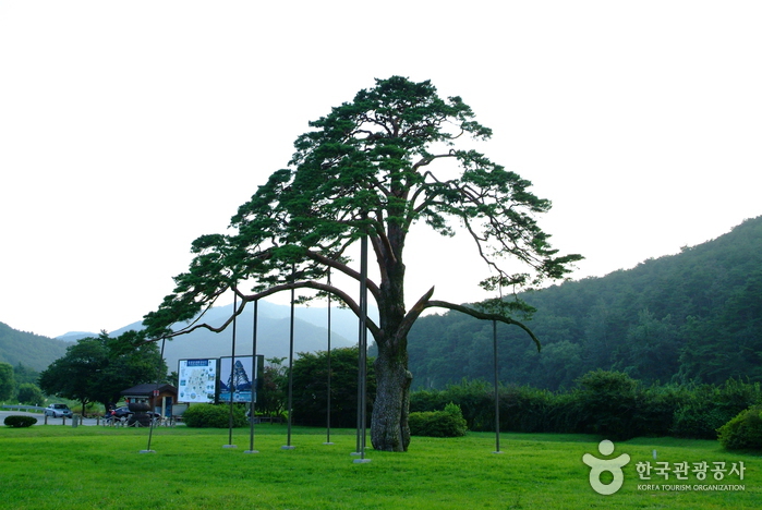 Jeongipum Pine Tree (보은 속리 정이품송)
6.8 km from the summit
-
 Janggakpokpo Falls (장각폭포)
8.1 km from the summit
Times and difficulty are estimates from GPS tracks. Before you go, check the weather, sunset time and any trail closures. Course tracks recorded: 2022-01-06
Text on this page was translated automatically from Korean public data. Place names follow the Revised Romanization; signs on the trail are in Korean.
Data: Korea Forest Service and Korea Hiking & Trekking Support Center (Public Data Portal). Course times and difficulty are estimates from GPS tracks (2022).