
Gongjaksan 887m
Rocky peaks and ancient pines framed like an Oriental painting
Easy Moderate Hard Spring flowers Valleys Autumn foliage Snow scenery Public transport


- Location
- Dong-myeon and Hwachon-myeon, Hongcheon-gun, Gangwon-do
- Courses
- 10 · 2 h 50 min – 5 h 25 min
- Distance
- 6.8 km – 13.9 km
- Facilities
- Toilets 4 · Parking 3
- Managed by
- Hongcheon County Office · 033-432-7801
Trail map
Why it is one of the 100 famous mountains
Selected for its lush forests and the scenic beauty of Suta Valley. The mountain derives its name from its topography, which resembles a peacock spreading its wings. Sutasa Temple, which preserves Volumes 17 and 18 of Worinseokbo (Treasure No. 745), and the 20-ri (approx. 8 km) Suta Valley extending from Sutasa Temple to Nocheon-ri are particularly famous.
About Gongjaksan
It is said that when a mountain resembles an animal, it possesses spiritual energy: Yeongchwisan, Sajasan, Seoraksan whose summit was once called Bongjeong... That is why Buddhist Master Jajang enshrined Buddha's genuine relics at the feet of these mountains. If such a mountain had been discovered after all relics had run out, one could not help but lament in awe. Gongjaksan is a prime example.
Tracing up Guneopcheon Stream, which serves as the catchment basin for eastern Hwachon-myeon on both sides of the Hongcheongang River, the summit unmistakably resembles the head of a bird, spreading both wings to the borders of Naesampo-ri and Eungbongsan. The ridgelines west of Angongjakjae Pass swirl around, waving a long tail toward the Hongcheongang River. At this sight, one can truly grasp the geomancer's wistful feeling of discovery.
Gongjaksan is better known for Sutasa Valley forming its southern boundary, where water flowing from open fields enters deep into the mountain to create a hidden wonderland. Gongjak Falls cascades 40 meters down a rock slab, and there is a historic temple where national treasures (Treasures Nos. 745 and 746, Worinseokbo) were discovered. How could it not be considered a celebrated mountain?
Gongjaksan straddles the border between Dong-myeon and Hwachon-myeon in Hongcheon-gun, Gangwon-do. Resembling a peacock spreading its wings, its rocky peaks and ancient pine trees harmonize to evoke a panoramic Oriental ink painting.
From Sutasa Temple, located about 6 km along the southwest ridge from the summit, the 8 km-long Suta Valley stretching toward Nocheon-ri boasts outstanding bedrock formations and stream scenery, making it a renowned summer getaway. The summit commands an open view of Hongcheon-gun, where scenic vistas and sheer cliffs create a magnificent spectacle.
Suta Valley, stretching about 8 km from Sutasa Temple to Nocheon-ri about 6 km below the southwest ridge, is unmatched with picturesque rock formations and scenic beauty. Looking out from the peak, all of Hongcheon-gun comes into view. In spring, royal azaleas bloom, in autumn, fall foliage blends with ancient pines and steep cliffs to captivate visitors, and snow-covered slopes in winter continue to enchant hikers.
Courses recommended by the Korea Forest Service
- Gulun-ri Bus Terminus → Cheonjisa Temple → Angongjakjae Pass → Summit → East Ridge Col → Angol → Gongjakgol Garden 4 h 35 min
- Guneopgyo Bridge → Trail Guide Board → Gongjak Falls → Ttemegigol Valley → Summit → Angongjakjae Pass → Suribong Peak → Yaksubong Peak → Sutasa Valley → Sutasa Temple 6 h 40 min
- Sinbonggyo Bridge → Dongbongsa Temple → Suribong Prayer Retreat → Suribong Peak → Angongjakjae Pass → Summit → Peak 735 → Munbawigol Valley → Gongjakgol Garden 4 h 40 min
Public transport
Hongcheon serves as the starting point.
Intercity buses run 52 times daily from Dong Seoul Terminal and 41 times from Sangbong Terminal.
To start at Guneop-ri, take the local bus bound for Eoron departing every hour. For Gulun-ri, take the Seongsan-bound bus (15 times daily), get off at Songjeong, and walk about 2 km.
Local buses run to Sutasa Temple and Sinbong-ri 3 times daily each. For the entrance to Gongjakgol, take the bus bound for Mulgol (3 times daily) and get off at Nocheon-samgeori Intersection.
Food, lodging & more (Korea Forest Service data, may change)
● Lodging and Dining Info
Gongjaksan Natural Recreation Forest (☎ 033-434-4987) on Gongjaksan is recommended.
It features red clay cabins heated with real wood-burning fires and allows campfires; as a private facility, rates are comparable to pension accommodations.
Staying at Samma-chi-ri Korean Traditional Pine Sauna is also an option.
● Inquiries
Hongcheon National Forest Management Office ☎ 033-4363-2497
Nearby attractions
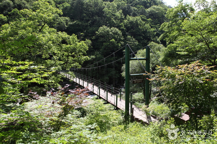 Gongjaksan Mountain (공작산)
Times and difficulty are estimates from GPS tracks. Before you go, check the weather, sunset time and any trail closures. Course tracks recorded: 2022-01-06
Text on this page was translated automatically from Korean public data. Place names follow the Revised Romanization; signs on the trail are in Korean.
Data: Korea Forest Service and Korea Hiking & Trekking Support Center (Public Data Portal). Course times and difficulty are estimates from GPS tracks (2022).