
Garisan 1,051m
From Soyangho Lake along the waterfall to the summit
Easy Moderate Spring flowers Valleys Public transport


- Location
- Buksan-myeon and Dong-myeon, Chuncheon-si; Duchon-myeon and Hwachon-myeon, Hongcheon-gun, Gangwon-do
- Courses
- 2 · 1 h 30 min – 3 h 20 min
- Distance
- 3.3 km – 6.5 km
- Facilities
- Toilets 3 · Parking 6
- Managed by
- Chuncheon City Hall · 033-253-3700
Trail map
Why it is one of the 100 famous mountains
Selected because it is known as the mountain with the most azaleas in Gangwon-do, has the typical appearance of Korean mountains with lush oak-centered forests and gentle mountain ridges, and serves as the source of the Hongcheon River and headwaters of the Soyang River. The rocky peak rising at the summit offers views of Soyangho Lake, and rich habitats of wild flowers provide great conditions for nature study. Designated as a natural recreation forest by Gangwon-do in 1998.
About Garisan
Garisan stands at an elevation of 1,050.9m, spanning Duchon-myeon and Hwachon-myeon in Hongcheon-gun, and Buksan-myeon and Dong-myeon in Chuncheon-si, Gangwon-do. Its name is said to originate from the resemblance of its summit to a "nadgari" (a neatly stacked pile of grain). While the mountain consists mostly of earth and forest, the summit area is formed of three massive rocky peaks. The view of Soyangho Lake to the northwest is superb, and the area around Daeryongsan is visible to the west. It is also famous for the mineral spring water that trickles year-round from the rocky cliffs below the summit. Garisan is counted as the second of the Nine Scenic Views of Hongcheon.
Straddling the boundary between Chuncheon-si and Hongcheon-gun in Gangwon-do, the open view and the landscape of Soyangho Lake unfolding beneath the summit make hikers stop in their tracks. Garisan refreshes visitors with the sound of small waterfalls flowing along the mountain foot, set amidst dense forests and old pine trees that create picturesque scenery. By descending toward Soyangho Lake, hikers can take an excursion boat from Mulno-ri Dock to Soyang Dam Dock, combining mountain hiking with a scenic boat ride.
The mountain name "Gari" is a native Korean word meaning a large stack of bundled grains or firewood, derived from the peak's cone shape resembling a grain stack. It forms part of the inland range of the Taebaek Mountain Range. The Hongcheon River originates south of Peak 1, forming the headwaters of the Soyang River, a tributary of the Bukhan River. While the ridges are generally gentle, the summit area consists of three rocky peaks separated by narrow ravines, serving as Gangwon's premier observatory. It commands panoramic views of inland Gangwon's high peaks, including Soyangho Lake and the Baekdudaegan ridge stretching powerfully north from Hyangrobong Peak through Seoraksan to Odaesan. Near the summit lies Gasapgogae Pass leading toward Soyangho Lake, shaped like a terraced basin.
The northern foot reaches Soyangho Lake, and Hongcheon Mine lies on the eastern foot. Dense forests and uniquely shaped rocks line the foothills, while native oaks dominate the summit and valleys. Shrubs such as aralia elata, royal azalea, bush clover, and prickly ash, along with medicinal wildflowers like woodland poppies, celandine, and potentilla, inhabit the lower areas. It is also renowned as the mountain where azaleas bloom most abundantly in Gangwon-do. Opened as Garisan Natural Recreation Forest in 1998, it offers amenities such as log cabins, campsites, and athletic facilities. Yongso Falls (8m high) sits at the entrance of the recreation forest, and nearby attractions include ski resorts, hot springs, Sutasa Temple, and Palbongsan.
Courses recommended by the Korea Forest Service
- Garisan Natural Recreation Forest → Intersection → Musaemaljae Pass → Summit → Gasapgogae Pass → Mulno-ri, Soyangho Lake 4 h 30 min
- Garisan Natural Recreation Forest → Gasapgogae Pass → Summit → Garisangyo Bridge → Cheoljeong-ri 4 h 30 min
Public transport
From Hongcheon, take a bus heading to Yeongnae-ri or Cheonhyeon-ri and get off at Garisan Natural Recreation Forest.
- Hongcheon → Yeongnae-ri: runs every 60 minutes
- Hongcheon → Cheonhyeon-ri: runs 10 times a day
Food, lodging & more (Korea Forest Service data, may change)
● Accommodation & Other Information
It is convenient to use Garisan Natural Recreation Forest (☎ 033-435-6034~5) at the trailhead, accommodating up to about 1,500 people.
Other accommodations: Daemyung Hongcheon Ski Resort Condo ☎ 033-434-8311, Daemyung Vivaldi Park Youth Hostel ☎ 033-434-2188
● Inquiries
Hongcheon-gun Economic & Tourism Division ☎ 033-430-2544, Hongcheon-gun Duchon-myeon Office ☎ 033-435-3327, Garisan Natural Recreation Forest Office ☎ 033-435-6034
Nearby attractions
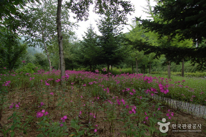 Garisan Recreational Forest (가리산자연휴양림)
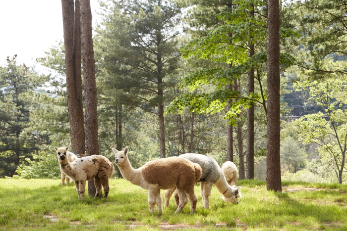 Alpaca World (알파카월드)
Times and difficulty are estimates from GPS tracks. Before you go, check the weather, sunset time and any trail closures. Course tracks recorded: 2022-01-06
Text on this page was translated automatically from Korean public data. Place names follow the Revised Romanization; signs on the trail are in Korean.
Data: Korea Forest Service and Korea Hiking & Trekking Support Center (Public Data Portal). Course times and difficulty are estimates from GPS tracks (2022).