
Gangcheonsan 586m
Korea's First County Park
Easy Moderate Hard Spring flowers Valleys Autumn foliage Public transport


- Location
- Paldeok-myeon, Sunchang-gun, Jeollabuk-do; Yong-myeon, Damyang-gun, Jeollanam-do
- Courses
- 5 · 2 h 55 min – 4 h 40 min
- Distance
- 6.6 km – 11 km
- Facilities
- Toilets 17 · Parking 9
- Managed by
- Sunchang County · 063-650-1114
Trail map
Why it is one of the 100 famous mountains
Designated as a County Park in 1981, selected for its outstanding scenery along Gangcheon Valley and splendid views. Houses Gangcheonsa Temple, founded by Master Doseonguksa in 887 during the reign of Queen Jinseong of Silla, which gave the mountain its name. Geumseongsanseong Fortress, presumed built during the Three Kingdoms period, is also renowned.
About Gangcheonsan
Designated in 1981, this was the nation's very first County Park. True to its county scale, it is under 600 meters in elevation, yet true to a park, it boasts exceptional stream scenery.
The upper section is soil mountain and the lower section is rocky mountain, meaning rocks are mostly clustered below the mid-slope. Down the 5-kilometer rocky gorge plunge Biryong Falls in Biryonggyegok Valley, Yaksu Falls in Multonggol, Yongdu Falls in Somokgol, and along the main valley stream, an artificial waterfall at Byeongpungbawi Rock and the grand Gujanggun Falls. Together with rocks like Yongbawi, Hoduam, and Tugoobong, caves such as Geumganggul, Sujwagul, and Hyeongjegul, and legends steeped in Gangcheonsa Temple and Samindae, it is a miniature Myohyangsan—both grand and exquisitely scenic.
It was formerly called Yongcheonsan, but it is said to have been renamed Gangcheonsan after Song Ik-pil's poem 'Lodging at Gangcheonsa'. Song Ik-pil was an influential political figure behind the Westerners faction during King Seonjo's reign.
Located just 10 km from Sunchang-eup, Gangcheonsan is celebrated as the Little Geumgang of the Honam region. Peculiar peaks rise everywhere, waterfalls flow through countless rocks, and its 4 km deep valley blanketed in lush forest preserves its pristine natural beauty.
It was originally named Yongcheonsan because its shape was thought to resemble a dragon thrashing its tail to ascend to heaven. Historic sites abound, including Gangcheonsa Temple, the Five-story Stone Pagoda at Samindae, and Geumseongsanseong Fortress. Also known as Gwangdeoksan, it was designated as Korea's first County Park in 1981, and features a 76-meter-long suspension bridge hanging 50 meters above the ground.
Highlights include autumn leaves that peak in early November and wild cherry blossoms in full bloom in early April, which can be enjoyed along any hiking trail as well as around Gangcheonho Lake at the mountain entrance. Beneath the rocky peak sits Gangcheonsa Temple, founded in 887 (year 1 of Queen Jinseong of Silla) by Master Doseonguksa.
The stone pagoda here is designated as Jeollabuk-do Tangible Cultural Heritage No. 92, and the Chinese quince tree at the temple entrance is Jeollabuk-do Monument No. 97. Other cultural assets include Sunchang Samindae (Jeollabuk-do Tangible Cultural Heritage No. 27) and Geumseongsanseong Fortress (Jeollabuk-do Monument No. 52). Naejangsan (763.5m), Baegyangsa Temple, and Damyang Dam are also nearby.
Courses recommended by the Korea Forest Service
- Ticket Office → Gangcheonsa Temple → Sinseonbong Peak → Suspension Bridge → Summit → Gitdaebong Peak → Ticket Office 3 h 35 min
- Ticket Office → Gangcheonsa Temple → Suspension Bridge → Summit → Provincial Boundary Traverse → Yeondaebong Peak → Yeondaeam Temple Site → Gangcheonsa Temple 5 h 15 min
- Ticket Office → Gangcheonsa Temple → Suspension Bridge → Summit → 530 Peak → Northwest Ridge → Buntong Village 2 h 45 min
- Ticket Office → Gangcheonsa Temple → Suspension Bridge → Summit → Gangcheonho Lake → Songnakbawi Rock → Yeondaebong Peak → Sanseongsan → Yeondaeam Temple Site → Suspension Bridge → Gangcheonsa Temple → Ticket Office 4 h 30 min
Public transport
The starting point is Sunchang. Local buses run to the Gangcheonsan parking lot every 5 minutes. As it is 9 kilometers away, it can also be walked. Express buses to Sunchang depart 6 times daily from Seoul Gangnam Express Bus Terminal. Buses outside Jeollabuk-do also connect from Incheon, Daegu, and Gwangju.
Food, lodging & more (Korea Forest Service data, may change)
● Lodging and other info
Gangcheongak Motel (063-652-9920) and several minbak guesthouses operate inside the mountain area.
Hoemunsan Recreational Forest (063-653-4779) is also nearby.
● Inquiries
Gangcheonsan County Park Management Office: 063-650-1533
Nearby attractions
-
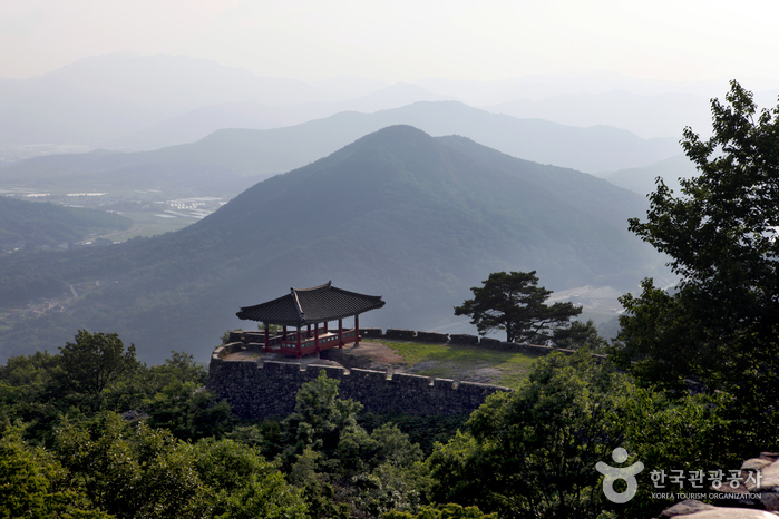 Geumseongsanseong Fortress (담양 금성산성)
1.1 km from the summit
-
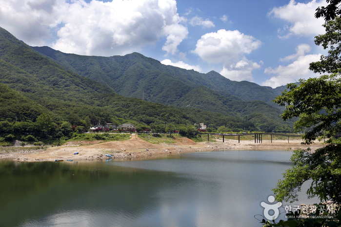 Damyangho Lake (담양호)
2.3 km from the summit
- Damyang Resort Spa (담양리조트 온천) 2.6 km from the summit
-
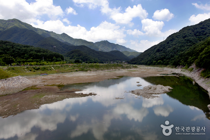 Chuwolsan Mountain (추월산)
4.2 km from the summit
-
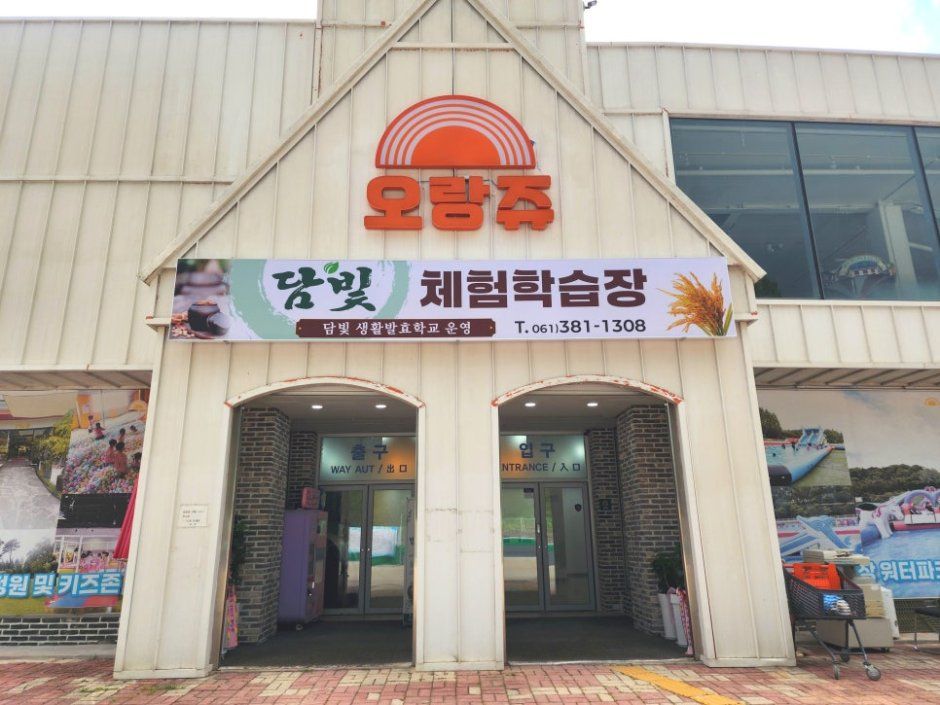 Dambit Experience Learning Center (담빛체험학습장)
6.6 km from the summit
-
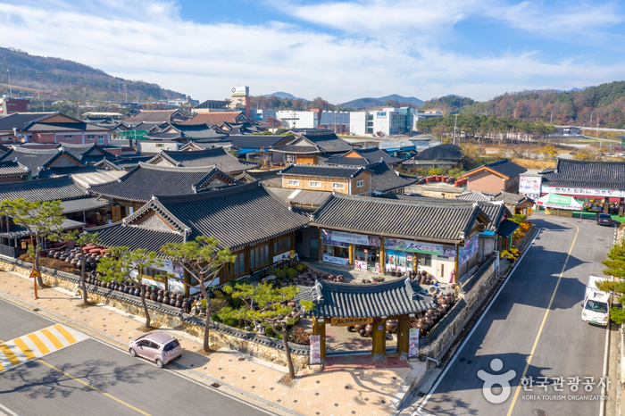 Sunchang Gochujang Village (순창고추장민속마을)
7.2 km from the summit
Times and difficulty are estimates from GPS tracks. Before you go, check the weather, sunset time and any trail closures. Course tracks recorded: 2022-01-06
Text on this page was translated automatically from Korean public data. Place names follow the Revised Romanization; signs on the trail are in Korean.
Data: Korea Forest Service and Korea Hiking & Trekking Support Center (Public Data Portal). Course times and difficulty are estimates from GPS tracks (2022).