
Eungbongsan 1,000m
A Continuous Series of Countless Ravines
Moderate Valleys Sea views
- Location
- Gagok-myeon and Wondeok-eup, Samcheok-si, Gangwon-do; Buk-myeon, Uljin-gun, Gyeongsangbuk-do
- Courses
- 1 · 5 h – 5 h
- Distance
- 11.4 km – 11.4 km
- Facilities
- Toilets 3 · Parking 3
- Managed by
- Samcheok City Hall · 033-572-2011
Trail map
Why it is one of the 100 famous mountains
Selected for its suitability as a gorge trekking destination along numerous scenic ravines, dense forests, Deokgu Hot Springs (a natural open-air spring), and the picturesque cascades and plunge pools of Yongso-gol Valley. Legend says that a hunter of the Uljin Jo clan retrieved his lost hunting falcon on this mountain, named it Eungbong ('Falcon Peak'), and subsequently saw his family prosper after burying his parents nearby. The summit is also renowned for distant panoramic views of Baegamsan, Tonggosan, Hambaeksan, and Taebaeksan.
About Eungbongsan
Rising on the border between Samcheok, Gangwon-do, and Uljin, Gyeongsangbuk-do, Eungbongsan is a magnificent peak shaped like a falcon in flight. Both Onjeong-gol Valley in Uljin and Yongso-gol Valley in Samcheok are exceptionally scenic, attracting an endless stream of visitors. Highlights of Onjeong-gol include Yongsopokpo Falls cascading like a cochlea, its plunge pool below, and Deokgu Hot Springs. Originally an open-air hot spring in a snow-covered ravine, Deokgu was redeveloped into a modern hot spring resort via drilling wells after being washed out by floods. Yongso-gol's 14 km winding ravine features sheer bedrock canyons with not a handful of soil, bottomless deep pools, and spectacular large and small waterfalls. The terrain is so rugged and hazardous that ordinary hikers dared not venture into it even during the 1990s. Although local residents have since maintained trails and installed signage, it remains too demanding for novices.
Flanked by numerous pristine ravines around its perimeter along the Samcheok and Uljin border, Eungbongsan is an ideal venue for gorge trekking. Radiating from Eungbongsan are Gagokcheon Stream and Jaerangbak-gol to the north; Yongso-gol, Munji-gol, Gaengi-gol, and Bori-gol to the west; and Daegwangcheon Stream, Pokpo-gol, and Seong-u-gol toward the East Coast to the south. Continuing about 1 km past the bus terminus at Hosan leads to an abandoned mine site, past which two consecutive waterfalls rush vigorously. Further up, an endless cascade zone opens deep to the right. Reminiscent of Geumgangsan in miniature, up to three tiers are visible, but the canyon drops so steeply beneath that the remaining steps cannot be counted. Anyone trekking Yongso-gol should be accompanied by an experienced rock climber and carry at least two 20-meter ropes to negotiate dangerous sections.
Courses recommended by the Korea Forest Service
- Deokpung Village → Yongso-gol Valley → Jageundangwi-gol Valley → Summit → Deokgu Hot Springs 9 h 30 min
- Sagok Branch School (closed) → Jaerangbak-gol Valley → South Ridge of Eungbongji → Northwest Ridge of Eungbongsan → Summit → Deokgu Hot Springs 6 h 10 min
- Borigyo Bridge → Bori-gol Valley → 862m Peak → Northwest Ridge of Eungbongsan → Summit → Deokgu Hot Springs 6 h
Public transport
The transit hub for Onjeong-ri is Uljin, while for Deokpung-ri it is Taebaek. Uljin → Deokgu Hot Springs: Runs 15 times daily; Taebaek → Punggok (entrance to Deokpung-ri): Runs 4 times daily.
Food, lodging & more (Korea Forest Service data, may change)
● Accommodations & Other Information
Lodging is available in Deokgu-ri and Punggok-ri.
In Deokgu-ri, options include Hotel Deokgu Hot Springs (☎ 054-782-0677), Byucksan Deokgu Hot Springs Condo (☎ 054-783-0811), and around 20 local homestays (minbak). In Punggok-ri, options include Punggok Log Cabin (☎ 033-573-0777), Gyegok Minbak (☎ 572-7130), Gohyang Minbak (☎ 572-2133), and Morosoe Farm (☎ 572-4244). Gagok Natural Recreation Forest, operated by the Samcheok National Forest Management Office, is also a recommended nearby option (☎ 573-4657).
● Inquiries
Samcheok City Hall Tourism Development Division ☎ 033-570-3530
Nearby attractions
 Deokgu Spaworld (덕구온천스파월드)
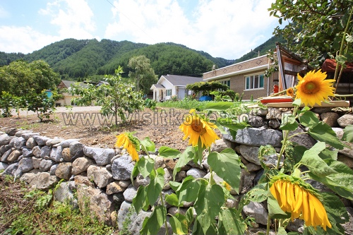 Samcheok Deokpunggyegok Valley Village (삼척 덕풍계곡마을)
Times and difficulty are estimates from GPS tracks. Before you go, check the weather, sunset time and any trail closures. Course tracks recorded: 2022-01-06
Text on this page was translated automatically from Korean public data. Place names follow the Revised Romanization; signs on the trail are in Korean.
Data: Korea Forest Service and Korea Hiking & Trekking Support Center (Public Data Portal). Course times and difficulty are estimates from GPS tracks (2022).