
Duryunsan 700m
A Natural Fortress Free from the Three Calamities
Moderate Hard Valleys Autumn foliage Snow scenery Sea views Public transport
- Location
- Samsan-myeon, Bugil-myeon, Bukpyeong-myeon, and Hyeonsan-myeon, Haenam-gun, Jeollanam-do
- Courses
- 4 · 2 h 25 min – 5 h 5 min
- Distance
- 5.2 km – 11.4 km
- Facilities
- Toilets 10 · Parking 7
- Managed by
- Haenam-gun County Office · 061-530-5114
Trail map
Why it is one of the 100 famous mountains
Selected because it rises on the Haenam Peninsula at the southernmost tip of the Korean Peninsula, serves as a natural habitat for King cherry trees, offers sweeping vistas of the South Sea archipelago, and was designated as a provincial park in 1972. It is renowned for spring cherry blossoms, summer greenery, autumn foliage, and winter camellias, and is also known as a source of citron and tea. It is home to Daeheungsa Temple, which preserves numerous cultural properties including Treasure No. 320, a three-story stone pagoda.
About Duryunsan
It is the southernmost mountain worthy of the name. As an earthy mountain, it feels dependable though not overly flashy. Yet Master Seosan, who had a discerning eye for mountains, chose to enshrine his monastic robe and bowl here, suggesting it possesses unique significance.
You cannot discover its true character simply by walking in. You must walk through the long Jangchun Valley in spring. Next, instead of heading straight for the summit, climb Hyangnobong Peak (469 m) on the opposite side, sit cross-legged, and take in the lay of the land.
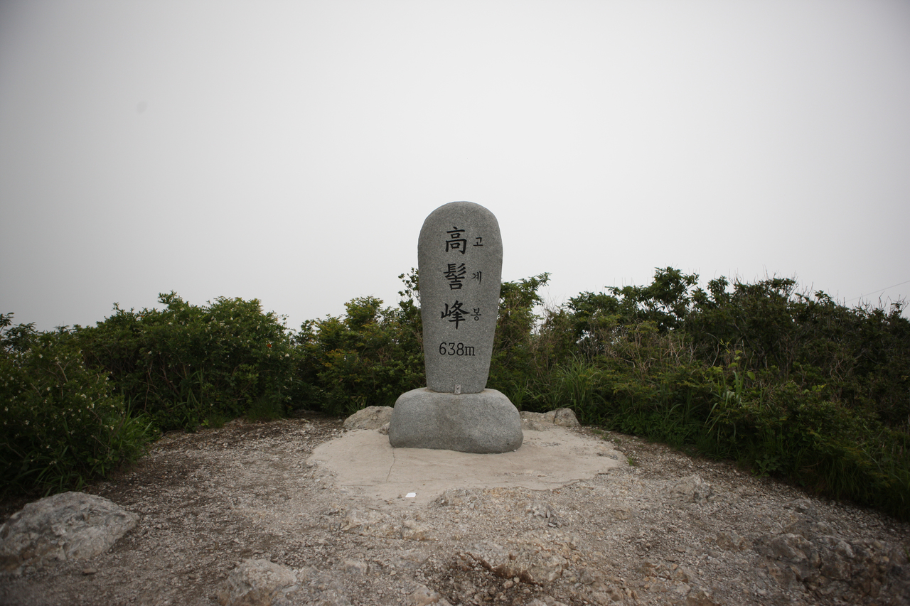
The Blue Dragon on the left descends from Dosolbong Peak (673.2 m). The White Tiger on the right follows the ridge of Gogyebong Peak (638 m). The primary energy ridge originates from Duryunbong Peak (629.3 m), with all ridges converging before the valley fronting Daeheungsa Temple. At the auspicious site between where this ridge rises and settles stands Pyochungsa Shrine, dedicated to Master Seosan. The master's robe and bowl were preserved here, reflecting the profound geomantic virtue of Duryunsan.
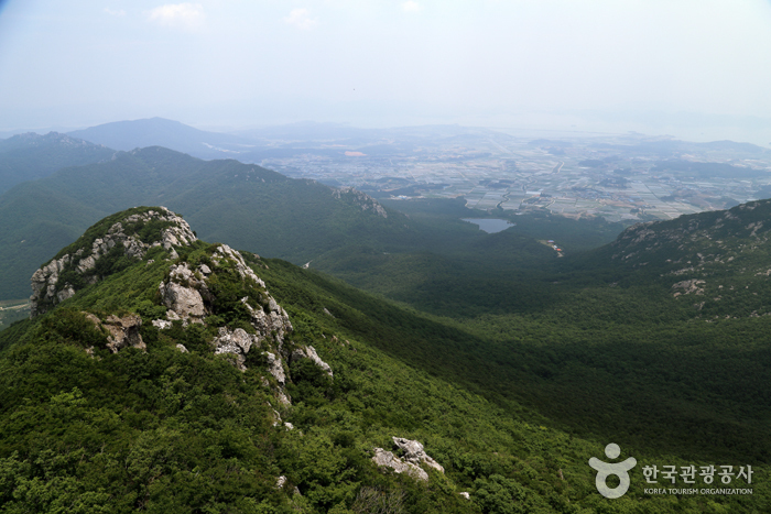
Seven peaks—Gogyebong Peak, the highest Garyeonbong Peak, Duryunbong Peak, Dosolbong Peak (673.5 m, marked as Daedunsan on National Geographic Information Institute maps), Yeonhwabong Peak (613 m), Hyeolmangbong Peak (379 m), and Hyangnobong Peak—encircle the renowned Daeheungsa Temple like a coiled rope. Connecting the 400-meter contour lines reveals the shape of a massive lobster holding a wish-fulfilling jewel. Thanks to this extraordinary terrain, Duryunsan nurtured Daeheungsa Temple and earned its status among celebrated mountains.
Located at the southernmost tip of the Korean Peninsula, Duryunsan (700 m) is the final peak that rises where the Honam Jeongmaek, stemming from the Baekdudaegan ridge, reaches the sea.
Straddling Samsan-myeon and Hyeonsan-myeon in Haenam-gun, Jeollanam-do, it is also known as Daedunsan. Master Seosan, who mobilized monk-soldiers across the country to repel Japanese invaders during the Imjin War, praised Duryunsan as 'a mountain unbroken for eternity, untouched by the three calamities.' Freedom from the three calamities indicates safety from floods and natural disasters.
Indeed, Duryunsan enjoys recognized geomantic prominence, flanked to the north by Wolchulsan supporting the heavens and to the south by Dalmasan anchoring the earth. Its name is said to take one character each from Kunlun Mountain (the mythical progenitor of all mountains) and Baekdusan.
Courses recommended by the Korea Forest Service
- Ticket Office → Yuseon Yeogwan → Gogyebong Peak → Osimjae Pass → Garyeonbong Peak → Duryunbong Peak → Jinburam Hermitage → Daeheungsa Temple → Ticket Office 5 h 40 min
- Ticket Office → Hyangnobong Peak → Odochi Pass → Hyeolmangbong Peak → Yeonhwabong Peak → Namam Hermitage → Daeheungsa Temple → King Cherry Tree → Ticket Office 5 h 50 min
- Cable Car Station → Gogyebong Peak → Osimjae Pass → Garyeonbong Peak → Maniljae Pass → Iljiam Hermitage → Daeheungsa Temple → Ticket Office 4 h 40 min
Public transport
The transit hub is Haenam, where local buses bound for Daedunsa Temple depart every 30 minutes. Express buses to Haenam run every 40 minutes from Dong Seoul Terminal and 7 times daily from Gangnam Terminal. From outside Jeollanam-do, direct intercity buses run from Busan and Masan.
Food, lodging & more (Korea Forest Service data, may change)
● Lodging and Other Information
Accommodations are plentiful in the Daedunsa Facility Complex.
Duryungwan (061-535-5115), Uri Sanjang (061-534-9393), and Yuseon Yeogwan (061-534-2959), a traditional Joseon-era tiled-roof inn right in front of Daedunsa Temple, are popular options.
● Inquiries
Duryunsan Provincial Park Management Office: 061-533-0088
Nearby attractions
-
 Daeheungsa Temple [UNESCO World Heritage] (대흥사[유네스코 세계문화유산])
2 km from the summit
-
 Duryunsan Provincial Park (두륜산도립공원)
2.8 km from the summit
- Duryunsan Cable Car (두륜산케이블카) 3 km from the summit
-
 Haenam Forest Arboretum (4est 수목원)
4.4 km from the summit
- Historic Site of Gosan Yun Seondo (고산 윤선도 유적지) 8.9 km from the summit
Times and difficulty are estimates from GPS tracks. Before you go, check the weather, sunset time and any trail closures. Course tracks recorded: 2022-01-06
Text on this page was translated automatically from Korean public data. Place names follow the Revised Romanization; signs on the trail are in Korean.
Data: Korea Forest Service and Korea Hiking & Trekking Support Center (Public Data Portal). Course times and difficulty are estimates from GPS tracks (2022).