
Dobongsan 740m
A Mountain with a Web-like Maze of Trails
Easy Moderate Hard Valleys Autumn foliage Public transport


- Location
- Dobong-gu, Seoul; Howon-dong, Uijeongbu-si and Jangheung-myeon, Yangju-si, Gyeonggi-do
- Courses
- 19 · 1 h 45 min – 5 h 20 min
- Distance
- 3.8 km – 12.6 km
- Facilities
- Toilets 101 · Parking 45
- Managed by
- Dobong-gu Office · 02-2091-2120
Trail map
- Directions to trailhead
- Directions to trailhead
- Directions to trailhead
- Directions to trailhead
- Directions to trailhead
- Directions to trailhead
- Directions to trailhead
- Directions to trailhead
- Directions to trailhead
- Directions to trailhead
- Directions to trailhead
- Directions to trailhead
- Directions to trailhead
- Directions to trailhead
- Directions to trailhead
- Directions to trailhead
- Directions to trailhead
- Directions to trailhead
- Directions to trailhead
Why it is one of the 100 famous mountains
Selected for its scenic landscape centered around Jaunbong Peak, alongside Manjangbong Peak, Seoninbong Peak, Wondobong Valley, Yongeocheon Valley, and Songchu Valley. Designated as a national park in 1983, it serves as a cherished retreat for metropolitan residents and an ideal destination for rock climbing, while hosting renowned temples including Hoeryongsa Temple, Mangwolsa Temple, Cheonchuksa Temple, and Bomunsa Temple.
About Dobongsan
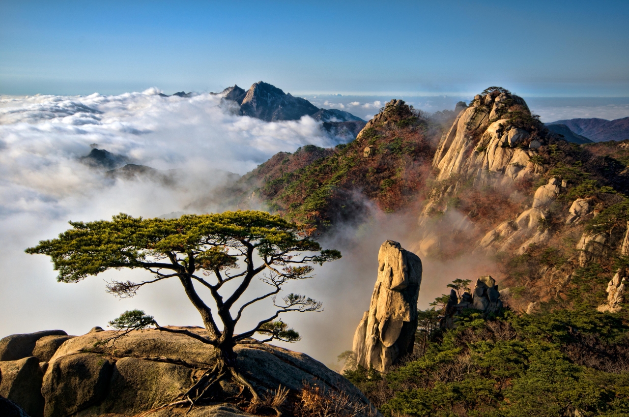
Dobongsan is a mountain celebrated for the magnificent beauty of its rocky peaks. From the imposing Seoninbong Peak—evoking the words of an ancient poet who marveled at 'a ten-thousand-fathom peak carved into the blue sky'—to Manjangbong Peak, Jaunbong Peak, Sinseonbong Peak rising behind it, and the peculiar five spires of Obong at the western edge, all are composed of gleaming granite that accentuates the clear blue skies.
With such prominent rock structure, the main ridge consists almost entirely of exposed rock. While true knife-edge rocky paths like Podae Ridge and Kalbawi Ridge cut across the mountain, most paths offer a refreshing walk skirting around rocky towers in the shade of pine trees. For this reason, a rainy day hike, when drifting clouds turn the scenery into a classical landscape painting, is often considered Dobongsan at its finest.
Due to the steep relief and rocky ground, water volume in the valleys is typically low, but the beauty of the streams still makes a rainy-day visit worthwhile. On the other side, Songchu Valley offers a contrasting sight: pristine waters flowing from dense greenery feed the three drops of Songchu Falls, as well as wide cascades and clear pools around Songchu Resort.
Dobongsan has the densest trail network and is one of the most heavily frequented mountains in the country—to the extent that seasoned local hikers often avoid it on Sundays.
Located on the outskirts of Seoul, Dobongsan has traditionally been considered one continuous mountain range with Bukhansan. Rising side by side across Uiryeong Pass, both are protected together under Bukhansan National Park. While Dobongsan's area of about 24㎢ is less than half of Bukhansan's 55㎢, its dramatic topography attracts a constant flow of hikers.
Along the main ridge stand rocky crags including Jaunbong Peak (the highest summit), Manjangbong Peak, Seoninbong Peak, and Jubong Peak, as well as the five aligned peaks of Obong to the west. Seoninbong, Manjangbong, Jubong, and Uiam Rock are each massive rock cliffs. Dobongsan presents a dramatic panorama of imposing crags and sharp rock towers, framed by lush valleys radiating in every direction.
Though popular year-round, its autumn foliage is just as vibrant as any other celebrated mountain. The three major valleys—Munsadong Valley, Mangwolsa Valley (Wondobong Valley), and Bomunsa Valley (Musugol)—lead straight to key trailheads. Among the numerous routes on Dobongsan, the courses starting from Ui-dong, Dobong Resort, Mangwolsa Station (Jangsuwon), and Seonghwangdang are the most prominent.
The primary summit is Jaunbong Peak (740.2m), from which trails radiate in all directions like a spiderweb, totaling roughly 100 hiking routes. The core trail spine follows the Podae Ridge - Jaunbong Peak - Kalbawi - Uiam Ridge axis. Podae Ridge was named after an anti-aircraft artillery battery (podae) that once stood along it. Among the countless entry points, the main trailheads are Angol Resort, Hoeryongsa Entrance, Wondobong Resort, Dobong Resort, Seonghwangdang, Ui-dong, and Songchu. With rocky ridges present across almost every trail, caution is required. On weekends and holidays, heavy traffic can cause bottlenecks along the main ridge, particularly around Podae Ridge. Due to the dense maze of branching trails, hikers are advised to carry a map.
Courses recommended by the Korea Forest Service
- Parking Lot → Dobongseowon Confucian Academy → Dobong Mountain Hut → Madangbawi Rock → Sinseonbong Peak → Kalbawi → Uiam Rock → Ui-dong 3 h 30 min
- Mangwolsa Station → Wondobong Ticket Office → Mangwolsa Temple → Sinseonbong Peak → Songchu Falls → Songchu Valley → Songchu Station 3 h 30 min
- Hoeryonggol Ticket Office → Hoeryongsa Temple → Podae Ridge → Sinseonbong Peak → Madangbawi Rock → Dobong Mountain Hut → Parking Lot 4 h
Public transport
Subway access is convenient. For the Dobong-dong area, take Line 1 or Line 7 to Dobongsan Station. For Mangwolsa Temple or Hoeryongsa Temple, continue further on Line 1 and alight at the respective stations of the same names. For Songchu, get off at Gupabal Station on Line 3 and take Bus 7023 or 704 bound for Songchu, or Bus 34 or 36 bound for Uijeongbu.
Food, lodging & more (Korea Forest Service data, may change)
● Lodging and Facilities
For accommodation at the foot of the mountain, Darakwon Campsite operated by Seoul YMCA offers campsites as well as five cabins accommodating up to 15 people each. ☎ 031-873-5624
● Inquiries
Bukhansan National Park Dobong Branch Office ☎ 02-954-2566
Nearby attractions
-
 Kansong House (간송옛집)
4 km from the summit
- Seoul Doseonsa Temple (도선사(서울)) 4.1 km from the summit
- Seoul Hiking Tourism Center - Bukhansan Branch (서울도심등산관광센터(북한산)) 4.1 km from the summit
- Seoul Novos Hospital (서울노보스병원) 4.2 km from the summit
-
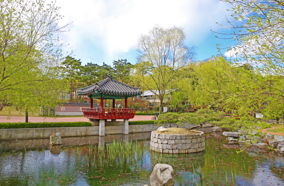 Wondangsaem Park (원당샘공원)
4.3 km from the summit
- Samgaksan Mountain (삼각산) 5 km from the summit
Times and difficulty are estimates from GPS tracks. Before you go, check the weather, sunset time and any trail closures. Course tracks recorded: 2022-01-06
Text on this page was translated automatically from Korean public data. Place names follow the Revised Romanization; signs on the trail are in Korean.
Data: Korea Forest Service and Korea Hiking & Trekking Support Center (Public Data Portal). Course times and difficulty are estimates from GPS tracks (2022).