
Deokhangsan 1,073m
Into Hwanseongul Cave Preserving Primeval Mysteries
Easy Hard Public transport


- Location
- Singi-myeon, Samcheok-si and Hasami-dong, Taebaek-si, Gangwon-do
- Courses
- 2 · 2 h 5 min – 3 h 30 min
- Distance
- 5.2 km – 6.2 km
- Facilities
- Toilets 5 · Parking 0
- Managed by
- Taebaek City Hall · 033-552-1360
Trail map
Why it is one of the 100 famous mountains
Selected for its classic tilted fault-block topography harmonizing crags, cliffs, and grasslands, as well as its many limestone caves including Galmaegul, Jeampunghyeol, Yangteomoksegul, Deokbalsegul, and Keunjaesegul caves within Daei Cave County Park (designated in 1996). It is also famous for Hwanseongul Cave (Natural Monument No. 178), one of Asia's largest caves formed about 400 to 500 million years ago, measuring 6.9 km in length with ceiling heights up to 30 m.
About Deokhangsan
A mountain of remarkable scenery that one hiker once described as Korea's Grand Canyon at Jaamgol Valley. It is an exemplar of tilted fault-block terrain, with sheer limestone escarpments to the east and an elevated peneplain around 1,000 meters in elevation to the west.
The limestone slopes are home to caves like Hwanseongul Cave, Baramgul Cave, and Gwaneumgul Cave, as well as craggy rock formations such as Chotdaebong Peak, Sadaribawi Rock, Nahanbong Peak, Suribong Peak, Geumgangbong Peak, and Mireukbong Peak. The valley is almost perpetually mist-shrouded, creating a fantastical landscape where rugged peaks and odd rocks appear intermittently through the fog.
Its original name was Deokmegi [Mountain]. Called so around Samcheok, it meant "a mountain beyond which lies a plateau suitable for slash-and-burn farming." This shifted to Deokmogi, which eventually was written in Hanja as Deokhangsan. That plateau has now become high-altitude vegetable fields cultivated by people relocated due to the Gwangdong Dam.
Because the mountain was not well known, little geographical and ecological surveying has been done. The boundaries of the mountain area are particularly unestablished: even though Peak 1130 stands west of the Gwangdong Dam relocation community, Peak 1071, which appears highest from Daei-ri, is often treated as the main peak. This is lower than Hwanseonbong Peak (1,079 m) on the Baekdudaegan ridge to the northwest.
In the Sangeongpyo (mountain treatise), Jukhyeon (Daetjae Pass) is followed by Geonuiryeong Pass. Thus, Deokhangsan encompasses the area between Daetjae Pass and Geonuiryeong Pass, making Peak 1130 the true highest peak.
Famed for Hwanseongul Cave, Deokhangsan is situated in Singi-myeon, Samcheok-si, Gangwon-do. With sheer, neatly carved rocks and massive cliffs such as Byeongpungam Rock stretching to the southeast, alongside the 12 km Mureungcheon Stream flowing east to join Osipcheon Stream, the mountain is well suited for hiking.
Courses recommended by the Korea Forest Service
- Golmal → Jaamgol Valley → Jaamjae Pass → Hwanseonbong Peak → Crossroad Col → Summit → Crossroad Col → Oenamugol Valley → Jeomchon 4 h 10 min
- Jeomchon → Oenamugol Valley → Gubusiryeong Pass → Summit → Crossroad Col → Peak 1048 → Keungaraegol Valley → Musadong 3 h 20 min
- Golmal → Jaammogineungseon Ridge → View Rock → Crossroad Col → Summit → Gubusiryeong Pass → Oenamugol Valley → Jeomchon 3 h 30 min
Public transport
The main hubs are Taebaek and Samcheok. From Taebaek, buses run to Jeomchon 8 times a day, and from Samcheok to Daei-ri 9 times a day. Buses to Taebaek from outside Gangwon-do operate from Seoul, Incheon, Suwon, Seongnam, Uijeongbu, Goyang, Ansan, Pohang, Daegu, Andong, Bonghwa, and Yecheon; buses to Samcheok run from Seoul, Busan, Ulsan, Gyeongju, Pohang, Uljin, Daegu, and Daejeon. Taking a train (4 times daily) and getting off at Taebaek or Dogye Station is convenient; on the Taebaek Line from Cheongnyangni, trains arrive at Dogye Station at 10:00, 14:00, and 17:00, and on the Yeongdong Line at 05:50.
Food, lodging & more (Korea Forest Service data, may change)
● Accommodations & Other Information
Stay at guesthouses (minbak) in Daei-ri or Gwangdong-ri.
Daei-ri Lee Jong-dae ☎033-541-1554, Daei Super ☎033-541-5978, Miro Sangjeong Branch School (closed) ☎033-575-0668, Gwangdong-ri Jeon Yeong-su ☎033-552-0194, Jangjeon-ri Ham Jeong-hui ☎033-554-1233
Although slightly farther away, staying in a red-clay shingle house or log cabin at Sin-ri Neowa Village (pension) is also a good option. ☎033-552-5967
● Inquiries
Deokhangsan County Park Management Office ☎033-541-9266
Nearby attractions
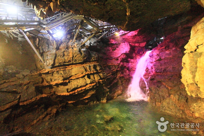 Daegeumgul Cave - Daei-ri Cave Area (대금굴 (대이리 동굴지대))
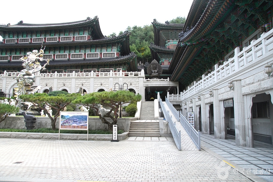 Gangwon Comprehensive Museum (강원종합박물관)
Times and difficulty are estimates from GPS tracks. Before you go, check the weather, sunset time and any trail closures. Course tracks recorded: 2022-01-06
Text on this page was translated automatically from Korean public data. Place names follow the Revised Romanization; signs on the trail are in Korean.
Data: Korea Forest Service and Korea Hiking & Trekking Support Center (Public Data Portal). Course times and difficulty are estimates from GPS tracks (2022).