
Daeyasan 931m
A sacred mountain where Daoist hermits roamed (also known as Daehasan)
Moderate Hard Valleys Public transport


- Location
- Gaeun-eup, Mungyeong-si, Gyeongsangbuk-do / Cheongcheon-myeon, Goesan-gun, Chungcheongbuk-do
- Courses
- 3 · 4 h – 6 h 30 min
- Distance
- 8.6 km – 13.2 km
- Facilities
- Toilets 15 · Parking 5
- Managed by
- Mungyeong City Hall · 054-552-3210
Trail map
Why it is one of the 100 famous mountains
Selected for its magnificent scenery blending fantastic rock formations, waterfalls, and clear pools, as well as being part of Songnisan National Park. Famous sights include Wolyeongdae Rock and Seonyudong Valley, which features Yongchu Falls and Chotdaebawi Rock.
About Daeyasan
Rising between Baekhwasan, Huiyangsan, and Songnisan, Daeyasan is located within Songnisan National Park along the Baekdudaegan ridge. It is particularly famed for its valleys, flanking both Naeseonyudong in Gyeongsangbuk-do and Oeseonyudong in Chungcheongbuk-do. Streams flowing down Daeyasan form Yongchu Valley, designated as one of the Eight Scenic Views of Mungyeong. Waters from Yongchugol Valley merge with streams from neighboring Dundeoksan to create the picturesque Seonyudong Valley, noted for its wide expanses of bedrock. Sheer rock pinnacles and wondrous stone formations further enhance the mountain's scenic terrain.
The scenery of Yongchu, counted among Mungyeong's Eight Scenic Views, is regarded as the finest attraction of Daeyasan. Below a waterfall tumbling through massive granite bedrock, a heart-shaped hollow pool allows water to glide smoothly over polished rock slabs, creating several cascading pools. In addition, Wolyeongdae Rock—where moonlight reflects off the rocks and valley waters on moonlit nights—and Hakcheonjeong Pavilion, erected in 1906 in Seonyudong Valley to honor scholar Yi Jae of the Joseon Dynasty, infuse Daeyasan with remarkable beauty.
- Duration: 5 hours
- Best Season to Visit: April–September / Summer (Yongchu Valley); July and August attract the most visitors as a popular summer hiking destination
- Attractions: Yongchu Valley, Daemunbawi Rock, Mungyeongsaejae, Mungyeong Hot Springs, Mungyeong Coal Museum, Ungang Memorial Hall, Seonyudong Valley. Marked by cool streams and broad bedrock flats; the unique shape of Yongchu captivates every visitor.
- Trail Highlights: Hikes generally start from Beolbawi in Gaeun-eup after passing through Mungyeong-si via Ihwaryeong Pass. Walking along the road running beside the stream offers a view toward the west of a peak crowned with prominent rocky cliffs. This is Yongchu Valley, marked by a stone monument inscribed with 'Mungyeong Palgyeong' (Eight Scenic Views of Mungyeong) at the entrance.
Yongchu Falls, considered the crown jewel of Yongchu Valley, cascades in three tiers, forming a distinctive heart-shaped pool in the middle of pale grayish-white granite. Carved into the cliffs flanking Yongchu are calligraphic inscriptions attributed to Choe Chi-won of Silla, including Sesimdae, Hwalcheongdam, Okhadae, and Yeongchaseok.
Ascending about 20 minutes from Yongchu brings hikers to Wolyeongdae, a scenic spot where the moon is said to cast its reflection upon the rocks and valley stream.
Positioned along the Baekdudaegan mountain system, Daeyasan enjoys great renown even among Mungyeong's many famous peaks. Belonging to Wanjang-ri, Gaeun-eup, Mungyeong-si, Gyeongsangbuk-do, Daeyasan borders Samsong-ri, Cheongcheon-myeon, Goesan-gun, Chungcheongbuk-do along the main ridgeline. Encompassing both Inner and Outer Seonyudong Valleys, it was selected by the Korea Forest Service during the 2002 International Year of Mountains as one of Korea's 100 Famous Mountains, along with Mungyeong's Juheulsan, Hwangjangsan, and Huiyangsan. Long revered as a sacred mountain, historical records mention it as 'Daeyasan (大耶山)'. Notably, the Daedongjiji (estimated after 1861 during the reign of King Cheoljong) records: 'Daeyasan is the southern branch of Huiyangsan; its highest peak is Birobong, and it is the main mountain of Seonyudong, located 30 li east of Hwayangdong in Cheongju,' showing that the summit of Daeyasan was once referred to as Birobong.
Courses recommended by the Korea Forest Service
- Beolbawi Village → Yongchu → Wolyeongdae → Miljae Pass → Summit → Chotdaebong Peak → Beolbawi (duration) 5 h
- Nongbawi Rock → Miljae Pass → Summit → Jungdaebong Peak → Gombawi Rock → Nongbawi Rock (duration) 5 h
Public transport
The starting base is Mungyeong. Take a bus bound for Gaeun from Mungyeong Intercity Bus Terminal, then take a bus bound for Beolbawi Village from Gaeun Bus Terminal.
> Mungyeong Intercity Bus Terminal → Gaeun: Runs 16 times daily
> Gaeun → Beolbawi: Runs 4 times daily
Food, lodging & more (Korea Forest Service data, may change)
● Lodging and Dining Information
Numerous accommodations are available in downtown Mungyeong. Alternatively, motels and guesthouses around Seonyudong Valley can be used.
Seonyudong Yeogwan: 054-571-3325, Gamnamujip Minbak: 016-544-5399, Cheongju Garden: 054-571-7698, Beolbawi Garden: 054-571-5691
● Inquiries
Songnisan National Park Office: 054-550-6393
Nearby attractions
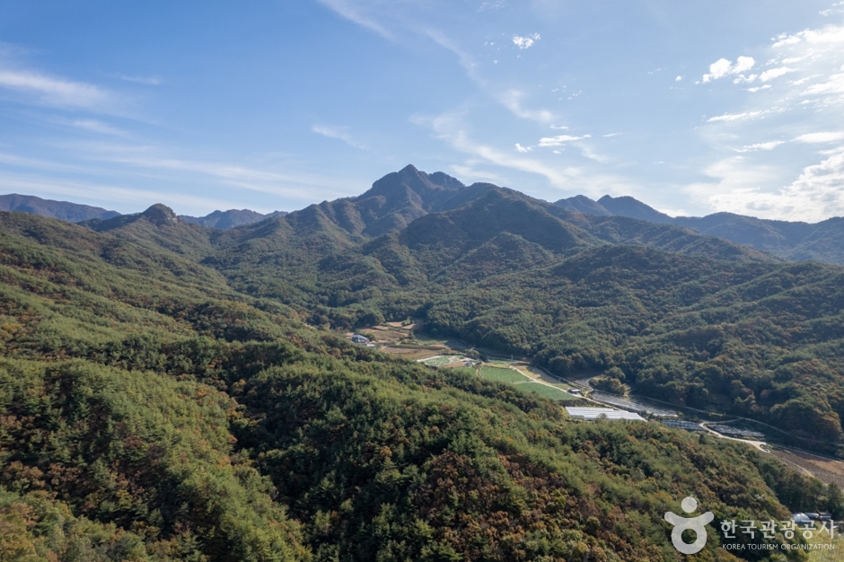 Daeyasan Mountain (대야산)
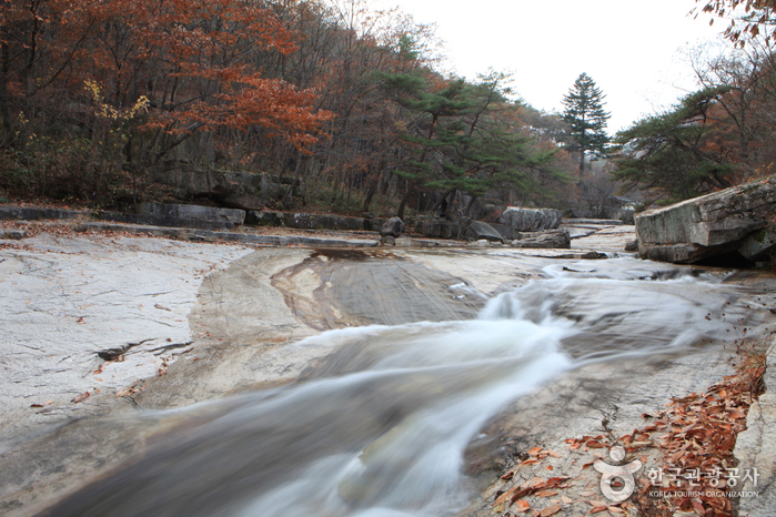 Mungyeong Seonyudonggyegok Valley (선유동계곡(문경))
 Mungyeong Eco World (문경에코월드)
Times and difficulty are estimates from GPS tracks. Before you go, check the weather, sunset time and any trail closures. Course tracks recorded: 2022-01-06
Text on this page was translated automatically from Korean public data. Place names follow the Revised Romanization; signs on the trail are in Korean.
Data: Korea Forest Service and Korea Hiking & Trekking Support Center (Public Data Portal). Course times and difficulty are estimates from GPS tracks (2022).