
Bukhansan 836m
Farewell, Samgaksan; See You Again, Hangang River
Easy Moderate Hard Spring flowers Valleys Public transport


- Location
- Gangbuk-gu, Seongbuk-gu, Jongno-gu, Eunpyeong-gu, Seoul; Goyang-si, Yangju-si, Gyeonggi-do
- Courses
- 36 · 40 min – 8 h 50 min
- Distance
- 1.7 km – 21.9 km
- Facilities
- Toilets 130 · Parking 53
- Managed by
- Gangbuk-gu Office · 02-901-6114
Trail map
- Directions to trailhead
- Directions to trailhead
- Directions to trailhead
- Directions to trailhead
- Directions to trailhead
- Directions to trailhead
- Directions to trailhead
- Directions to trailhead
- Directions to trailhead
- Directions to trailhead
- Directions to trailhead
- Directions to trailhead
- Directions to trailhead
- Directions to trailhead
- Directions to trailhead
- Directions to trailhead
- Directions to trailhead
- Directions to trailhead
- Directions to trailhead
- Directions to trailhead
- Directions to trailhead
- Directions to trailhead
- Directions to trailhead
- Directions to trailhead
- Directions to trailhead
- Directions to trailhead
- Directions to trailhead
- Directions to trailhead
- Directions to trailhead
- Directions to trailhead
- Directions to trailhead
- Directions to trailhead
- Directions to trailhead
- Directions to trailhead
- Directions to trailhead
- Directions to trailhead
Why it is one of the 100 famous mountains
Selected for its outstanding scenery including the highest peak Baegundae, Insubong Peak, Mangyeongdae, and Nojeokbong Peak, its role as a retreat for urban citizens, and its designation as a national park (1983). Bukhansanseong Fortress, Ui-dong Valley, Jeongneung Valley, and Segeomjeong Valley are famous. There are numerous ancient temples such as Doseonsa Temple founded by National Preceptor Doseon, Taegosa Temple, Hwagyesa Temple, Munsusa Temple, and Jingwansa Temple.
About Bukhansan
Bukhansan is a fortress. Outstanding rocky peaks including the highest peak Baegundae, Insubong Peak, Nojeokbong Peak, Uisangbong Peak, and Bohyeonbong Peak form rugged mountain terrain, and resting upon these, people built an actual fortress.
Though not exceedingly tall, it has no rivals nearby to match its shoulders and is visible wherever the eye reaches, from Gaeseong to the north to Anseong to the south. West of the Baegunsan–Unaaksan–Yongmunsan–Chiaksan line, nothing surpasses it.
The beauty of the three peaks soaring like horns at the summit is unmatched and striking. Valleys such as Ui-dong Valley, Bukhansanseong Valley, and Pyeongchang-dong Valley boast picturesque valley scenery with waterfalls and rocky streams. Standing at the summit, the glistening Hangang River shines in the sunlight like a single belt of water. Truly, it fulfills all three conditions of a celebrated mountain.
From the grand main ridge stretching from Baegundae to Bohyeonbong Peak, ridges such as Wonhyobong, Sangjangbong, Jindallae, Kalbawi, Hyeongjebong, Hyangnobong, and Uisangbong extend out like threads from a spindle, carving just as many valleys to embrace the ten million citizens of Seoul whenever they visit. Rock faces like Insubong, Nojeokbong, and Suribong have been shaped to train climbers who shout, "Let us burn our youth with ropes, hammers, pitons, and carabiners," to traverse mountains around the world. Bukhansan was destined from its birth to be the guardian mountain of the capital.
In the early Joseon Dynasty, Bukhansan, the guardian mountain of Seoul, was called Samgaksan. Regarding the name Samgaksan, the Sinjeung Dongguk Yeoji Seungnam records, 'Samgaksan lies on the border of Yangju. It is also called Hwasan, and during the Silla era it was called Buaak. This mountain is the guardian mountain of Gyeongseong (the capital), and Onjo, the son of King Dongmyeong, arrived at Hansan, climbed Buaak, and surveyed the land for a place to settle.' It further notes its origin: 'It was so named because of its three peaks: Baegunbong (now Baegundae), Insubong, and Mangyeongbong (now Mangyeongdae).' Bukhansanseong Fortress is recorded in detail in Sinjeung Dongguk Yeoji Seungnam and Bukhanji. It is recorded that King Onjo of Baekje laid its foundation and King Gaeru later built the fortress walls; during the Joseon Dynasty, following the Imjin War and the Byeongja Horan, construction began in the 37th year of King Sukjong (1711) and was completed six months later in October of that year.
Utilizing the rugged terrain, Bukhansanseong Fortress spans a total length of 10 km, built by connecting from the western foothills starting at the summit to Wonhyobong Peak, Yeomchobong Peak, Baegundae, Mangyeongdae, Yongambong Peak, Munsubong Peak, Nahanbong Peak, Nawolbong Peak, Yongchulbong Peak, and Uisangbong Peak. At that time, 14 fortress gates were built. Centered on Daeseomun Gate, the main gate, there were Sumun, Seoammun (Sigumun), and Bukmun to the north; passing Baegundae, Wimun, Yongammun, Daedongmun, Bogukmun, Daeseongmun, Daenammun, and Cheongsudongammun were built; and Buhwangdongammun and Gasadongammun were installed on the wall leading northwest from Daeseomun.
Most of the fortress gates have now been restored. Bukhansan features countless hiking trails intertwined like a spider's web, requiring caution when hiking. There are six representative trailheads for hiking Bukhansan: Ui-dong, the April 19th Memorial Tower, Jeongneung, Segeomjeong, Bulgwang-dong, and Gupabal Bukhansanseong.
Courses recommended by the Korea Forest Service
- Bukhansanseong Ticket Office → Wimun Gate → Yongammun Gate → Daedongmun Gate → Daeseongmun Gate → Daenammun Gate → Gasadangammun Gate → Bukhansanseong Ticket Office 7 h
- Gugi-dong → Office of Five Korean Provinces → Geumseonsa Temple → Hyangnobong Peak → Bibong Peak → Seunggabong Peak → Munsubong Peak → Daenammun Gate → Gugi-dong 4 h 20 min
- Bugaktunnel → Hyeongjebong Peak → Bohyeonbong Peak → Daeseongmun Gate → Bogukmun Gate → Daedongmun Gate → Dongjangdae → Yongammun Gate → Baegundae → Ui-dong 7 h
Public transport
Subway Lines 3 and 4. For Ui-dong, get off at Suyu Station on Line 4 and take bus 101 or 1217; for Bugaktunnel, take bus 7211 from Gireum Station and get off at Kookmin University. For Gugi-dong, take bus 7022 or 7211 from Bulgwang Station on Lines 3 and 6; for Bukhansanseong, take bus 704 from Gupabal Station.
> Suyu Station → Ui-dong : Departs every 5 minutes
> Bulgwang Station → Gugi Tunnel : Departs every 5 minutes
> Gupabal → Sanseong Ticket Office : Departs every 5 minutes
Food, lodging & more (Korea Forest Service data, may change)
● Lodging, Dining, and Other Information
There are many places to eat and stay near the trailheads of each course, and there is a campground above Insu Mountain Shelter.
● Inquiries
Bukhansan National Park Office ☎02-909-0497
Nearby attractions
- Samgaksan Mountain (삼각산) 1.1 km from the summit
- Seoul Hiking Tourism Center - Bukhansan Branch (서울도심등산관광센터(북한산)) 2.8 km from the summit
-
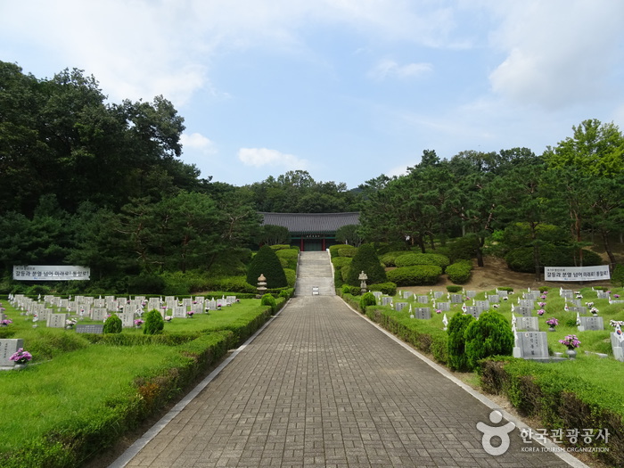 April 19th National Cemetery (국립4.19민주묘지)
3 km from the summit
- Seoul Doseonsa Temple (도선사(서울)) 3 km from the summit
- Goyang Heungguksa Temple (흥국사(고양)) 3.4 km from the summit
-
 Jingwansa Temple (Seoul) [진관사(서울)]
3.6 km from the summit
Times and difficulty are estimates from GPS tracks. Before you go, check the weather, sunset time and any trail closures. Course tracks recorded: 2022-01-06
Text on this page was translated automatically from Korean public data. Place names follow the Revised Romanization; signs on the trail are in Korean.
Data: Korea Forest Service and Korea Hiking & Trekking Support Center (Public Data Portal). Course times and difficulty are estimates from GPS tracks (2022).