
Baegunsan (Gwangyang) 1,222m
Sunset Seen from Ttoaribong Peak
Moderate Hard Spring flowers Silver grass Sea views Public transport


- Location
- Jinsang-myeon, Ongnyong-myeon, Bonggang-myeon, and Daap-myeon, Gwangyang-si; Ganjeon-myeon, Gurye-gun, Jeollanam-do
- Courses
- 8 · 3 h 40 min – 10 h 10 min
- Distance
- 6.8 km – 21.9 km
- Facilities
- Toilets 10 · Parking 3
- Managed by
- Gwangyang City Hall · 061-797-2114
Trail map
Why it is one of the 100 famous mountains
Selected for its scenic and ecological value, featuring a grand mountain landscape anchored by the main peak alongside Ttoaribong, Dosolbong, Maebong, and Eokbulbong peaks, splendid scenery, silver grass and royal azalea colonies, and a habitat supporting around 900 plant species spanning temperate and cold climates. It is also home to a natural recreation forest and famous temples including Baegunsa and Seongbulsa Temples.
About Baegunsan (Gwangyang)
This mountain serves as the very model for the ideal geomantic landscape (myeongdangdo) in Korean pungsu (feng shui) geography. Principles like the Left Azure Dragon, Right White Tiger, Ipsu (incoming energy ridge), and Ansan (table mountain) were systematized after observing the topography of this mountain, credited to Master Doseon, who lived during the transition from Later Silla to Early Goryeo and is revered as a National Preceptor.
If you unfold a map and trace the 600-meter contour line with a highlighter, Baegunsan appears shaped like a large bird taking flight toward the sea. The bird's head, the southern ridge of Dosolbong Peak, splits to the left and right at an elevation of 700 meters. The right branch sweeps westward in an arc and heads south toward Naeusan, the guardian mountain of Gwangyang, while the left branch curves eastward like a crescent to form Baekgyesan (505.8m).
At the center, wrapped like a flower bud, lies the pistil-shaped incoming ridge (ipsu). The Ongnyongsa Temple Site, where Doseon once resided, sits at the end of this ridge amidst a dense forest of over 7,000 camellia trees. On both sides of the ridges embracing this auspicious terrain flow the Dongcheon and Bonggangcheon streams, which are flanked once more by the Eokbulbong and Bibongsan ridges. This mountain is the authentic archetype of the auspicious geomantic map introduced by Doseon.
It was originally called Baekgyesan. Not only the mountain behind Ongnyongsa Temple Site, but the entire great massif spanning Gwangyang, Suncheon, and Gurye was known as Baekgyesan. In historical records detailing Doseon's life, Ongnyongsa was consistently recorded as "Ongnyongsa on Baekgyesan." This exceptional mountain was not merely another ordinary "white cloud mountain" found widely across the country.
The Baekdudaegan Mountain Range, which starts at Baekdusan, extends down along the East Coast, shifts southwest at Pijae in Taebaek, Gangwon-do, and runs through the inland of the peninsula toward the South Sea. Baegunsan was thrust up with the final energy of the Honam Jeongmaek before it descends into the South Sea, making it the highest peak of the Honam Jeongmaek.
Facing Jirisan across the Seomjingang River to the north, Baegunsan forms an expansive mountain range with Ttoaribong Peak (1,127m) and Dosolbong Peak (1,153.2m) to the west of the summit, Maebong Peak (866.9m) connecting to the Honam Jeongmaek to the east, and Eokbulbong Peak (1,007.5m) to the south. Ongnyong-myeon below Baegunsan is a large valley surrounded on three sides by ridges, shaped like a sack open only toward the south. The valley retains so many Buddhist remains that it was called Buldang-gol.
Master Doseon, widely regarded as the founder of Korean geomantic prophecy and feng shui theory, lived at Ongnyongsa Temple (no longer standing) for 35 years from age 37 until entering nirvana here at age 72. On Baekgyesan (505.8m), where the Ongnyongsa Temple Site sits to the left of Dongdong Village—a trailhead for Baegunsan—the camellia forest said to have been planted by Master Doseon is designated as a Natural Monument. The mountain is also rich in painted maples (gorosoe), and because their sap has long been regarded as a cure-all, many visitors travel to Baegunsan around Gyeongchip (the Day of Awakening Insects in early March).
Courses recommended by the Korea Forest Service
- Nonsil Village → Hanjae → Sinseondae → Summit → South Ridge Intersection → Byeongam Valley Intersection → Jinteul Village 4 h 30 min
- Naehoe Village → Maebong Peak → Summit → South Ridge Intersection → Byeongam Valley Intersection → Jinteul Village 4 h 50 min
- Seongbulgyo Bridge → Hyeongjebong Peak → Dosolbong Peak → Ttaribong Peak → Summit → Helipad Intersection → Baegunsa Temple → Meokbang Village 8 h 55 min
Public transport
Gwangyang serves as the primary base. From Gwangyang Bus Terminal, Bus No. 21-2 (bound for Donggok/Mukbang) runs 8 times daily, and Bus No. 21-3 (bound for Nonsil) runs 4 times daily. From East Seoul Terminal, premium express buses run to Gwangyang 13 times daily. Buses also operate from Busan, Daegu, Pohang, Gyeongju, Masan, Jinju, Hadong, Bucheon, and Jeongeup, with 23 daily runs from Gwangju and departures every 10 minutes from Suncheon. For Gyeongjeon Line rail travel, there are 4 trains from Bujeon (Busan), and 1 departure each from Gwangju and Mokpo.
Food, lodging & more (Korea Forest Service data, may change)
● Accommodation and Facilities
Residents in Jinteul Village operate guesthouses (minbak): Jinteul Minbak (☎061-762-5579), Baegun Minbak (☎061-762-3860), and Dauri Pension in Meokbang Village (☎011-9359-9075). Baegunsan Natural Recreation Forest (☎061-763-8615), located just past the Ongnyongsa Temple Site, is also recommended.
● Inquiries
Culture and Public Relations Division, Gwangyang City Hall (☎061-797-2731)
Nearby attractions
-
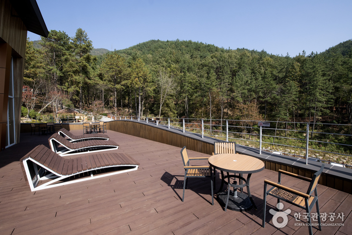 Baegunsan Recreational Forest (백운산자연휴양림)
6.4 km from the summit
-
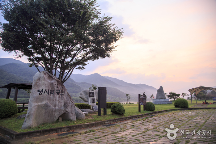 Pyeongsari Park (평사리공원)
7.1 km from the summit
-
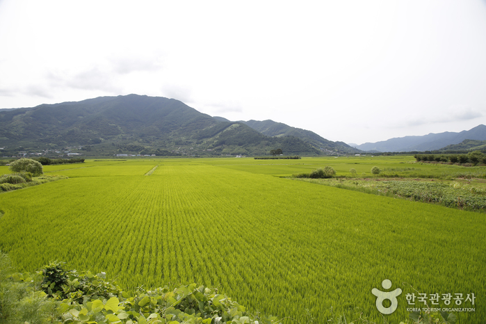 Pyeongsari Field (평사리들판)
7.5 km from the summit
-
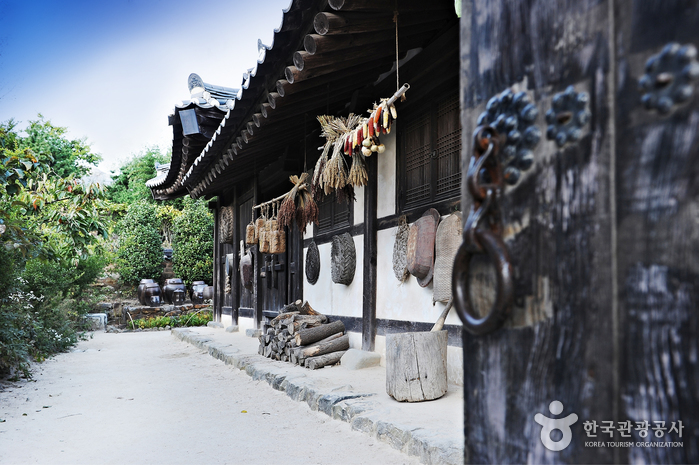 Choi Champandaek (House of Choi Champan) (최참판댁)
8.2 km from the summit
-
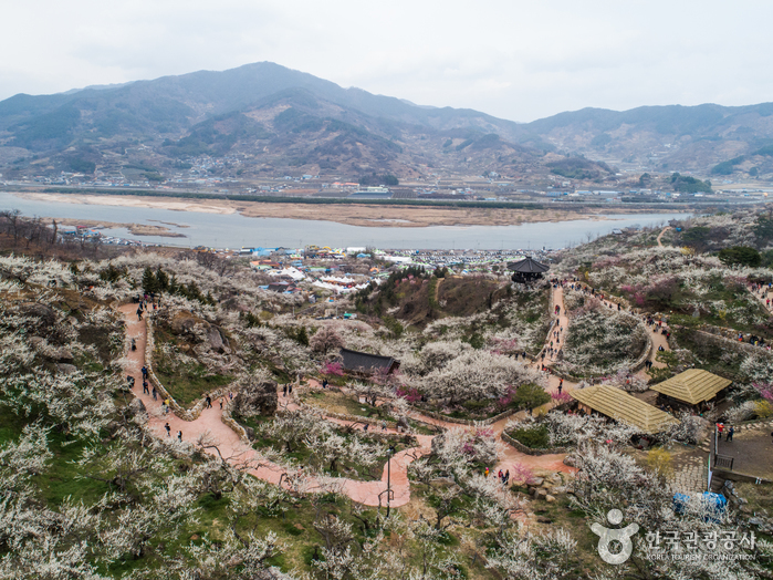 Gwangyang Maehwa Village (광양 매화마을)
8.9 km from the summit
-
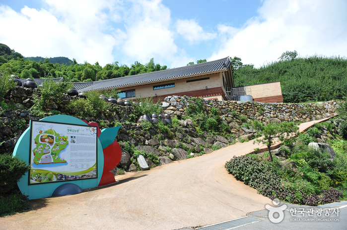 Cheong Maesil Farm (홍쌍리 청매실농원)
9.2 km from the summit
Times and difficulty are estimates from GPS tracks. Before you go, check the weather, sunset time and any trail closures. Course tracks recorded: 2022-01-06
Text on this page was translated automatically from Korean public data. Place names follow the Revised Romanization; signs on the trail are in Korean.
Data: Korea Forest Service and Korea Hiking & Trekking Support Center (Public Data Portal). Course times and difficulty are estimates from GPS tracks (2022).