
Baegamsan 741m
Naejang for Mountains, Baegam for Historic Sites
Moderate Hard Spring flowers Autumn foliage Public transport

- Location
- Bukha-myeon, Jangseong-gun, Jeollanam-do / Bokheung-myeon, Sunchang-gun, Jeollabuk-do
- Courses
- 4 · 3 h 15 min – 4 h 35 min
- Distance
- 8.2 km – 10.1 km
- Facilities
- Toilets 12 · Parking 6
- Managed by
- Jangseong-gun Office · 061-393-1989
Trail map
Why it is one of the 100 famous mountains
Selected in consideration of its inclusion within Naejangsan National Park and its outstanding scenery, often paired with Naejangsan as in the saying "Baegyang in spring, Naejang in autumn," as well as its massive natural colonies of Japanese torreya and Daphniphyllum macropodum (Natural Monuments). Features Hakbawi Rock, the 12 Scenic Views of Baegyangsan, and Yeongcheongul Cave. Also renowned for Baegyangsa Temple, which preserves numerous cultural properties including the Stupa of Master Soyo, Daeungjeon Hall, Geungnakbojeon Hall, Sacheonwangmun Gate, Gwaneumjeon of Cheongnyuam Hermitage, and the scenic Ssanggyeru Pavilion.
About Baegamsan
Baegamsan is part of Naejangsan National Park along with Naejangsan and Ipbamsan. Between the rocky Sajabong and Baekhakbong peaks, Sangwangbong Peak rises tall to rival Sinseonbong Peak of Naejangsan on the opposite side. From long ago, Baegyangsa Temple's Japanese torreya forest and cherry blossoms have been famous alongside Naejangsan's autumn foliage, and the mountain's gentle topography allows for an accessible hiking experience.
At the foot of the mountain lies Baegyangsa Temple, the head temple of the 18th district of the Jogye Order of Korean Buddhism. It was founded in 632 (33rd year of King Mu) under the name Baegamsa Temple, and Monk Hwanyang renamed it Baegyangsa during the Joseon King Seonjo era. Legend has it that when Hwanyang was preaching to his disciples below Baekhakbong Peak, a white sheep (baegyang) listened and shed tears of enlightenment, giving rise to the name Baegyangsa.
Baegamsan is a 741.2m-high mountain rising before the vast Honam Plain and belongs to Naejangsan National Park.
As an old saying goes, "Baegyang in spring, Naejang in autumn," and "Naejang for mountains, Baegam for historic sites," its stunning scenery rivals that of Naejangsan. Fantastic rocks and bizarre crags such as Baekhakbong Peak, Sangwangbong Peak, and Sajabong Peak are found throughout, and the terrain can be rugged. Particularly famous for its Japanese torreya forest and grey-striped squirrels, it is also home to the major temple Baegyangsa, the head temple of the 18th district of the Jogye Order of Korean Buddhism.
Courses recommended by the Korea Forest Service
- Baegyangsa Temple → Yaksanam Hermitage → Hakbawi Rock → Baekhakbong Peak → Sangwangbong Peak → Sajabong Peak → Cheongnyuam Hermitage → Gain Campground → Ticket Office 5 h 10 min
- Baegyangsa Temple → Unmunam Hermitage → Sajabong Peak → Cheongnyuam Hermitage → Gain Campground → Ticket Office 3 h 40 min
- Baegyangsa Temple → Unmunam Hermitage → Sangwangbong Peak → Baekhakbong Peak → Yaksanam Hermitage → Baegyangsa Temple 4 h 10 min
Public transport
Take a direct bus bound for Baegyangsa Temple from Jeongeup Sageori Bus Terminal (runs every 30 minutes / takes 35 minutes). Alternatively, take a bus bound for Baegyangsa Temple from Jangseong-eup (runs every 20-30 minutes).
Food, lodging & more (Korea Forest Service data, may change)
● Accommodation and Other Info
Near the ticket office below Baegyangsa Temple are Baegyang Sanjang (☎ 061-392-7500), Green Sanjang (☎ 061-392-7524), etc., and there is a minbak (homestay) village in Gain Village.
Restaurants in the complex below the ticket office serve sanchae jeongsik (wild vegetable set meal), with bokbunja (wild black raspberry) wine being a local delicacy.
● Inquiries
Jangseong-gun Office Culture and Tourism Division ☎ 061-390-7224
Nearby attractions
-
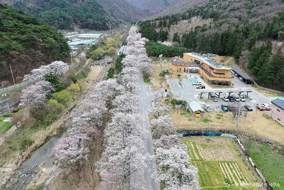 Naejangsan National Park (내장산국립공원)
1.1 km from the summit
- Namchanggyegok Valley (남창계곡) 2.5 km from the summit
- Baegyangsa Temple (백양사) 2.7 km from the summit
-
 Uhwajeong Pavilion (우화정(내장산))
4.8 km from the summit
- Mirsaem Bridge (미르샘 다리) 5.4 km from the summit
-
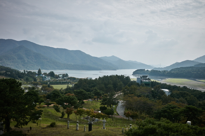 Jangseongho Tourist Area (장성호관광지)
5.4 km from the summit
Times and difficulty are estimates from GPS tracks. Before you go, check the weather, sunset time and any trail closures. Course tracks recorded: 2022-01-06
Text on this page was translated automatically from Korean public data. Place names follow the Revised Romanization; signs on the trail are in Korean.
Data: Korea Forest Service and Korea Hiking & Trekking Support Center (Public Data Portal). Course times and difficulty are estimates from GPS tracks (2022).